<< Other Photo Pages >> Bayou Grande Cheniere Mounds - Artificial Mound in United States in The South
Submitted by AKFisher on Thursday, 03 August 2023 Page Views: 225
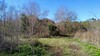
Pre-ColumbianSite Name: Bayou Grande Cheniere Mounds Alternative Name: 16 PL 159Country: United States
NOTE: This site is 55.8 km away from the location you searched for.
Region: The South Type: Artificial Mound
Nearest Town: Port Sulphur, LA
Latitude: 29.541230N Longitude: 89.78993W
Condition:
| 5 | Perfect |
| 4 | Almost Perfect |
| 3 | Reasonable but with some damage |
| 2 | Ruined but still recognisable as an ancient site |
| 1 | Pretty much destroyed, possibly visible as crop marks |
| 0 | No data. |
| -1 | Completely destroyed |
| 5 | Superb |
| 4 | Good |
| 3 | Ordinary |
| 2 | Not Good |
| 1 | Awful |
| 0 | No data. |
| 5 | Can be driven to, probably with disabled access |
| 4 | Short walk on a footpath |
| 3 | Requiring a bit more of a walk |
| 2 | A long walk |
| 1 | In the middle of nowhere, a nightmare to find |
| 0 | No data. |
| 5 | co-ordinates taken by GPS or official recorded co-ordinates |
| 4 | co-ordinates scaled from a detailed map |
| 3 | co-ordinates scaled from a bad map |
| 2 | co-ordinates of the nearest village |
| 1 | co-ordinates of the nearest town |
| 0 | no data |
Internal Links:
External Links:
")
The site is located on a natural levee of Bayou Grande Chenière and has twelve mounds, eleven arranged around a central plaza and one 75 metres (246 ft) to the south, connected to the main group by a constructed landform. The site was connected by a manmade causeway to Bayou Grande Chenière.[2] The elliptical plaza measures 100 feet (30 m) on its north-south axis by 75 feet (23 m) east-west.[1] Mound 1, the largest, is a conical mound measuring 60 feet (18 m)[2] and located on the eastern edge of the plaza. The southern edge of the plaza is bounded by Mound 10 and the northern edge by Mound 3, both are platform mounds. The western edge of the plaza is a string of interconnected small mounds, Mounds 4 to 9.[1]
The site is unusual in its size and number of mounds. Typically Coastal Coles Creek settlements had three mounds arranged around a plaza. The site's plan and large scale are most like the large Coles Creek settlement in Avoyelles Parish, the Greenhouse site.[1]
Excavations:
Henry Collins, Jr., an assistant entomologist for the Smithsonian Institution, first excavated the site in 1926. The mound site was mapped by McGimsey in 2000. Dr. Rebecca Saunders, Timothy Schilling, and seven students from Louisiana State University conducted field excavations at the site in January 2003. Pottery found during excavations was dated from 875 to 1200 CE during the Bayou Ramos (700-875 CE), Bayou Cutler (875-1000 CE) and St. Gabriel (1000-1200 CE) phases, spanning the Early Coles Creek period to the Transitional Coles Creek/Plaquemine period for the eastern delta. No material from earlier than the Troyville culture were found, nor were any materials from after the Plaquemine period.[1]
In the late 2000s NASA's Stennis Space Center, in partnership with the US Army Corps of Engineers New Orleans District and Tulane University, undertook an archaeological survey of the southeastern Louisiana marshes, including the Bayou Grande Chenière site. This survey discovered the manmade causeway leading from the site to the bayou.[2]
References:
1. Timothy M. Schilling (May 2004). Excavations at the Bayou Grande Cheniere Mounds (16PL159) : A Coles Creek Period Mound Complex (PDF) (Master of Arts thesis). Louisiana State University and Agricultural and Mechanical College. Archived from the original (PDF) on 2012-01-19. Retrieved 2011-10-31.
2. NASA, Remote Sensing and Archaeology: An example from Southeast Louisiana" (PDF). NASA Stennis Space Center. Retrieved 2011-10-31
Source: Wikipedia:
https://en.wikipedia.org/wiki/Bayou_Grande_Cheniere_Mounds
Wikiwand:
https://www.wikiwand.com/en/Bayou_Grande_Cheniere_Mounds
Directions: Port Suphur, via LA-23N then across swamp/bayou, 6.3 mi.
You may be viewing yesterday's version of this page. To see the most up to date information please register for a free account.
Do not use the above information on other web sites or publications without permission of the contributor.
Nearby Images from Flickr

The above images may not be of the site on this page, but were taken nearby. They are loaded from Flickr so please click on them for image credits.
Click here to see more info for this site
Nearby sites
Click here to view sites on an interactive map of the areaKey: Red: member's photo, Blue: 3rd party photo, Yellow: other image, Green: no photo - please go there and take one, Grey: site destroyed
Download sites to:
KML (Google Earth)
GPX (GPS waypoints)
CSV (Garmin/Navman)
CSV (Excel)
To unlock full downloads you need to sign up as a Contributory Member. Otherwise downloads are limited to 50 sites.
Turn off the page maps and other distractions
Nearby sites listing. In the following links * = Image available
165.6km NW 306° Louisiana State University Campus Mounds Artificial Mound
180.7km ENE 63° Dauphin Island Shell Mound Park* Ancient Mine, Quarry or other Industry
221.4km ENE 68° Gulf State Park Shell and Sand Mounds* Artificial Mound
221.7km NE 54° Fuller Shell Mound Site* Artificial Mound
224.3km NE 53° Blakeley Indian Mounds* Artificial Mound
231.5km ENE 67° Bamahenge* Modern Stone Circle etc
239.6km NW 319° Lessley Mound Artificial Mound
241.3km NE 47° Bottle Creek* Ancient Village or Settlement
243.0km NW 317° Smith Creek Mounds* Artificial Mound
255.8km NNE 18° Graveline Mound Site* Artificial Mound
267.9km NW 326° Grand Village of Natchez Indians* Ancient Village or Settlement
269.3km NNW 326° Natchez Trace* Ancient Trackway
271.5km NNW 329° Emerald Mound, Mississippi* Artificial Mound
272.3km NNW 328° Foster Mounds* Artificial Mound
272.3km NNW 328° Fosters Ancient Village or Settlement
279.3km NW 310° Marksville* Artificial Mound
282.3km NNW 328° Anna Mound Complex* Artificial Mound
288.1km NW 324° DePrato Mounds* Artificial Mound
291.7km NW 322° Frogmore Mound* Artificial Mound
292.1km NE 43° Mauvilla Ancient Village or Settlement
292.5km NNW 339° Mangum Mound* Artificial Mound
293.1km NW 323° Elkhorn Plantation Mound* Artificial Mound
294.9km NW 323° Churupa Plantation Mound* Artificial Mound
295.2km NNW 337° Bayou Pierre Mounds* Artificial Mound
296.4km NNW 335° Windsor Mounds* Artificial Mound
View more nearby sites and additional images


 We would like to know more about this location. Please feel free to add a brief description and any relevant information in your own language.
 Wir möchten mehr über diese Stätte erfahren. Bitte zögern Sie nicht, eine kurze Beschreibung und relevante Informationen in Deutsch hinzuzufügen.
 Nous aimerions en savoir encore un peu sur les lieux. S'il vous plaît n'hesitez pas à ajouter une courte description et tous les renseignements pertinents dans votre propre langue.
 Quisieramos informarnos un poco más de las lugares. No dude en añadir una breve descripción y otros datos relevantes en su propio idioma.