


<< Other Photo Pages >> Devil's Lake Mounds - Artificial Mound in United States in Great Lakes Midwest
Submitted by AKFisher on Monday, 04 September 2023 Page Views: 242
Pre-ColumbianSite Name: Devil's Lake Mounds Alternative Name: Devil's Lake State ParkCountry: United States Region: Great Lakes Midwest Type: Artificial Mound
Nearest Town: Baraboo, WI
Latitude: 43.414722N Longitude: 89.713056W
Condition:
| 5 | Perfect |
| 4 | Almost Perfect |
| 3 | Reasonable but with some damage |
| 2 | Ruined but still recognisable as an ancient site |
| 1 | Pretty much destroyed, possibly visible as crop marks |
| 0 | No data. |
| -1 | Completely destroyed |
| 5 | Superb |
| 4 | Good |
| 3 | Ordinary |
| 2 | Not Good |
| 1 | Awful |
| 0 | No data. |
| 5 | Can be driven to, probably with disabled access |
| 4 | Short walk on a footpath |
| 3 | Requiring a bit more of a walk |
| 2 | A long walk |
| 1 | In the middle of nowhere, a nightmare to find |
| 0 | No data. |
| 5 | co-ordinates taken by GPS or official recorded co-ordinates |
| 4 | co-ordinates scaled from a detailed map |
| 3 | co-ordinates scaled from a bad map |
| 2 | co-ordinates of the nearest village |
| 1 | co-ordinates of the nearest town |
| 0 | no data |
Internal Links:
External Links:
")
Devil's Lake State Park is a state park located in the Baraboo Range, just south of Baraboo, Wisconsin. It is on the western edge of the last ice-sheet deposited during the Wisconsin glaciation. The park has several American Indian mounds including effigy mounds built in stylized animal shapes.
Devil's Lake State Park is a state park located in the Baraboo Range in eastern Sauk County, just south of Baraboo, Wisconsin. It is around thirty-five miles northwest of Madison, and is on the western edge of the last ice-sheet deposited during the Wisconsin glaciation.[2] The state park encompasses 9,217 acres (3,730 ha),[3] making it the largest in Wisconsin.[4] The state park is known for its 500-foot-high (150 m) quartzite bluffs along the 360-acre (150 ha) Devil's Lake, which was created by a glacier depositing terminal moraines that plugged the north and south ends of the gap in the bluffs during the last ice age approximately 12,000 years ago. The sand at the bottom of Devil's Lake is thought to be deposited by glaciers.
There are many quartzite rock formations, such as Balanced Rock and Devil's Doorway, throughout the park. Effigy mounds are also located throughout the park. The park contains approximately eleven miles of the 1,200-mile (1,900 km) Ice Age Trail.[5] Its scenic beauty, along with its proximity to the Wisconsin Dells, has made it one of the most popular of Wisconsin's state parks for both day use and overnight camping; the park receives over three million visitors annually.[6] During the fall, the park's brilliant foliage makes it a popular attraction. Parfrey's Glen, Wisconsin's first state natural area, is managed by the Devil's Lake State Park and located just east of the park.
The original inhabitants of the area around the lake date back much further than when the European settlers first discovered the land. There is proof that humans occupied the land between 12,000 to 16,000 years ago, but Ho-Chunk historians speak of people living there longer than 300,000 years ago.[7] The area may have been inhabited originally between 12,000 to 16,000 years ago due to the fact that this was the time the last of the glaciers had receded from the area. Many Native tribes throughout Wisconsin inhabited the lands. They called the lake various different names, such as Tewakakak or Minnewaukan, which translate to spirit lake in various Native American Languages.[7]
In 1974, the National Park Service declared the Southern portion of the Baraboo Hills a National Natural Landmark. The Nature Conservancy also designated it as one of the "Last Great Places," one of only 77 such designations in the world.[4]
Mounds:
The park has several American Indian mounds. Across the parking lot from the nature center are effigy mounds built in stylized animal shapes, such as a lynx and a sparrow. In front of the concession building is a linear mound, one of several geometric mounds in the park. These mounds were used as ancient burial sites by early North Americans. The nature center offers courses on the history of the effigy mounds.[15][16]. Source: Wikipedia (see link below)
References:
1. Devils Lake State Park. Geographic Names Information System. United States Geological Survey. August 29, 1980. Retrieved March 18, 2011.
2. Salisbury, Rollin; Wallace Walter Atwood (1897). "Drift Phenomena in the Vicinity of Devil's Lake and Baraboo, Wisconsin". The Journal of Geology. 5 (2): 131–147. Bibcode:1897JG......5..131S. doi:10.1086/607730.
3. Pick a Park – WDNR. Wisconsin Department of Natural Resources. Archived from the original on May 10, 2009. Retrieved January 25, 2009.
4. Regional & Property Analysis: Sauk Prairie Recreation Area. July 2012: 1–67.
5. Ice Age Trail: Devil's Lake Segment Hiking Trail, Baraboo, Wisconsin. Hiking Project. Retrieved October 15, 2021.
6. [Devil's Lake - What Do I Need to Know?] Devil's Lake State Park Area Visitor's Guide. Accessed 19 Sept 2019.
7. A Brief Human History of Devil's Lake State Park, Baraboo, WI. Devils Lake Climbing Guides. Retrieved May 2, 2022.
15. Wisconsin Department of Natural Resources (January 5, 2011). "Effigy Mounds of Devil's Lake". Archived from the original on June 6, 2010.
16. Wayside exhibits located by each mound
Further reading and information:
Wikipedia
Wisconsin DNR: dnr.wisconsin.gov/topic/parks/devilslake
Directions:
From Baraboo, WI via Walnut St., 3.7 mi.
You may be viewing yesterday's version of this page. To see the most up to date information please register for a free account.
")
")
")
Do not use the above information on other web sites or publications without permission of the contributor.
Nearby Images from Flickr
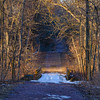
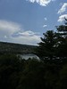
The above images may not be of the site on this page, but were taken nearby. They are loaded from Flickr so please click on them for image credits.
Click here to see more info for this site
Nearby sites
Click here to view sites on an interactive map of the areaKey: Red: member's photo, Blue: 3rd party photo, Yellow: other image, Green: no photo - please go there and take one, Grey: site destroyed
Download sites to:
KML (Google Earth)
GPX (GPS waypoints)
CSV (Garmin/Navman)
CSV (Excel)
To unlock full downloads you need to sign up as a Contributory Member. Otherwise downloads are limited to 50 sites.
Turn off the page maps and other distractions
Nearby sites listing. In the following links * = Image available
8.9km NNE 22° Man Mound Park* Artificial Mound
40.5km SSW 199° Circle Sanctuary Nature Preserve* Modern Stone Circle etc
41.1km SSW 201° Brighid's Spring at Circle Sanctuary* Holy Well or Sacred Spring
45.2km SSE 150° Forest Hill Cemetery* Artificial Mound
79.1km ESE 119° Aztalan State Park* Ancient Village or Settlement
82.4km E 85° Nitschke Mounds State Park Artificial Mound
84.0km W 268° Tainter Cave Cave or Rock Shelter
88.0km NNW 342° Cranberry Creek Mound Group Artificial Mound
88.7km SE 132° Lake Koshkonong Mounds* Artificial Mound
90.3km SE 132° The Finch Site Ancient Village or Settlement
103.4km NW 311° Fort McCoy Artificial Mound
109.2km WSW 256° Larsen Cave, Crawford Co* Rock Art
115.6km SSE 151° Beloit College Mounds* Artificial Mound
123.5km WSW 247° Wyalusing Mounds* Artificial Mound
124.6km WSW 254° Effigy Mounds National Monument* Artificial Mound
126.6km W 273° Fish Farm Mounds State Preserve Artificial Mound
127.2km E 87° Lizard Mound State Park* Artificial Mound
127.3km SW 217° Dunleith Mounds* Artificial Mound
128.1km ESE 110° Cutler Mound Group* Artificial Mound
136.6km SSE 158° Beattie Park Mound Group* Misc. Earthwork
172.6km ESE 116° Mound Cemetery (Racine) Barrow Cemetery
179.9km S 179° Sinnissippi Mounds* Artificial Mound
186.5km SSW 193° Albany Mounds* Barrow Cemetery
243.0km SE 134° The Field Museum* Museum
250.3km SE 136° University of Chicago Institute* Museum
View more nearby sites and additional images


 We would like to know more about this location. Please feel free to add a brief description and any relevant information in your own language.
 Wir möchten mehr über diese Stätte erfahren. Bitte zögern Sie nicht, eine kurze Beschreibung und relevante Informationen in Deutsch hinzuzufügen.
 Nous aimerions en savoir encore un peu sur les lieux. S'il vous plaît n'hesitez pas à ajouter une courte description et tous les renseignements pertinents dans votre propre langue.
 Quisieramos informarnos un poco más de las lugares. No dude en añadir una breve descripción y otros datos relevantes en su propio idioma.