<< Our Photo Pages >> Dauphin Island Shell Mound Park - Ancient Mine, Quarry or other Industry in United States in The South
Submitted by bat400 on Tuesday, 25 February 2014 Page Views: 4338
Multi-periodSite Name: Dauphin Island Shell Mound Park Alternative Name: Indian Mound Park (Alabama), Shell Mound Park (Alabama)Country: United States
NOTE: This site is 68.346 km away from the location you searched for.
Region: The South Type: Ancient Mine, Quarry or other Industry
Nearest Town: Mobile, AL Nearest Village: Dauphin Island, AL
Latitude: 30.258300N Longitude: 88.1074W
Condition:
| 5 | Perfect |
| 4 | Almost Perfect |
| 3 | Reasonable but with some damage |
| 2 | Ruined but still recognisable as an ancient site |
| 1 | Pretty much destroyed, possibly visible as crop marks |
| 0 | No data. |
| -1 | Completely destroyed |
| 5 | Superb |
| 4 | Good |
| 3 | Ordinary |
| 2 | Not Good |
| 1 | Awful |
| 0 | No data. |
| 5 | Can be driven to, probably with disabled access |
| 4 | Short walk on a footpath |
| 3 | Requiring a bit more of a walk |
| 2 | A long walk |
| 1 | In the middle of nowhere, a nightmare to find |
| 0 | No data. |
| 5 | co-ordinates taken by GPS or official recorded co-ordinates |
| 4 | co-ordinates scaled from a detailed map |
| 3 | co-ordinates scaled from a bad map |
| 2 | co-ordinates of the nearest village |
| 1 | co-ordinates of the nearest town |
| 0 | no data |
Internal Links:
External Links:
")
Six shell middens are found within the borders of this small public park. Archaeological surveys (1940) and excavations (1990s) revealed the layers of discarded oyster shells, broken cooking pots, fish bones, and charcoal. The site was used for hundreds of years (dated to 1100 CE - 1550 CE) for fishing and oyster gathering and processing.
Archaeologist Gregory Waselkov (University of South Alabama) believes that the visitors to the island came from Bottle Creek for seasonal resources.
Like many barrier islands on the Gulf of Mexico, the park is a migration stop for a wide variety of birds on their yearly flights between Mexico and Central America and the Continental United States and Canada. Over 350 species have been sighted here.
National Register of Historic Places site: Indian Mound Park (added 1973 - - #73000360)
Also known as Dauphin Island Indian Shell Mound;University of South Alabama
Address Restricted , Dauphin Island
Historic Significance: Information Potential
Area of Significance: Prehistoric
Cultural Affiliation: Mississippian, Woodland
Period of Significance: 1749-1500 AD, 1499-1000 AD, 1000 AD-999 BC
Owner: State
Historic Function: Agriculture/Subsistence
Historic Sub-function: Processing
Current Function: Landscape
You may be viewing yesterday's version of this page. To see the most up to date information please register for a free account.
")
")
Do not use the above information on other web sites or publications without permission of the contributor.
Nearby Images from Flickr
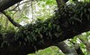
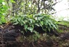
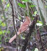
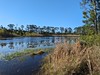
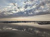
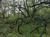
The above images may not be of the site on this page, but were taken nearby. They are loaded from Flickr so please click on them for image credits.
Click here to see more info for this site
Nearby sites
Click here to view sites on an interactive map of the areaKey: Red: member's photo, Blue: 3rd party photo, Yellow: other image, Green: no photo - please go there and take one, Grey: site destroyed
Download sites to:
KML (Google Earth)
GPX (GPS waypoints)
CSV (Garmin/Navman)
CSV (Excel)
To unlock full downloads you need to sign up as a Contributory Member. Otherwise downloads are limited to 50 sites.
Turn off the page maps and other distractions
Nearby sites listing. In the following links * = Image available
44.1km E 90° Gulf State Park Shell and Sand Mounds* Artificial Mound
52.0km NNE 21° Fuller Shell Mound Site* Artificial Mound
52.5km E 81° Bamahenge* Modern Stone Circle etc
57.3km NNE 18° Blakeley Indian Mounds* Artificial Mound
85.1km N 11° Bottle Creek* Ancient Village or Settlement
138.0km NNE 17° Mauvilla Ancient Village or Settlement
144.9km E 83° Fort Walton Mound* Artificial Mound
180.7km WSW 244° Bayou Grande Cheniere Mounds* Artificial Mound
182.9km NNW 334° Graveline Mound Site* Artificial Mound
248.3km NNE 22° Old Cahawba Archaeological Park* Misc. Earthwork
295.6km W 274° Louisiana State University Campus Mounds Artificial Mound
304.4km E 100° Pierce Site* Artificial Mound
305.2km NE 35° Mound at Fort Toulouse - Fort Jackson Park* Artificial Mound
305.6km E 80° Chattahoochee Landing Mound Group* Artificial Mound
306.7km NNW 345° Nanih Waiya Mound* Artificial Mound
306.9km NW 323° Boyd Mounds* Barrow Cemetery
309.1km N 8° Moundville Archeological Park* Ancient Village or Settlement
321.4km NW 320° Pocahontas Mound A* Artificial Mound
328.3km NW 307° Mangum Mound* Artificial Mound
332.0km ENE 65° Kolomoki Mounds Historic Park* Artificial Mound
334.0km WNW 288° Lessley Mound Artificial Mound
335.9km NW 306° Bayou Pierre Mounds* Artificial Mound
336.3km WNW 298° Emerald Mound, Mississippi* Artificial Mound
340.3km WNW 288° Smith Creek Mounds* Artificial Mound
341.5km WNW 297° Foster Mounds* Artificial Mound
View more nearby sites and additional images


 We would like to know more about this location. Please feel free to add a brief description and any relevant information in your own language.
 Wir möchten mehr über diese Stätte erfahren. Bitte zögern Sie nicht, eine kurze Beschreibung und relevante Informationen in Deutsch hinzuzufügen.
 Nous aimerions en savoir encore un peu sur les lieux. S'il vous plaît n'hesitez pas à ajouter une courte description et tous les renseignements pertinents dans votre propre langue.
 Quisieramos informarnos un poco más de las lugares. No dude en añadir una breve descripción y otros datos relevantes en su propio idioma.