


<< Other Photo Pages >> Page Site, Kentucky - Artificial Mound in United States in Great Lakes Midwest
Submitted by AKFisher on Sunday, 27 August 2023 Page Views: 488
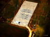
Pre-ColumbianSite Name: Page Site, Kentucky Alternative Name: Lost City, KentuckyCountry: United States
NOTE: This site is 27.562 km away from the location you searched for.
Region: Great Lakes Midwest Type: Artificial Mound
Nearest Town: Lewisburg, KY
Latitude: 36.976576N Longitude: 86.905469W
Condition:
| 5 | Perfect |
| 4 | Almost Perfect |
| 3 | Reasonable but with some damage |
| 2 | Ruined but still recognisable as an ancient site |
| 1 | Pretty much destroyed, possibly visible as crop marks |
| 0 | No data. |
| -1 | Completely destroyed |
| 5 | Superb |
| 4 | Good |
| 3 | Ordinary |
| 2 | Not Good |
| 1 | Awful |
| 0 | No data. |
| 5 | Can be driven to, probably with disabled access |
| 4 | Short walk on a footpath |
| 3 | Requiring a bit more of a walk |
| 2 | A long walk |
| 1 | In the middle of nowhere, a nightmare to find |
| 0 | No data. |
| 5 | co-ordinates taken by GPS or official recorded co-ordinates |
| 4 | co-ordinates scaled from a detailed map |
| 3 | co-ordinates scaled from a bad map |
| 2 | co-ordinates of the nearest village |
| 1 | co-ordinates of the nearest town |
| 0 | no data |
Internal Links:
External Links:
")
Rafinesque probably visited the site in the 1800s while it was still being inhabited by Native Americans. In 1928-29, the site was partially excavated by the University of Kentucky revealing numerous stone box graves; many large, well-constructed stone burial chambers in burial mounds; and huge numbers of cremations and burials.[2] So many skulls and skeletal remains were found that Raymond Vietzen wrote in the 1940s that "wagonloads of bones" were removed and taken from the site.[3]
References:
1. Wikipedia: Rafinesque, Constantine en.wikipedia.org/wiki/Constantine_Samuel_Rafinesque<2>
2. Little, Gregory PhD., Illustrated Encyclopedia of Native American Indian Mounds & Earthworks (2016), pp. 154.
3. Vietzen, Raymond (1946). "Fraternizing with the ancient Kentuckians". Ohio Indian Relic Collectors Society Bulletin. 16: 3-13.
Further reading and information:
Western Kentucky University digitalcommons ~ Lost City incorporation papers
digitalcommons.wku.edu/dlsc_mss_fin_aid/4454/
Directions:From Lewisburg, KY via Lost City Rd. and spur, 3.4 mi.
You may be viewing yesterday's version of this page. To see the most up to date information please register for a free account.
")
")
")
")
Do not use the above information on other web sites or publications without permission of the contributor.
Nearby Images from Flickr
The above images may not be of the site on this page, but were taken nearby. They are loaded from Flickr so please click on them for image credits.
Click here to see more info for this site
Nearby sites
Click here to view sites on an interactive map of the areaKey: Red: member's photo, Blue: 3rd party photo, Yellow: other image, Green: no photo - please go there and take one, Grey: site destroyed
Download sites to:
KML (Google Earth)
GPX (GPS waypoints)
CSV (Garmin/Navman)
CSV (Excel)
To unlock full downloads you need to sign up as a Contributory Member. Otherwise downloads are limited to 50 sites.
Turn off the page maps and other distractions
Nearby sites listing. In the following links * = Image available
32.0km N 350° Indian Knoll* Barrow Cemetery
73.6km SSW 200° Copena Mound Site* Artificial Mound
75.0km ENE 71° Mammoth Cave Kentucky* Cave or Rock Shelter
83.2km SE 140° Castalian Springs Mounds* Artificial Mound
90.9km S 173° Tennessee State Museum* Museum
94.7km S 191° Mound Bottom* Ancient Village or Settlement
104.0km S 181° Old Town (Franklin) Ancient Village or Settlement
106.4km ESE 108° Skeleton Mountain Snake Effigy Site* Stone Row / Alignment
107.6km SSE 146° Sellars Farm* Ancient Village or Settlement
109.2km S 181° Old Town (Williamson)* Ancient Village or Settlement
112.8km S 174° Fewkes* Artificial Mound
115.9km S 181° Glass Mounds (Tennessee)* Artificial Mound
117.8km NNW 336° Angel Mounds - Mound F* Pyramid / Mastaba
117.8km NNW 336° Angel Mounds - Mound A* Artificial Mound
117.9km NNW 336° Angel Mounds Museum* Museum
118.0km NNW 336° Angel Mounds* Ancient Village or Settlement
118.0km NNW 336° Angel Mounds - Mound E* Artificial Mound
118.2km NNW 336° Angel Mounds - Mound G* Artificial Mound
126.6km SSE 158° Black Cat Cave Cave or Rock Shelter
130.3km NW 316° Hovey Lake Village Ancient Village or Settlement
131.6km NW 312° Slack Farm Ancient Village or Settlement
132.9km NW 322° Mann Site Misc. Earthwork
137.0km NW 319° GE. Mound Artificial Mound
141.4km W 275° Kincaid Mounds* Ancient Village or Settlement
146.2km WSW 245° Obion Mounds* Artificial Mound
View more nearby sites and additional images


 We would like to know more about this location. Please feel free to add a brief description and any relevant information in your own language.
 Wir möchten mehr über diese Stätte erfahren. Bitte zögern Sie nicht, eine kurze Beschreibung und relevante Informationen in Deutsch hinzuzufügen.
 Nous aimerions en savoir encore un peu sur les lieux. S'il vous plaît n'hesitez pas à ajouter une courte description et tous les renseignements pertinents dans votre propre langue.
 Quisieramos informarnos un poco más de las lugares. No dude en añadir una breve descripción y otros datos relevantes en su propio idioma.