<< Our Photo Pages >> Sculptured Stone near Robbinsville - Sculptured Stone in United States in The South
Submitted by shamana on Tuesday, 30 June 2009 Page Views: 8659
Multi-periodSite Name: Sculptured Stone near RobbinsvilleCountry: United States
NOTE: This site is 42.611 km away from the location you searched for.
Region: The South Type: Sculptured Stone
Nearest Town: Robbinsville Nearest Village: Robbinsville
Latitude: 35.326920N Longitude: 83.80487W
Condition:
| 5 | Perfect |
| 4 | Almost Perfect |
| 3 | Reasonable but with some damage |
| 2 | Ruined but still recognisable as an ancient site |
| 1 | Pretty much destroyed, possibly visible as crop marks |
| 0 | No data. |
| -1 | Completely destroyed |
| 5 | Superb |
| 4 | Good |
| 3 | Ordinary |
| 2 | Not Good |
| 1 | Awful |
| 0 | No data. |
| 5 | Can be driven to, probably with disabled access |
| 4 | Short walk on a footpath |
| 3 | Requiring a bit more of a walk |
| 2 | A long walk |
| 1 | In the middle of nowhere, a nightmare to find |
| 0 | No data. |
| 5 | co-ordinates taken by GPS or official recorded co-ordinates |
| 4 | co-ordinates scaled from a detailed map |
| 3 | co-ordinates scaled from a bad map |
| 2 | co-ordinates of the nearest village |
| 1 | co-ordinates of the nearest town |
| 0 | no data |
Internal Links:
External Links:
I have visited· I would like to visit
teresaunser would like to visit
")
Investigating the area surrounding this site, more indications suggest that a near-by water fall was built using large stone slab and block method, on very steep terrain. I found a possible native american marker there of a triangle with a single diagonal band that has been carved. This triangle artifact will need to be verified by an expert. if the artifact is Native American, there is an indication of the marker representing a spirit portal. Not clear whether this was placed there long after the sight was built.
There are also 'steps' in the waterfall.
at a third area, more tear drop shapes in large stones that look very similar to a face or could be something else.
this site is quite large and is being investigated further. site was originally found on 6 june, 2009.
IMPORTANT NOTE: Location given is for the town of Robbinsville
You may be viewing yesterday's version of this page. To see the most up to date information please register for a free account.
")
")
")
Do not use the above information on other web sites or publications without permission of the contributor.
Nearby Images from Flickr
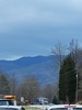
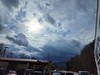


The above images may not be of the site on this page, but were taken nearby. They are loaded from Flickr so please click on them for image credits.
Click here to see more info for this site
Nearby sites
Click here to view sites on an interactive map of the areaKey: Red: member's photo, Blue: 3rd party photo, Yellow: other image, Green: no photo - please go there and take one, Grey: site destroyed
Download sites to:
KML (Google Earth)
GPX (GPS waypoints)
CSV (Garmin/Navman)
CSV (Excel)
To unlock full downloads you need to sign up as a Contributory Member. Otherwise downloads are limited to 50 sites.
Turn off the page maps and other distractions
Nearby sites listing. In the following links * = Image available
35.7km E 101° Cowee Mound Artificial Mound
38.7km ENE 71° Kituwah* Ancient Village or Settlement
42.2km ESE 112° Nikwasi Mound* Artificial Mound
47.7km ENE 68° Museum of the Cherokee Indian* Museum
49.6km S 188° Track Rock* Rock Art
50.0km S 187° Track Rock Gap Archaeological Area* Stone Row / Alignment
62.8km E 92° Judaculla Rock* Rock Art
68.6km S 177° Hickorynut Track Rock* Rock Art
70.0km N 350° University of Tennessee Agriculture Farm Mound* Barrow Cemetery
70.4km N 351° McClung Museum of Natural History and Culture* Museum
72.1km S 173° Nacoochee* Barrow Cemetery
72.1km S 171° Sautee-Nacoochee earthwork Ancient Village or Settlement
72.5km S 171° Kenimer* Artificial Mound
99.4km W 263° Candies Creek Village Archaeological Preserve* Ancient Village or Settlement
103.0km SW 233° Fort Mountain Stone Enclosure* Cairn
107.9km W 276° Hiwassee Island Mounds* Artificial Mound
108.2km ESE 114° South Carolina Rock Art Center* Rock Art
108.5km NE 54° Hot Springs (North Carolina)* Holy Well or Sacred Spring
115.9km ENE 78° Biltmore Mound Artificial Mound
131.1km SSW 212° Funk Heritage Center* Museum
135.0km W 259° Roxbury Indian Mound* Artificial Mound
141.3km E 83° Chimney Rock (North Carolina)* Natural Stone / Erratic / Other Natural Feature
147.4km SE 145° Georgia Guidestones* Modern Stone Circle etc
149.0km SSE 165° Sandy Creek terrace complex* Ancient Village or Settlement
151.9km NNE 14° Ely Mound* Artificial Mound
View more nearby sites and additional images


 We would like to know more about this location. Please feel free to add a brief description and any relevant information in your own language.
 Wir möchten mehr über diese Stätte erfahren. Bitte zögern Sie nicht, eine kurze Beschreibung und relevante Informationen in Deutsch hinzuzufügen.
 Nous aimerions en savoir encore un peu sur les lieux. S'il vous plaît n'hesitez pas à ajouter une courte description et tous les renseignements pertinents dans votre propre langue.
 Quisieramos informarnos un poco más de las lugares. No dude en añadir una breve descripción y otros datos relevantes en su propio idioma.