<< Our Photo Pages >> Hot Springs (North Carolina) - Holy Well or Sacred Spring in United States in The South
Submitted by TimPrevett on Tuesday, 14 April 2009 Page Views: 9033
Springs and Holy WellsSite Name: Hot Springs (North Carolina)Country: United States
NOTE: This site is 42.515 km away from the location you searched for.
Region: The South Type: Holy Well or Sacred Spring
Nearest Town: Hot Springs NC
Latitude: 35.893660N Longitude: 82.82785W
Condition:
| 5 | Perfect |
| 4 | Almost Perfect |
| 3 | Reasonable but with some damage |
| 2 | Ruined but still recognisable as an ancient site |
| 1 | Pretty much destroyed, possibly visible as crop marks |
| 0 | No data. |
| -1 | Completely destroyed |
| 5 | Superb |
| 4 | Good |
| 3 | Ordinary |
| 2 | Not Good |
| 1 | Awful |
| 0 | No data. |
| 5 | Can be driven to, probably with disabled access |
| 4 | Short walk on a footpath |
| 3 | Requiring a bit more of a walk |
| 2 | A long walk |
| 1 | In the middle of nowhere, a nightmare to find |
| 0 | No data. |
| 5 | co-ordinates taken by GPS or official recorded co-ordinates |
| 4 | co-ordinates scaled from a detailed map |
| 3 | co-ordinates scaled from a bad map |
| 2 | co-ordinates of the nearest village |
| 1 | co-ordinates of the nearest town |
| 0 | no data |
Internal Links:
External Links:
I have visited· I would like to visit
TimPrevett sitedowser have visited here
 (PID:46719)")
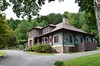
Famous healing springs of thermally heated water still very much in use and available to bathe in on a commercial basis. Wesite HERE
You may be viewing yesterday's version of this page. To see the most up to date information please register for a free account.
 (PID:46715)")
 (PID:46714)")
Do not use the above information on other web sites or publications without permission of the contributor.
Nearby Images from Flickr


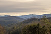
The above images may not be of the site on this page, but were taken nearby. They are loaded from Flickr so please click on them for image credits.
Click here to see more info for this site
Nearby sites
Click here to view sites on an interactive map of the areaKey: Red: member's photo, Blue: 3rd party photo, Yellow: other image, Green: no photo - please go there and take one, Grey: site destroyed
Download sites to:
KML (Google Earth)
GPX (GPS waypoints)
CSV (Garmin/Navman)
CSV (Excel)
To unlock full downloads you need to sign up as a Contributory Member. Otherwise downloads are limited to 50 sites.
Turn off the page maps and other distractions
Nearby sites listing. In the following links * = Image available
46.5km SSE 148° Biltmore Mound Artificial Mound
63.2km SW 224° Museum of the Cherokee Indian* Museum
69.9km SE 132° Chimney Rock (North Carolina)* Natural Stone / Erratic / Other Natural Feature
70.7km SSW 202° Judaculla Rock* Rock Art
72.4km SW 226° Kituwah* Ancient Village or Settlement
88.0km SW 218° Cowee Mound Artificial Mound
91.7km ENE 76° Split Rock / Sphinx Rock* Natural Stone / Erratic / Other Natural Feature
93.0km SSW 212° Nikwasi Mound* Artificial Mound
98.9km NNW 329° Ely Mound* Artificial Mound
99.2km W 274° McClung Museum of Natural History and Culture* Museum
100.3km W 274° University of Tennessee Agriculture Farm Mound* Barrow Cemetery
107.2km ENE 75° The Blowing Rock* Natural Stone / Erratic / Other Natural Feature
108.0km S 175° South Carolina Rock Art Center* Rock Art
108.5km SW 235° Sculptured Stone near Robbinsville* Sculptured Stone
113.6km NE 44° Cornelius Ancient Village or Settlement
147.1km SW 221° Track Rock* Rock Art
147.1km SW 220° Track Rock Gap Archaeological Area* Stone Row / Alignment
154.7km SSW 210° Sautee-Nacoochee earthwork Ancient Village or Settlement
155.3km SSW 210° Kenimer* Artificial Mound
156.5km SSW 211° Nacoochee* Barrow Cemetery
156.8km SSW 213° Hickorynut Track Rock* Rock Art
163.1km NNW 329° Red Bird Petroglyphs Rock Art
184.9km S 182° Georgia Guidestones* Modern Stone Circle etc
201.2km WSW 249° Candies Creek Village Archaeological Preserve* Ancient Village or Settlement
202.1km WSW 256° Hiwassee Island Mounds* Artificial Mound
View more nearby sites and additional images


 We would like to know more about this location. Please feel free to add a brief description and any relevant information in your own language.
 Wir möchten mehr über diese Stätte erfahren. Bitte zögern Sie nicht, eine kurze Beschreibung und relevante Informationen in Deutsch hinzuzufügen.
 Nous aimerions en savoir encore un peu sur les lieux. S'il vous plaît n'hesitez pas à ajouter une courte description et tous les renseignements pertinents dans votre propre langue.
 Quisieramos informarnos un poco más de las lugares. No dude en añadir una breve descripción y otros datos relevantes en su propio idioma.