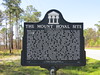
<< Other Photo Pages >> Mount Royal Site - Artificial Mound in United States in The South
Submitted by AKFisher on Friday, 04 August 2023 Page Views: 234
Pre-ColumbianSite Name: Mount Royal Site Alternative Name: Mount Royal MoundsCountry: United States
NOTE: This site is 66.195 km away from the location you searched for.
Region: The South Type: Artificial Mound
Nearest Town: Crescent City, FL
Latitude: 29.436430N Longitude: 81.66027W
Condition:
| 5 | Perfect |
| 4 | Almost Perfect |
| 3 | Reasonable but with some damage |
| 2 | Ruined but still recognisable as an ancient site |
| 1 | Pretty much destroyed, possibly visible as crop marks |
| 0 | No data. |
| -1 | Completely destroyed |
| 5 | Superb |
| 4 | Good |
| 3 | Ordinary |
| 2 | Not Good |
| 1 | Awful |
| 0 | No data. |
| 5 | Can be driven to, probably with disabled access |
| 4 | Short walk on a footpath |
| 3 | Requiring a bit more of a walk |
| 2 | A long walk |
| 1 | In the middle of nowhere, a nightmare to find |
| 0 | No data. |
| 5 | co-ordinates taken by GPS or official recorded co-ordinates |
| 4 | co-ordinates scaled from a detailed map |
| 3 | co-ordinates scaled from a bad map |
| 2 | co-ordinates of the nearest village |
| 1 | co-ordinates of the nearest town |
| 0 | no data |
Internal Links:
External Links:
")
The Mount Royal site was occupied beginning about 4,000 years ago. The site was largely unoccupied from 500 BCE until 750 CE. Mount Royal was occupied again after 750, and after 1050 it grew into the main town of an important chiefdom with connections to the Mississippian culture. The town lost importance after 1300, but a settlement, called Enacape, was still there when Europeans entered the area in the 1560s. The Spanish mission of San Antonio de Enacape was located in the town from 1595 until after 1656.
Location:
The Mount Royal site is located on the east side of the St. Johns River between Lake George, to the south, and Little Lake George. The site is on the north side of a short section of the river that flows to the west (the river in general flows northward). The most prominent feature is a large sand mound about 90 metres (300 ft) from the river. A causeway or avenue, still visible at the end of the 19th century, but since obscured, ran north from the mound to a rectangular pond. The mound is on a 1 acre (0.40 ha) parcel now owned by the State of Florida. The surrounding area, including the middens and village area, is part of the Mount Royal Airpark residential development.[4]
Archaeological investigation:
The Bartrams
The Mount Royal site entered the archaeological record in 1766, when John Bartram and his son William visited it. William returned to the site 15 years later. They found a sand mound 100 yards (90 m) in diameter, and almost 20 feet (6 m) tall. The Bartrams described an "avenue" running north from the mound, with raised banks on the sides. The avenue was "level as a floor", 60 yards (50 m) wide, and extended about .75 miles (1.2 km) to a rectangular pond 100 yards (91.4 m) wide and 150 yards (137.2 m) long. John Bartram speculated the pond had been a borrow pit from which the sand in the mound had been taken.[5]
On William's return to the site, he found that an orange grove and palms and live oaks that had flanked the avenue in 1766 had been cleared in preparation for planting. The 19th-century archaeologist Samuel Foster Haven called the reports published by the Bartrams "the earliest 'careful and intelligent' descriptions of a native American Indian mound."[6]
Clarence Moore:
In 1891, Clarence Bloomfield Moore, a self-trained archaeologist, investigated shell middens along the St. Johns River. In 1893, he returned to the St. Johns and began excavating sand mounds, including the one at Mount Royal. In two short seasons (two-and-a-half weeks in 1893 and three weeks in 1894), Moore excavated and backfilled almost all of the sand mound.[7] He published his findings at Mount Royal in two parts in the Journal of the Academy of Natural Sciences of Philadelphia in 1894, a total of more than 250 pages.[8]
Before Moore's first visit, the mound had been plowed over and the sides of the mound had slumped down, raising the ground level around the mound. As a result, Moore encountered problems with measuring the height of the mound. He estimated that the mound was 4.9 m. high, and stated that it had been much higher originally. He reported that the mound was 168 metres (551 ft) in circumference. The connection of the avenue to the mound was no longer discernible. He reported that the avenue was 12 to 20 yards (11 to 18 m) wide, flanked by berms that were an average of 2.5 feet (0.76 m) high and 12 feet (3.7 m) wide.[9]
Later investigations:
In the early 1950s John Goggin and his students from the University of Florida collected potsherds and other artifacts from the ground surface of the middens and other areas surrounding the Mount Royal mound. By this time the avenue reported by the Bartrams and Moore was no longer visible from the ground, but did show up in aerial photos. With the area slated for residential development, B. Calvin Jones of the Florida Bureau of Archaeological Research conducted investigations in 1983, 1994 and 1995, including shovel tests and focused excavations of selected areas.[10]. Souce: Wikipedia.
References:
1. National Register Information System". National Register of Historic Places. National Park Service. July 9, 2010.
2. Milanich 1999, p. 8.
3. Milanich 1999, pp. 9–13.
4. Ashley 2005, pp. 265–266.
5. Ashley 2005, p. 265.
6. Ashley 2005, pp. 265–66.
7. Milanich 1999, pp. 3, 6.
8. Milanich 1999, Sources.
9. Ashley 2005, pp. 266–67.
10. Ashley 2005, p. 272.
Sources:
Ashley, Keith H. (September–December 2005). "Archaeological Overview of Mt. Royal". The Florida Anthropologist. 58 (3–4): 265–286 – via University of Florida Digital Collections.
Milanich, Jerald T. (1994). Archaeology of Precolumbian Florida. Gainesville, Florida: University Press of Florida. ISBN 0-8130-1273-2.
Milanich, Jerald T. (1999). Famous Florida Sites: Crystal River and Mount Royal. Gainesville, Florida: University Press of Florida. ISBN 978-0-8130-1694-8.
Further reading and information:
Moore, Clarence Bloomfield (1894). Certain Sand Mounds of the St. John's River, Florida, Part 1. Philadelphia: The Levytype Company. - Free downloadable ebook
Moore, Clarence Bloomfield (1894). Certain Sand Mounds of the St. John's River, Florida, Part 2. Philadelphia: The Levytype Company. - Free downloadable ebook
Directions:
From Crescent City, FL via Huntington Rd, 11.1 mi.
You may be viewing yesterday's version of this page. To see the most up to date information please register for a free account.
")
")
Do not use the above information on other web sites or publications without permission of the contributor.
Nearby Images from Flickr
The above images may not be of the site on this page, but were taken nearby. They are loaded from Flickr so please click on them for image credits.
Click here to see more info for this site
Nearby sites
Click here to view sites on an interactive map of the areaKey: Red: member's photo, Blue: 3rd party photo, Yellow: other image, Green: no photo - please go there and take one, Grey: site destroyed
Download sites to:
KML (Google Earth)
GPX (GPS waypoints)
CSV (Garmin/Navman)
CSV (Excel)
To unlock full downloads you need to sign up as a Contributory Member. Otherwise downloads are limited to 50 sites.
Turn off the page maps and other distractions
Nearby sites listing. In the following links * = Image available
56.1km E 99° Nocoroco* Ancient Village or Settlement
56.8km E 101° Strickland Mound Complex Barrow Cemetery
59.0km SSE 150° Hontoon Island State Park* Artificial Mound
61.3km ESE 106° Ormond Burial Mound* Barrow Cemetery
77.6km ESE 117° Green Mound Artificial Mound
82.7km SSE 148° Indian Mound Village Site* Artificial Mound
84.9km ESE 122° Old Fort Mound Artificial Mound
98.5km SE 125° Turtle Mound* Artificial Mound
101.7km SE 128° Snyder's Mound* Ancient Mine, Quarry or other Industry
102.4km SE 126° Castle Windy Artificial Mound
104.5km N 5° Mill Cove Complex* Artificial Mound
108.7km WSW 238° Crystal River Archaeological State Park* Barrow Cemetery
127.5km SE 141° Windover (Florida)* Barrow Cemetery
145.9km SE 143° Brevard Museum of History and Natural Sciences* Museum
166.4km SW 219° Oelsner Indian Mound* Artificial Mound
184.5km SSE 151° Three Forks Marsh Artificial Mound
187.1km SSW 212° Safety Harbor Mound* Artificial Mound
199.4km SSW 208° Weedon Island Preserve* Barrow Cemetery
219.8km SSW 196° Portavant Mound Site Artificial Mound
227.1km SSW 204° Madira Bickel Mound State Archaeological Site* Artificial Mound
232.6km N 10° Sapelo Island Shell Ring Complex Ancient Village or Settlement
233.4km SSW 205° De Soto National Memorial* Artificial Mound
234.0km SSW 205° Pillsbury Temple Mound Artificial Mound
235.0km SSE 148° Vero Beach* Ancient Village or Settlement
249.9km SSW 200° Humming Stone Sarasota (Summstein)* Modern Stone Circle etc
View more nearby sites and additional images


 We would like to know more about this location. Please feel free to add a brief description and any relevant information in your own language.
 Wir möchten mehr über diese Stätte erfahren. Bitte zögern Sie nicht, eine kurze Beschreibung und relevante Informationen in Deutsch hinzuzufügen.
 Nous aimerions en savoir encore un peu sur les lieux. S'il vous plaît n'hesitez pas à ajouter une courte description et tous les renseignements pertinents dans votre propre langue.
 Quisieramos informarnos un poco más de las lugares. No dude en añadir una breve descripción y otros datos relevantes en su propio idioma.