<< Other Photo Pages >> Ormond Burial Mound - Barrow Cemetery in United States in The South
Submitted by bat400 on Friday, 06 May 2011 Page Views: 3595
Neolithic and Bronze AgeSite Name: Ormond Burial MoundCountry: United States
NOTE: This site is 9.281 km away from the location you searched for.
Region: The South Type: Barrow Cemetery
Nearest Town: Ormond Beach, FL
Latitude: 29.280150N Longitude: 81.05345W
Condition:
| 5 | Perfect |
| 4 | Almost Perfect |
| 3 | Reasonable but with some damage |
| 2 | Ruined but still recognisable as an ancient site |
| 1 | Pretty much destroyed, possibly visible as crop marks |
| 0 | No data. |
| -1 | Completely destroyed |
| 5 | Superb |
| 4 | Good |
| 3 | Ordinary |
| 2 | Not Good |
| 1 | Awful |
| 0 | No data. |
| 5 | Can be driven to, probably with disabled access |
| 4 | Short walk on a footpath |
| 3 | Requiring a bit more of a walk |
| 2 | A long walk |
| 1 | In the middle of nowhere, a nightmare to find |
| 0 | No data. |
| 5 | co-ordinates taken by GPS or official recorded co-ordinates |
| 4 | co-ordinates scaled from a detailed map |
| 3 | co-ordinates scaled from a bad map |
| 2 | co-ordinates of the nearest village |
| 1 | co-ordinates of the nearest town |
| 0 | no data |
Internal Links:
External Links:
")
You may be viewing yesterday's version of this page. To see the most up to date information please register for a free account.
")
")
")
")
Do not use the above information on other web sites or publications without permission of the contributor.
Nearby Images from Flickr

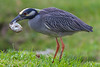


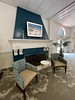
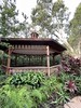
The above images may not be of the site on this page, but were taken nearby. They are loaded from Flickr so please click on them for image credits.
Click here to see more info for this site
Nearby sites
Click here to view sites on an interactive map of the areaKey: Red: member's photo, Blue: 3rd party photo, Yellow: other image, Green: no photo - please go there and take one, Grey: site destroyed
Download sites to:
KML (Google Earth)
GPX (GPS waypoints)
CSV (Garmin/Navman)
CSV (Excel)
To unlock full downloads you need to sign up as a Contributory Member. Otherwise downloads are limited to 50 sites.
Turn off the page maps and other distractions
Nearby sites listing. In the following links * = Image available
7.1km NNW 334° Strickland Mound Complex Barrow Cemetery
9.0km NNW 337° Nocoroco* Ancient Village or Settlement
20.9km SSE 151° Green Mound Artificial Mound
30.9km SSE 156° Old Fort Mound Artificial Mound
44.6km SSE 150° Turtle Mound* Artificial Mound
44.8km SW 221° Hontoon Island State Park* Artificial Mound
49.1km SSE 151° Castle Windy Artificial Mound
50.2km SSE 155° Snyder's Mound* Ancient Mine, Quarry or other Industry
55.3km SSW 196° Indian Mound Village Site* Artificial Mound
61.3km WNW 287° Mount Royal Site* Artificial Mound
84.8km SSE 166° Windover (Florida)* Barrow Cemetery
103.2km SSE 164° Brevard Museum of History and Natural Sciences* Museum
131.3km NNW 338° Mill Cove Complex* Artificial Mound
147.5km SSE 169° Three Forks Marsh Artificial Mound
156.5km WSW 255° Crystal River Archaeological State Park* Barrow Cemetery
193.5km SSE 160° Vero Beach* Ancient Village or Settlement
198.4km SW 236° Oelsner Indian Mound* Artificial Mound
212.3km SW 229° Safety Harbor Mound* Artificial Mound
220.0km SW 224° Weedon Island Preserve* Barrow Cemetery
227.4km SSW 212° Portavant Mound Site Artificial Mound
242.9km SW 219° Madira Bickel Mound State Archaeological Site* Artificial Mound
247.2km N 356° Sapelo Island Shell Ring Complex Ancient Village or Settlement
249.7km SW 219° De Soto National Memorial* Artificial Mound
250.5km SW 219° Pillsbury Temple Mound Artificial Mound
258.6km S 182° Fort Center Archaeological Site* Artificial Mound
View more nearby sites and additional images


 We would like to know more about this location. Please feel free to add a brief description and any relevant information in your own language.
 Wir möchten mehr über diese Stätte erfahren. Bitte zögern Sie nicht, eine kurze Beschreibung und relevante Informationen in Deutsch hinzuzufügen.
 Nous aimerions en savoir encore un peu sur les lieux. S'il vous plaît n'hesitez pas à ajouter une courte description et tous les renseignements pertinents dans votre propre langue.
 Quisieramos informarnos un poco más de las lugares. No dude en añadir una breve descripción y otros datos relevantes en su propio idioma.