<< Our Photo Pages >> Castro de Santa Olaia - Castro or Chafurdão in Portugal in Coimbra
Submitted by TheCaptain on Wednesday, 08 September 2010 Page Views: 3596
Iron Age and Later PrehistorySite Name: Castro de Santa Olaia Alternative Name: Castro de Santa EuláliaCountry: Portugal
NOTE: This site is 8.47 km away from the location you searched for.
Distrito: Coimbra Type: Castro or Chafurdão
Nearest Town: Figueira da Foz Nearest Village: Ferreira-a-Nova
Latitude: 40.170785N Longitude: 8.719425W
Condition:
| 5 | Perfect |
| 4 | Almost Perfect |
| 3 | Reasonable but with some damage |
| 2 | Ruined but still recognisable as an ancient site |
| 1 | Pretty much destroyed, possibly visible as crop marks |
| 0 | No data. |
| -1 | Completely destroyed |
| 5 | Superb |
| 4 | Good |
| 3 | Ordinary |
| 2 | Not Good |
| 1 | Awful |
| 0 | No data. |
| 5 | Can be driven to, probably with disabled access |
| 4 | Short walk on a footpath |
| 3 | Requiring a bit more of a walk |
| 2 | A long walk |
| 1 | In the middle of nowhere, a nightmare to find |
| 0 | No data. |
| 5 | co-ordinates taken by GPS or official recorded co-ordinates |
| 4 | co-ordinates scaled from a detailed map |
| 3 | co-ordinates scaled from a bad map |
| 2 | co-ordinates of the nearest village |
| 1 | co-ordinates of the nearest town |
| 0 | no data |
Internal Links:
External Links:
I have visited· I would like to visit
Bak_teria visited on 29th Aug 2015 - their rating: Cond: 2 Amb: 3 Access: 4

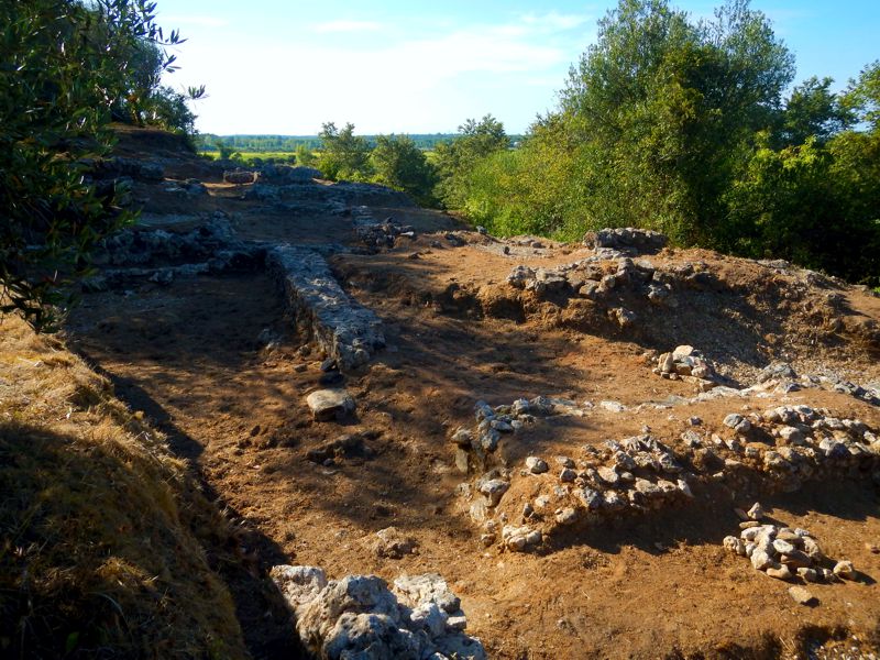
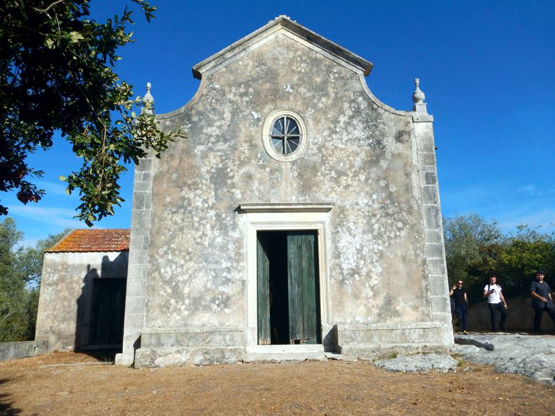
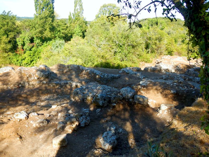
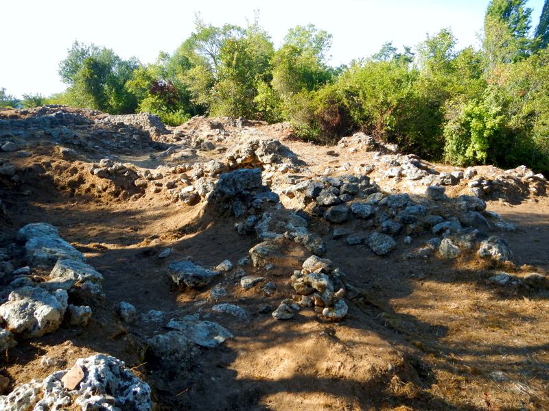
The site of Santa Olaia was very probably, in antiquity, deployed in a small islet in a low altitude hill (with an average height of 20m), surrounded at north and at south by alluvial land, now occupied by rice paddies. At East is one depression of 80m in width, its designated as a Pit and separates the ancient settlement of Santa Olaia from the Ferrestelo Hill. The Hill of Santa Eulalia has an ellipsoidal configuration with the major axis oriented from W/NW to E/SE. The maximum length is of 160m and the maximum width is of about 35m. In this space were identified 6 different times of occupation: One from the Neolithic era, three periods at the Iron Age, one at the Roman era and another at Medieval times. The most important remains date from the Iron Age, in such have been identified a big group of houses as well as many objects of pottery and iron. This site was excavated by Santos Rocha in the early years of the twentieth century. It was again interventioned at 1992-93 by Isabel Pereira. This monument was classified as IIP – Imóvel de Interesse Público (Estate of Public Interest) at the 2nd of November, 1954. About the location and the degradation of the site The site early suffered with systematic destruction of disastrous consequences, since the road connections that connect Figueira da Foz with Coimbra pass near by the site. The construction of the main road, yet in time before the first works of the archaeologist Santos Rocha, it was the beginning of a long process of damage. In 1937, the widening of the road, now called EN 111 (national road 111), would cause the destruction of part of the walls and of the floor, at time put open by Santos Rocha and also the landfill of the Pit, to enable access to the paddy fields. More serious were, however, the damage caused by the construction of the IP3 road, when the North structures (the ditch, the walls and ovens) were seriously affected. About the different phases of occupation In all the constructive moments from the Iron Age, housing structures were built with rectangular plants, some of which are divided into compartments, the larger ones belong to the first moment of occupation. These are compartments whose length varies between 3.75m and 3.25m and whose width does not exceed 2.25 m. The walls were made up of abode heave on foundations built with small and medium-sized stones, all connected with clay. The floors of the houses were made of a very compacted clay ground, which was covered with yellow sand. These floors amounted to only 10 cm above the base of the stony foundation. The site was all surrounded by a big wall. At a distance of 22 meters in length, limited at North by a wall, was discovered a battery of furnaces of different types, which have been operating between the seventh century and the fifth century BC. The ovens excavated in 1992, covering an area of 960 square meters, were circular, semicircular and piriform. The first two had exterior stone walls and were coated inside with a thin clay layer, which also coated the bottom of these ovens. The pear-shaped form ovens were fully built in clay. About the artefacts The excavation of the site provided a large ceramic and metallic estate. The presence of polished and rough manual ceramic and red engobe ceramic stands out (small lamps, plates and carinated bowls), which includes broad and flattened board dishes, some of which feature painted decoration white on the boards. There are also present vessels painted in bands such as pithoi and cruz del negro style urns and polished thin gray ceramics. About the access Near by the main road there's a small access road which leads to the site. Is also possible to see informative plaques with the map of the location. There's also a small chapel and an Iron Age necropolis known as Ferrestelo that is also possible to visit near by. At the time of my visit, the woods were in a serious need of a cleaning.
Links and other important information sources (texts written in Portuguese):
- DGPC
- Portal do Arqueólogo
- Portuguese Wikipedia page
- Blog from the University of Lisbon, Os Fenícios em Portugal
Note: Site originally posted by TheCaptain. Aditional info by Bak_teria.
You may be viewing yesterday's version of this page. To see the most up to date information please register for a free account.


Do not use the above information on other web sites or publications without permission of the contributor.
Nearby Images from Flickr


The above images may not be of the site on this page, but were taken nearby. They are loaded from Flickr so please click on them for image credits.
Click here to see more info for this site
Nearby sites
Click here to view sites on an interactive map of the areaKey: Red: member's photo, Blue: 3rd party photo, Yellow: other image, Green: no photo - please go there and take one, Grey: site destroyed
Download sites to:
KML (Google Earth)
GPX (GPS waypoints)
CSV (Garmin/Navman)
CSV (Excel)
To unlock full downloads you need to sign up as a Contributory Member. Otherwise downloads are limited to 50 sites.
Turn off the page maps and other distractions
Nearby sites listing. In the following links * = Image available
196m E 99° Necrópole do Ferrestelo Cist
7.6km WNW 284° Anta das Carniçosas* Burial Chamber or Dolmen
12.2km W 260° Museu Municipal Santos Rocha Museum
21.1km ESE 112° Parque Arqueológico de Conimbriga* Ancient Village or Settlement
26.7km ESE 124° Villa Romana de Rabaçal Ancient Village or Settlement
32.1km SSE 159° Anta do Alto da Carrasqueira* Burial Chamber or Dolmen
33.0km NE 44° Mealhada City Park Sculptured Megalithic Circle Modern Stone Circle etc
44.1km E 80° Dólmen de São Pedro Dias* Burial Chamber or Dolmen
46.2km SE 145° Castro da Serra de Alvaiázere* Castro or Chafurdão
54.4km SSE 147° Complexo Megalítico do Rego da Murta* Burial Chamber or Dolmen
55.5km SE 140° Anthropomorphic Trapezoid Visigothic Grave* Rock Cut Tomb
58.8km E 82° Castro da Lomba do Canho Castro or Chafurdão
61.0km NNE 21° Mamoa de Açôres Round Barrow(s)
62.0km S 183° Miradouro Jurássico de Alqueidão da Serra* Modern Stone Circle etc
64.8km NE 41° Anta da Arca* Burial Chamber or Dolmen
64.8km NNE 32° Dólmen de Chão Redondo 2* Burial Chamber or Dolmen
64.8km NNE 32° Dólmen de Chão Redondo 1* Burial Chamber or Dolmen
65.3km NNE 31° Anta do Poço dos Mouros Passage Grave
67.2km NNE 32° Anta da Sepultura do Rei Chambered Tomb
67.7km NNE 31° Anta da Capela dos Mouros* Burial Chamber or Dolmen
68.3km NE 52° Castro de Nandunfe Castro or Chafurdão
68.5km ENE 62° Orca do sto. Tisco* Burial Chamber or Dolmen
68.9km NNE 25° Dólmen do Souto do Coval 2 Burial Chamber or Dolmen
69.0km NNE 25° Dólmen do Souto do Coval 1 Burial Chamber or Dolmen
71.0km ENE 58° Anta da Arquinha da Moura* Burial Chamber or Dolmen
View more nearby sites and additional images


 We would like to know more about this location. Please feel free to add a brief description and any relevant information in your own language.
 Wir möchten mehr über diese Stätte erfahren. Bitte zögern Sie nicht, eine kurze Beschreibung und relevante Informationen in Deutsch hinzuzufügen.
 Nous aimerions en savoir encore un peu sur les lieux. S'il vous plaît n'hesitez pas à ajouter une courte description et tous les renseignements pertinents dans votre propre langue.
 Quisieramos informarnos un poco más de las lugares. No dude en añadir una breve descripción y otros datos relevantes en su propio idioma.