<< Our Photo Pages >> Ballymacus megalithic tomb - Burial Chamber or Dolmen in Ireland (Republic of) in Co. Cork
Submitted by GaelicLaird on Monday, 26 April 2021 Page Views: 687
Neolithic and Bronze AgeSite Name: Ballymacus megalithic tombCountry: Ireland (Republic of)
NOTE: This site is 10.104 km away from the location you searched for.
County: Co. Cork Type: Burial Chamber or Dolmen
Nearest Town: Kinsale
Latitude: 51.683009N Longitude: 8.459136W
Condition:
| 5 | Perfect |
| 4 | Almost Perfect |
| 3 | Reasonable but with some damage |
| 2 | Ruined but still recognisable as an ancient site |
| 1 | Pretty much destroyed, possibly visible as crop marks |
| 0 | No data. |
| -1 | Completely destroyed |
| 5 | Superb |
| 4 | Good |
| 3 | Ordinary |
| 2 | Not Good |
| 1 | Awful |
| 0 | No data. |
| 5 | Can be driven to, probably with disabled access |
| 4 | Short walk on a footpath |
| 3 | Requiring a bit more of a walk |
| 2 | A long walk |
| 1 | In the middle of nowhere, a nightmare to find |
| 0 | No data. |
| 5 | co-ordinates taken by GPS or official recorded co-ordinates |
| 4 | co-ordinates scaled from a detailed map |
| 3 | co-ordinates scaled from a bad map |
| 2 | co-ordinates of the nearest village |
| 1 | co-ordinates of the nearest town |
| 0 | no data |
Internal Links:
External Links:
I have visited· I would like to visit
rrmoser would like to visit
")
This term is used for megalithic tombs that cannot be classified as a court tomb, portal tomb, passage tomb or wedge tomb. These may date from the Neolithic to the Bronze Age (c. 4000 - c. 500 BC).
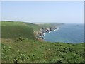
Situated at edge of steep slope above cliff at Ballymacus Point. Monument consists of oblong cairn (L 8.5m; Wth 2.5m) with oblong depression, abutting old fence. Remains of gallery, at W end (L 3.6m), aligned E-W; represented by three orthostats and a prostrate slab to S, single orthostat to W. Cremen (1924, 73) records that, in 1872, a party of soldiers dug into the monument and removed a 'covering slab'. The remains appear to be last vestiges of a megalithic tomb.
The above description is derived from the published 'Archaeological Inventory of County Cork. Volume 2: East and South Cork' (Dublin: Stationery Office, 1994).
I award this site the coveted score of 5 on Ambience....it really is superb.
You may be viewing yesterday's version of this page. To see the most up to date information please register for a free account.
")
")
")
")
Do not use the above information on other web sites or publications without permission of the contributor.
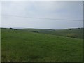
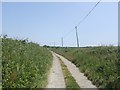
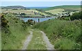
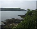
Nearby Images from Geograph Britain and Ireland:
©2009(licence)
©2009(licence)
©2015(licence)
©2009(licence)
©2009(licence)
The above images may not be of the site on this page, they are loaded from Geograph.
Please Submit an Image of this site or go out and take one for us!
Click here to see more info for this site
Nearby sites
Click here to view sites on an interactive map of the areaKey: Red: member's photo, Blue: 3rd party photo, Yellow: other image, Green: no photo - please go there and take one, Grey: site destroyed
Download sites to:
KML (Google Earth)
GPX (GPS waypoints)
CSV (Garmin/Navman)
CSV (Excel)
To unlock full downloads you need to sign up as a Contributory Member. Otherwise downloads are limited to 50 sites.
Turn off the page maps and other distractions
Nearby sites listing. In the following links * = Image available
1.7km NW 311° Clonleigh Standing Stone (Menhir) (W670490)
2.2km WNW 301° Clonleigh Boulder Burial* Burial Chamber or Dolmen
11.4km N 3° Piercetown* Stone Row / Alignment (W690593)
14.7km N 356° Meadstown standing stone* Standing Stone (Menhir)
15.0km WNW 285° Rathdrought Stone Row / Alignment (W53785184)
18.0km N 4° Ballinvuskig standing stone (south)* Standing Stone (Menhir)
18.3km N 3° Ballinvuskig standing stone (north)* Standing Stone (Menhir)
21.6km W 266° Burrane Standing Stone* Standing Stone (Menhir) (W4668346564)
22.6km WSW 256° Barryshall* Standing Stones (W46234269)
22.9km W 268° Clogagh Standing Stones (W45384715)
23.5km WNW 303° Castlenalacht* Stone Row / Alignment (W4863660858)
23.5km N 354° University College Cork - Stone Corridor* Museum
23.6km NNW 342° Carrigrohane north standing stone* Standing Stone (Menhir)
23.6km WNW 304° Castlenalact standing stone* Standing Stone (Menhir) (W4863461109)
23.8km N 354° Cork Public Museum* Museum
26.1km N 350° Killeens South standing stone* Standing Stone (Menhir)
26.2km W 264° Carrig Stone* Standing Stone (Menhir) (W4219245148)
26.4km NNW 335° Garravagh standing stone* Standing Stone (Menhir)
26.4km N 350° Killeens North standing stone* Standing Stone (Menhir)
26.6km WSW 252° Ballymacwilliam Standing Stone* Standing Stone (Menhir) (W4291739801)
27.0km WSW 257° Darrary Stone Fort Stone Fort or Dun
27.1km WSW 256° Lisnagrough fort Stone Fort or Dun
27.1km WSW 257° Lisnagun Standing Stone* Standing Stone (Menhir) (W4175141836)
27.2km NE 44° Rostellan* Portal Tomb (W8746267180)
27.2km WNW 300° Kilbarry standing stone* Standing Stone (Menhir)
View more nearby sites and additional images


 We would like to know more about this location. Please feel free to add a brief description and any relevant information in your own language.
 Wir möchten mehr über diese Stätte erfahren. Bitte zögern Sie nicht, eine kurze Beschreibung und relevante Informationen in Deutsch hinzuzufügen.
 Nous aimerions en savoir encore un peu sur les lieux. S'il vous plaît n'hesitez pas à ajouter une courte description et tous les renseignements pertinents dans votre propre langue.
 Quisieramos informarnos un poco más de las lugares. No dude en añadir una breve descripción y otros datos relevantes en su propio idioma.