<< Our Photo Pages >> Ráth Mór - Artificial Mound in Ireland (Republic of) in Co. Roscommon
Submitted by KaiHofmann on Wednesday, 28 November 2012 Page Views: 1837
Multi-periodSite Name: Ráth Mór Alternative Name: RathmoreCountry: Ireland (Republic of)
NOTE: This site is 5.64 km away from the location you searched for.
County: Co. Roscommon Type: Artificial Mound
Nearest Village: Rathcroghan
Latitude: 53.810096N Longitude: 8.310758W
Condition:
| 5 | Perfect |
| 4 | Almost Perfect |
| 3 | Reasonable but with some damage |
| 2 | Ruined but still recognisable as an ancient site |
| 1 | Pretty much destroyed, possibly visible as crop marks |
| 0 | No data. |
| -1 | Completely destroyed |
| 5 | Superb |
| 4 | Good |
| 3 | Ordinary |
| 2 | Not Good |
| 1 | Awful |
| 0 | No data. |
| 5 | Can be driven to, probably with disabled access |
| 4 | Short walk on a footpath |
| 3 | Requiring a bit more of a walk |
| 2 | A long walk |
| 1 | In the middle of nowhere, a nightmare to find |
| 0 | No data. |
| 5 | co-ordinates taken by GPS or official recorded co-ordinates |
| 4 | co-ordinates scaled from a detailed map |
| 3 | co-ordinates scaled from a bad map |
| 2 | co-ordinates of the nearest village |
| 1 | co-ordinates of the nearest town |
| 0 | no data |
Be the first person to rate this site - see the 'Contribute!' box in the right hand menu.
Internal Links:
External Links:
")
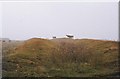
Artificial mound of the 6th-7th century CE. It belongs to the Rathcroghan complex which is an important site of the Irish mythology. In this area 4 other larger mounds are located.
You may be viewing yesterday's version of this page. To see the most up to date information please register for a free account.
")
Do not use the above information on other web sites or publications without permission of the contributor.
davidmorgan has found this location on Google Street View:
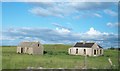
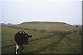
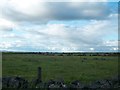
Nearby Images from Geograph Britain and Ireland:

©2011(licence)
©2011(licence)
©2008(licence)
©2011(licence)
©2008(licence)
The above images may not be of the site on this page, they are loaded from Geograph.
Please Submit an Image of this site or go out and take one for us!
Click here to see more info for this site
Nearby sites
Click here to view sites on an interactive map of the areaKey: Red: member's photo, Blue: 3rd party photo, Yellow: other image, Green: no photo - please go there and take one, Grey: site destroyed
Download sites to:
KML (Google Earth)
GPX (GPS waypoints)
CSV (Garmin/Navman)
CSV (Excel)
To unlock full downloads you need to sign up as a Contributory Member. Otherwise downloads are limited to 50 sites.
Turn off the page maps and other distractions
Nearby sites listing. In the following links * = Image available
868m SSE 147° Misgaun Maeve Stone Standing Stone (Menhir)
883m S 189° Rath na tDarbh* Round Barrow(s)
997m SSE 152° Rath Cruachan* Artificial Mound
1.4km S 179° Oweynagat* Cave or Rock Shelter
3.9km NW 308° Standing stone near Rathcroghan* Standing Stone (Menhir)
4.3km SSE 148° Ogulla Well Holy Well or Sacred Spring
4.7km NW 305° Drummin Stones* Standing Stones
5.1km SE 133° Cruachan Aí Heritage Centre* Museum
5.6km WNW 295° Kilcorkey Stone* Standing Stone (Menhir)
6.9km SSE 151° Cloghfadnacarn Stone* Standing Stone (Menhir)
18.0km N 351° Ballynanultagh* Portal Tomb (G76800237)
21.8km NNW 333° Ballynakill (LoughRea) Stone Circle* Stone Circle (G696040)
25.0km S 174° Castlestrange* Rock Art (M8203559675)
25.6km WNW 289° Kilcashel Stone Fort* Stone Fort or Dun
26.3km WNW 292° Kilmovee Ogham Stone* Sculptured Stone
27.0km N 351° Carrowkeel N Passage Grave (G756113)
27.1km N 351° Carrowkeel M Passage Grave (G755114)
27.2km N 350° Carrowkeel F* Passage Grave (G749114)
27.3km N 352° Carrowkeel P Passage Grave (G760116)
27.4km N 352° Carrowkeel O Passage Grave (G759117)
27.4km N 350° Carrowkeel Cairn E* Court Tomb (G7492711606)
27.5km N 351° Carrowkeel L* Passage Grave (G753117)
27.5km N 351° Carrowkeel Cairn K* Chambered Cairn (G7533511726)
27.5km N 349° Carrowkeel B* Passage Grave (G7446711598)
27.6km N 351° Carrowkeel H* Passage Grave (G7530211863)
View more nearby sites and additional images


 We would like to know more about this location. Please feel free to add a brief description and any relevant information in your own language.
 Wir möchten mehr über diese Stätte erfahren. Bitte zögern Sie nicht, eine kurze Beschreibung und relevante Informationen in Deutsch hinzuzufügen.
 Nous aimerions en savoir encore un peu sur les lieux. S'il vous plaît n'hesitez pas à ajouter une courte description et tous les renseignements pertinents dans votre propre langue.
 Quisieramos informarnos un poco más de las lugares. No dude en añadir una breve descripción y otros datos relevantes en su propio idioma.