<< Text Pages >> Cueva de los Tayos - Cave or Rock Shelter in Ecuador
Submitted by Runemage on Tuesday, 31 July 2012 Page Views: 3518
Natural PlacesSite Name: Cueva de los Tayos Alternative Name: Cave of the OilbirdsCountry: Ecuador
NOTE: This site is 413.986 km away from the location you searched for.
Type: Cave or Rock Shelter
Latitude: 1.933333S Longitude: 77.792778W
Condition:
| 5 | Perfect |
| 4 | Almost Perfect |
| 3 | Reasonable but with some damage |
| 2 | Ruined but still recognisable as an ancient site |
| 1 | Pretty much destroyed, possibly visible as crop marks |
| 0 | No data. |
| -1 | Completely destroyed |
| 5 | Superb |
| 4 | Good |
| 3 | Ordinary |
| 2 | Not Good |
| 1 | Awful |
| 0 | No data. |
| 5 | Can be driven to, probably with disabled access |
| 4 | Short walk on a footpath |
| 3 | Requiring a bit more of a walk |
| 2 | A long walk |
| 1 | In the middle of nowhere, a nightmare to find |
| 0 | No data. |
| 5 | co-ordinates taken by GPS or official recorded co-ordinates |
| 4 | co-ordinates scaled from a detailed map |
| 3 | co-ordinates scaled from a bad map |
| 2 | co-ordinates of the nearest village |
| 1 | co-ordinates of the nearest town |
| 0 | no data |
Internal Links:
External Links:
Cave or Rock Shelter in Ecuador
The cave was popularized by Erich von Däniken's 1973 book The Gold of the Gods, in which he wrote that Juan Moricz had claimed to have explored Cueva de los Tayos in 1969 and discovered mounds of gold, unusual sculptures and a metallic library. These items were said to be located within artificial tunnels that had been created by a lost civilization with help from extraterrestrial beings. Von Däniken had previously stirred public imagination by suggesting that extraterrestrials were involved in ancient civilizations in his popular book Chariots of the Gods?.
As a result of the claims published in von Däniken’s book, an investigation of Cueva de los Tayos was organized by Stan Hall from Britain in 1976. One of the largest and most expensive cave explorations ever undertaken, the expedition included over a hundred people, including experts in a variety of fields, British and Ecuadorian military personnel, a film crew, and former astronaut Neil Armstrong. The team also included eight experienced British cavers who thoroughly explored the cave and conducted an accurate survey to produce a detailed map of the cave. There was no evidence of Von Däniken’s more exotic claims, although some physical features of the cave did approximate his descriptions and some items of zoological, botanical and archaeological interest were found.
http://en.wikipedia.org/wiki/Cueva_de_los_Tayos
Leading to some controversial claims
http://www.goldlibrary.com/
http://tayoscave.wordpress.com/2012/07/24/legendary-metal-library-found-in-tayos-cave-in-ecuador/
You may be viewing yesterday's version of this page. To see the most up to date information please register for a free account.
Do not use the above information on other web sites or publications without permission of the contributor.
Nearby Images from Flickr
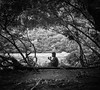
The above images may not be of the site on this page, but were taken nearby. They are loaded from Flickr so please click on them for image credits.
Click here to see more info for this site
Nearby sites
Click here to view sites on an interactive map of the areaKey: Red: member's photo, Blue: 3rd party photo, Yellow: other image, Green: no photo - please go there and take one, Grey: site destroyed
Download sites to:
KML (Google Earth)
GPX (GPS waypoints)
CSV (Garmin/Navman)
CSV (Excel)
To unlock full downloads you need to sign up as a Contributory Member. Otherwise downloads are limited to 50 sites.
Turn off the page maps and other distractions
Nearby sites listing. In the following links * = Image available
138.0km WSW 240° Ingapirca* Ancient Village or Settlement
172.2km SW 231° Pumapungo Ancient Village or Settlement
182.9km NW 318° Malqui-Machay* Ancient Village or Settlement
226.3km NNW 342° Catequilla* Stone Circle
227.8km NNW 342° Rumicucho Pucara Hillfort
228.3km NNW 346° Cochasqui Ancient Village or Settlement
239.3km N 353° Pyramids of Zuleta Pyramid / Mastaba
253.5km N 352° Inca-Caranqui* Ancient Village or Settlement
335.3km SSW 206° Santa Ana - La Florida Ancient Village or Settlement
404.7km S 186° Cordillera de Colan Citadel Hillfort
433.7km SSW 195° San Isidro Ancient Temple
435.0km SSW 195° Jaén Temples* Ancient Temple
444.5km SW 214° Laynes Vicus Site Ancient Village or Settlement
457.6km NNE 21° San Agustin Parque Arqueologico* Sculptured Stone
458.4km NNE 22° El Tablon (San Agustin)* Sculptured Stone
458.8km NNE 22° Alto del Tigre* Rock Art
459.0km NNE 21° El Purutal* Burial Chamber or Dolmen
459.0km NNE 21° La Pelota* Sculptured Stone
459.1km NNE 22° La Chaquira* Rock Art
459.8km NNE 21° Petroglifos del Estrecho* Rock Art
460.1km NNE 22° Alto de las Guacas* Burial Chamber or Dolmen
461.0km S 181° Iyacyecuj Cave Cave or Rock Shelter
461.5km NNE 21° Obando* Rock Cut Tomb
461.5km NNE 22° Alto de los Idolos* Artificial Mound
469.5km S 183° Karajia Burial Chamber or Dolmen
View more nearby sites and additional images


 We would like to know more about this location. Please feel free to add a brief description and any relevant information in your own language.
 Wir möchten mehr über diese Stätte erfahren. Bitte zögern Sie nicht, eine kurze Beschreibung und relevante Informationen in Deutsch hinzuzufügen.
 Nous aimerions en savoir encore un peu sur les lieux. S'il vous plaît n'hesitez pas à ajouter une courte description et tous les renseignements pertinents dans votre propre langue.
 Quisieramos informarnos un poco más de las lugares. No dude en añadir una breve descripción y otros datos relevantes en su propio idioma.