<< Text Pages >> Foamhenge (Cox Farms) - Modern Stone Circle etc in United States in Mid Atlantic
Submitted by AKFisher on Thursday, 04 April 2024 Page Views: 60
Modern SitesSite Name: Foamhenge (Cox Farms)Country: United States
NOTE: This site is 22.948 km away from the location you searched for.
Region: Mid Atlantic Type: Modern Stone Circle etc
Nearest Town: Centreville, VA Nearest Village: Centreville, VA
Latitude: 38.880670N Longitude: 77.49303W
Condition:
| 5 | Perfect |
| 4 | Almost Perfect |
| 3 | Reasonable but with some damage |
| 2 | Ruined but still recognisable as an ancient site |
| 1 | Pretty much destroyed, possibly visible as crop marks |
| 0 | No data. |
| -1 | Completely destroyed |
| 5 | Superb |
| 4 | Good |
| 3 | Ordinary |
| 2 | Not Good |
| 1 | Awful |
| 0 | No data. |
| 5 | Can be driven to, probably with disabled access |
| 4 | Short walk on a footpath |
| 3 | Requiring a bit more of a walk |
| 2 | A long walk |
| 1 | In the middle of nowhere, a nightmare to find |
| 0 | No data. |
| 5 | co-ordinates taken by GPS or official recorded co-ordinates |
| 4 | co-ordinates scaled from a detailed map |
| 3 | co-ordinates scaled from a bad map |
| 2 | co-ordinates of the nearest village |
| 1 | co-ordinates of the nearest town |
| 0 | no data |
Internal Links:
External Links:
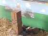
A full-scale styrofoam replica of Stonehenge, which was originally located in Natural Bridge, Virginia. It was conceived and built by artist Mark Cline as a roadside attraction, and opened on April 1, 2004. In 2017, Foamhenge was relocated to Cox Farms, Centreville, Virginia.
Foamhenge was created in 2004 by Mark Cline of Enchanted Castle Studios as an April Fool's Day stunt to generate tourism. The idea for Foamhenge came to Mark in 1998, when he was inspired by 16-foot-tall (4.9 m) foam blocks that he saw at a local insulation manufacturer. Mark had the concept and materials, but needed a location for his creation. In 2004, he made an agreement with The Natural Bridge for rent-free land with the intention of attracting tourists to both sites.[1]
Foamhenge was designed to match Stonehenge, with similarly sized pieces oriented in astronomically equivalent coordinates. The 'stones' are composed completely of styrofoam and painted gray, weighing approximately 420 lbs. apiece. They are stabilized with embedded 2.5-inch-diameter (6.4 cm) piping, extending from a concrete footing to the top of each stone. The entire structure was assembled in about ten days, as opposed to Stonehenge's construction period of about 1000 years.
Foamhenge stayed at the Natural Bridge site for over 12 years. By 2015, the foam pieces had deteriorated markedly due to the temporary nature of their construction and overexposure to the elements in a moderate climate. Many of the pieces had fallen into disrepair to the point that they had split apart and held together with temporary supports.[6]
The Natural Bridge became a state park in 2016, subsequently causing Foamhenge to close. The structure was dismantled on August 30, 2016, and placed in storage. After receiving over fifty inquiries from across the United States, Cline agreed to relocate Foamhenge to Cox Farms, a popular 116-acre (47 ha) family farm, near Centreville, VA, a suburb of Washington, D.C. After the pieces were repaired and repainted, they were moved and re-constructed, with help from an astronomer, for permanent display at Cox Farms. With guidance from Harold Geller, the Observatory Director at nearby George Mason University, the pieces were accurately placed to align with the Summer solstice just like Stonehenge.[5] Foamhenge officially re-opened at its new location just in time for the start of the farm's Fall Festival on September 16, 2017.
Further Information and Reading:
Wikipedia: en.wikipedia.org/wiki/Foamhenge
Foamhenge Site (Cox Farms): coxfarms.com/about/foamhenge/
Directions: From Centreville, VA via State Rte 620 and Braddock Rd., 5.3 mi.
Note: Please send us a photo if you have visited!
You may be viewing yesterday's version of this page. To see the most up to date information please register for a free account.
Do not use the above information on other web sites or publications without permission of the contributor.
Nearby Images from Flickr


The above images may not be of the site on this page, but were taken nearby. They are loaded from Flickr so please click on them for image credits.
Click here to see more info for this site
Nearby sites
Click here to view sites on an interactive map of the areaKey: Red: member's photo, Blue: 3rd party photo, Yellow: other image, Green: no photo - please go there and take one, Grey: site destroyed
Download sites to:
KML (Google Earth)
GPX (GPS waypoints)
CSV (Garmin/Navman)
CSV (Excel)
To unlock full downloads you need to sign up as a Contributory Member. Otherwise downloads are limited to 50 sites.
Turn off the page maps and other distractions
Nearby sites listing. In the following links * = Image available
38.7km E 84° Embassy of Costa Rica, Washington DC Carving
41.0km NW 307° Spout Run* Not Known (by us)
67.4km W 269° Thunderbird Archaeological District* Ancient Mine, Quarry or other Industry
69.0km E 98° Pig Point Ancient Village or Settlement
101.7km E 101° Paw Paw Cove Natural Stone / Erratic / Other Natural Feature
139.4km SSW 202° Elk Hill Petroglyphs Rock Art
148.1km NE 40° Safe Harbor Petroglyphs* Rock Art
172.0km NNE 33° Bring Rocks Manheim* Modern Stone Circle etc
203.1km NNE 24° Boxcar Rocks* Natural Stone / Erratic / Other Natural Feature
205.4km S 178° Cactus Hill Ancient Village or Settlement
225.8km SW 233° Foamhenge (Natural Bridge)* Modern Stone Circle etc
230.7km ENE 58° Penn Museum* Museum
238.7km NE 41° Oley Hills* Cairn
248.7km NE 43° Vera Cruz Quarry Pits* Ancient Mine, Quarry or other Industry
252.4km NE 41° Museum of Indian Culture* Museum
257.4km NE 51° Bucks County PA Sacred Ceremonial Stone Landscape* Standing Stones
275.4km NE 47° Ringing Rocks* Natural Stone / Erratic / Other Natural Feature
280.5km NE 43° Lenape Nation Cultural Center and Trading Post Museum
281.4km NW 310° McKees Rocks Mound* Artificial Mound
282.8km NE 41° Jacobsburg Stone Skull* Rock Art
287.6km NE 49° Quakertown Bedrock Mortar Museum
299.9km NW 307° Artificial Mound in Great Lakes Midwest* Artificial Mound
299.9km NE 40° Columcille Megalith Park* Modern Stone Circle etc
300.9km WNW 302° Meadowcroft Rockshelter* Cave or Rock Shelter
302.2km WNW 293° Grave Creek Mound* Artificial Mound
View more nearby sites and additional images


 We would like to know more about this location. Please feel free to add a brief description and any relevant information in your own language.
 Wir möchten mehr über diese Stätte erfahren. Bitte zögern Sie nicht, eine kurze Beschreibung und relevante Informationen in Deutsch hinzuzufügen.
 Nous aimerions en savoir encore un peu sur les lieux. S'il vous plaît n'hesitez pas à ajouter une courte description et tous les renseignements pertinents dans votre propre langue.
 Quisieramos informarnos un poco más de las lugares. No dude en añadir una breve descripción y otros datos relevantes en su propio idioma.