<< Other Photo Pages >> Elmore Balancing Rock - Natural Stone / Erratic / Other Natural Feature in United States in New England
Submitted by davidmorgan on Friday, 19 January 2024 Page Views: 205
Natural PlacesSite Name: Elmore Balancing RockCountry: United States
NOTE: This site is 28.401 km away from the location you searched for.
Region: New England Type: Natural Stone / Erratic / Other Natural Feature
Nearest Town: Morrisville
Latitude: 44.532000N Longitude: 72.548W
Condition:
| 5 | Perfect |
| 4 | Almost Perfect |
| 3 | Reasonable but with some damage |
| 2 | Ruined but still recognisable as an ancient site |
| 1 | Pretty much destroyed, possibly visible as crop marks |
| 0 | No data. |
| -1 | Completely destroyed |
| 5 | Superb |
| 4 | Good |
| 3 | Ordinary |
| 2 | Not Good |
| 1 | Awful |
| 0 | No data. |
| 5 | Can be driven to, probably with disabled access |
| 4 | Short walk on a footpath |
| 3 | Requiring a bit more of a walk |
| 2 | A long walk |
| 1 | In the middle of nowhere, a nightmare to find |
| 0 | No data. |
| 5 | co-ordinates taken by GPS or official recorded co-ordinates |
| 4 | co-ordinates scaled from a detailed map |
| 3 | co-ordinates scaled from a bad map |
| 2 | co-ordinates of the nearest village |
| 1 | co-ordinates of the nearest town |
| 0 | no data |
Internal Links:
External Links:
")
A balancing rock in Elmore State Park, Vermont.
Here is the state park information brochure.
You may be viewing yesterday's version of this page. To see the most up to date information please register for a free account.
Do not use the above information on other web sites or publications without permission of the contributor.
Nearby Images from Flickr
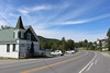

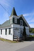
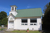
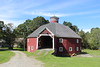

The above images may not be of the site on this page, but were taken nearby. They are loaded from Flickr so please click on them for image credits.
Click here to see more info for this site
Nearby sites
Click here to view sites on an interactive map of the areaKey: Red: member's photo, Blue: 3rd party photo, Yellow: other image, Green: no photo - please go there and take one, Grey: site destroyed
Download sites to:
KML (Google Earth)
GPX (GPS waypoints)
CSV (Garmin/Navman)
CSV (Excel)
To unlock full downloads you need to sign up as a Contributory Member. Otherwise downloads are limited to 50 sites.
Turn off the page maps and other distractions
Nearby sites listing. In the following links * = Image available
35.4km N 9° Balancing Stone Westfield Natural Stone / Erratic / Other Natural Feature
88.2km WNW 290° Earthwood Modern Stone Circle Modern Stone Circle etc
94.4km SSE 168° Humming Stone Norwich (Summstein) Modern Stone Circle etc
107.5km S 179° Calendar II* Artificial Mound
122.8km WNW 287° Earthwood new stone circle Modern Stone Circle etc
136.4km NW 324° Charles De Gaulle Obelisk* Modern Stone Circle etc
149.3km SSE 157° Mount Kearsarge Indian Museum Museum
155.5km S 177° Bellows Falls Petroglyphs* Rock Art
185.3km S 180° Brattleboro Petroglyphs Rock Art
191.3km S 180° Humming Stone Guilford (Summstein) Modern Stone Circle etc
191.5km SE 145° Pawtuckaway Balancing Rock* Natural Stone / Erratic / Other Natural Feature
208.9km S 186° Burnt Hill Heath* Stone Circle
215.8km S 179° Turner's Falls Standing Stones
216.4km SSE 150° America's Stonehenge* Ancient Village or Settlement
231.7km SSE 167° Wachusett Stone* Natural Stone / Erratic / Other Natural Feature
232.5km SSW 195° Balance Stone Lanesborough Natural Stone / Erratic / Other Natural Feature
232.7km S 185° Balanced rock Goshen* Natural Stone / Erratic / Other Natural Feature
239.7km SSW 195° EarthGate Circle Modern Stone Circle etc
243.0km W 274° Maitland Tower* Modern Stone Circle etc
243.2km S 182° Potential Grinding Stone at Northampton Site Polissoir
243.3km S 182° Early Archaic Settlement Site on North King Street* Ancient Village or Settlement
267.9km WNW 293° Canadian Museum of History* Museum
269.9km W 261° Perch Lake mounds* Artificial Mound
273.7km NNE 22° Quebec ice dolmen* Modern Stone Circle etc
283.1km SSE 155° Mary Caroline Herter Public Garden Modern Stone Circle etc
View more nearby sites and additional images


 We would like to know more about this location. Please feel free to add a brief description and any relevant information in your own language.
 Wir möchten mehr über diese Stätte erfahren. Bitte zögern Sie nicht, eine kurze Beschreibung und relevante Informationen in Deutsch hinzuzufügen.
 Nous aimerions en savoir encore un peu sur les lieux. S'il vous plaît n'hesitez pas à ajouter une courte description et tous les renseignements pertinents dans votre propre langue.
 Quisieramos informarnos un poco más de las lugares. No dude en añadir una breve descripción y otros datos relevantes en su propio idioma.