<< Text Pages >> Castro da Covilhã Velha - Castro or Chafurdão in Portugal in Castelo Branco
Submitted by TheCaptain on Wednesday, 08 September 2010 Page Views: 2342
Iron Age and Later PrehistorySite Name: Castro da Covilhã VelhaCountry: Portugal
NOTE: This site is 7.098 km away from the location you searched for.
Distrito: Castelo Branco Type: Castro or Chafurdão
Nearest Town: Fundão Nearest Village: Vale de Prazeres
Latitude: 40.103000N Longitude: 7.419W
Condition:
| 5 | Perfect |
| 4 | Almost Perfect |
| 3 | Reasonable but with some damage |
| 2 | Ruined but still recognisable as an ancient site |
| 1 | Pretty much destroyed, possibly visible as crop marks |
| 0 | No data. |
| -1 | Completely destroyed |
| 5 | Superb |
| 4 | Good |
| 3 | Ordinary |
| 2 | Not Good |
| 1 | Awful |
| 0 | No data. |
| 5 | Can be driven to, probably with disabled access |
| 4 | Short walk on a footpath |
| 3 | Requiring a bit more of a walk |
| 2 | A long walk |
| 1 | In the middle of nowhere, a nightmare to find |
| 0 | No data. |
| 5 | co-ordinates taken by GPS or official recorded co-ordinates |
| 4 | co-ordinates scaled from a detailed map |
| 3 | co-ordinates scaled from a bad map |
| 2 | co-ordinates of the nearest village |
| 1 | co-ordinates of the nearest town |
| 0 | no data |
Be the first person to rate this site - see the 'Contribute!' box in the right hand menu.
Internal Links:
External Links:
Castro in Estremadura & Tejo Valley
Castro da Covilhã Velha is a Castro in the community of Vale de Prazeres near the town of Fundão, District of Castelo Branco
You may be viewing yesterday's version of this page. To see the most up to date information please register for a free account.
Do not use the above information on other web sites or publications without permission of the contributor.
Nearby Images from Flickr
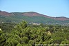

The above images may not be of the site on this page, but were taken nearby. They are loaded from Flickr so please click on them for image credits.
Click here to see more info for this site
Nearby sites
Click here to view sites on an interactive map of the areaKey: Red: member's photo, Blue: 3rd party photo, Yellow: other image, Green: no photo - please go there and take one, Grey: site destroyed
Download sites to:
KML (Google Earth)
GPX (GPS waypoints)
CSV (Garmin/Navman)
CSV (Excel)
To unlock full downloads you need to sign up as a Contributory Member. Otherwise downloads are limited to 50 sites.
Turn off the page maps and other distractions
Nearby sites listing. In the following links * = Image available
22.6km N 10° Anta da Rotunda de Caria* Modern Stone Circle etc
26.0km NNE 12° Villa Romana da Fórnea Ancient Village or Settlement
26.0km W 272° Barroca Rock Art Rock Art
26.2km ESE 117° Idanha a Velha Ancient Village or Settlement
26.5km N 3° Castro de Orjais e ruínas dunha construción ao carón da capela de Nossa Senhora Castro or Chafurdão
28.9km NNE 11° Castro da Chandeirinha de Belmonte Castro or Chafurdão
29.2km NNW 328° Serra de Estrela* Rock Outcrop
31.2km NNE 12° Torre de Centum Cellas Ancient Village or Settlement
33.5km S 187° Castro do Monte de São Martinho Castro or Chafurdão
35.5km NNW 335° Vale do Rossim* Rock Outcrop
35.8km WNW 295° Chãs d’Égua* Museum
38.6km NNW 334° Sabugueiro Cross II* Early Christian Sculptured Stone
39.2km NE 45° Museu do Sabugal* Museum
39.5km NNW 330° Sabugueiro Cross I* Early Christian Sculptured Stone
40.9km E 90° Salvaleon Castro or Chafurdão
41.8km N 6° Sepulturas antropomórficas de la Ermida de Nª Sª de Soito* Rock Cut Tomb
42.3km ENE 78° El Palancar Burial Chamber or Dolmen
48.5km NNW 336° Anta da Pedra da Orca* Burial Chamber or Dolmen
48.9km NW 307° Anta do Pinheiro dos Abraços* Burial Chamber or Dolmen
50.2km S 187° Molino de Viento Burial Chamber or Dolmen
50.3km SSE 146° Cabeço da Forca Burial Chamber or Dolmen
50.5km S 190° Basurero Burial Chamber or Dolmen
50.6km SSE 150° Ovelheiros Burial Chamber or Dolmen
50.6km S 187° Donde se Reza a la Senora Burial Chamber or Dolmen
50.6km S 189° Joaninha Dolmen Burial Chamber or Dolmen
View more nearby sites and additional images


 We would like to know more about this location. Please feel free to add a brief description and any relevant information in your own language.
 Wir möchten mehr über diese Stätte erfahren. Bitte zögern Sie nicht, eine kurze Beschreibung und relevante Informationen in Deutsch hinzuzufügen.
 Nous aimerions en savoir encore un peu sur les lieux. S'il vous plaît n'hesitez pas à ajouter une courte description et tous les renseignements pertinents dans votre propre langue.
 Quisieramos informarnos un poco más de las lugares. No dude en añadir una breve descripción y otros datos relevantes en su propio idioma.