<< Our Photo Pages >> Altdrumman - Portal Tomb in Ireland (Northern) in Co. Tyrone
Submitted by Anthony_Weir on Sunday, 13 October 2002 Page Views:
Neolithic and Bronze AgeSite Name: Altdrumman Alternative Name: The Cloghogle (cloch togálachCountry: Ireland (Northern)
NOTE: This site is 1.26 km away from the location you searched for.
County: Co. Tyrone Type: Portal Tomb
Nearest Village: Milltown-Loughmacror
Map Ref: H577768
Discoverer Map Number: D13
Latitude: 54.636076N Longitude: 7.107193W
Condition:
| 5 | Perfect |
| 4 | Almost Perfect |
| 3 | Reasonable but with some damage |
| 2 | Ruined but still recognisable as an ancient site |
| 1 | Pretty much destroyed, possibly visible as crop marks |
| 0 | No data. |
| -1 | Completely destroyed |
| 5 | Superb |
| 4 | Good |
| 3 | Ordinary |
| 2 | Not Good |
| 1 | Awful |
| 0 | No data. |
| 5 | Can be driven to, probably with disabled access |
| 4 | Short walk on a footpath |
| 3 | Requiring a bit more of a walk |
| 2 | A long walk |
| 1 | In the middle of nowhere, a nightmare to find |
| 0 | No data. |
| 5 | co-ordinates taken by GPS or official recorded co-ordinates |
| 4 | co-ordinates scaled from a detailed map |
| 3 | co-ordinates scaled from a bad map |
| 2 | co-ordinates of the nearest village |
| 1 | co-ordinates of the nearest town |
| 0 | no data |
Internal Links:
External Links:
Portal Tomb in Co. Tyrone
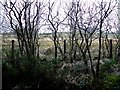
Marked as “Chambered Grave” on the map, this picturesque dolmen resembles the much larger one at Carrickglass, Sligo, both for the herbage growing on the massive capstone, and for the relative smallness of the supporting stones – which are not as tall as the one-metre-thick capstone.
~ 1.2 km NE, to the E of a by-road in Loughmacrory is a fine wedge-tomb known as Dermot and Grania’s bed, offering fine views. Four of its 5 roofstones are in place, much of the cairn survives, and the entrance to the antechamber or portico has a dividing-stone similar to that at Dunnamore. A hawthorn-tree now grows picturesquely out of the gallery.
~ 800 metres E by N of the portal-tomb, also in Loughmacrory, immediately SW of a by-road,are the impressive remains of a court-tomb, stretching some 25 metres back from the road. Much of the cairn and kerb survive. At the SW end are the apparent remains of 2 subsidiary chambers.
~ 850 metres N by E of Altdrumman portal-tomb, 140metres E of Lough Fingrean, is another intact court-tomb (with roofstones). and 130 metres S of this a kist whose large capstone only is visible on top of a low mound.
~ 7.2 km SE of the portal-tomb is another portal-tomb at Athenree (also marked “Chambered Grave”), 300 metres behind (E of) Termon House, approached by a private track from the stableyard. Before one of the portal-stones crumbled away under the weight of the enormous capstone (4.8 x 3.6 metres and 1 metre thick), it must have been quite magnificent
Note: Photo © Anthony Weir
You may be viewing yesterday's version of this page. To see the most up to date information please register for a free account.
Do not use the above information on other web sites or publications without permission of the contributor.
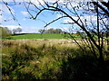
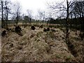
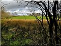
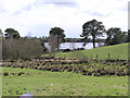
Nearby Images from Geograph Britain and Ireland:
©2016(licence)
©2013(licence)
©2024(licence)
©2006(licence)
©2013(licence)
The above images may not be of the site on this page, they are loaded from Geograph.
Please Submit an Image of this site or go out and take one for us!
Click here to see more info for this site
Nearby sites
Click here to view sites on an interactive map of the areaKey: Red: member's photo, Blue: 3rd party photo, Yellow: other image, Green: no photo - please go there and take one, Grey: site destroyed
Download sites to:
KML (Google Earth)
GPX (GPS waypoints)
CSV (Garmin/Navman)
CSV (Excel)
To unlock full downloads you need to sign up as a Contributory Member. Otherwise downloads are limited to 50 sites.
Turn off the page maps and other distractions
Nearby sites listing. In the following links * = Image available
360m ENE 57° Loughmacrory Stone Circle (H580770)
1.2km NE 48° Loughmacrory Wedge Tomb* Wedge Tomb
2.2km E 86° Copney East Group NE Stone Circle (H599770)
2.2km E 86° Copney East Group S Stone Circle (H599770)
2.2km E 86° Copney East Group W Stone Circle (H599770)
2.2km E 86° Copney East Group SW Stone Circle (H599770)
2.2km E 86° Copney East Group SW Stone Circle (H599770)
2.2km E 86° Copney East Group Center Stone Circle (H599770)
2.2km SE 145° Mullanmore Stone Circle (H590750)
2.6km ENE 63° Copney* Stone Circle (H5997077995)
2.6km ENE 58° Copney Stone Row / Alignment (H599782)
6.5km SE 126° Creggandevesky Stone Circle (H630730)
7.1km ESE 105° Creggandevesky* Court Tomb (H6459975037)
7.2km ESE 103° Cregganconroe SW Stone Circle (H6479075210)
7.3km ESE 103° Cregganconroe SW Stone Row / Alignment (H648752)
7.4km ESE 103° Cregganconroe NE Stone Row* Stone Row / Alignment (H650752)
7.5km ESE 103° Cregganconroe NE* Stone Circle (H65047521)
7.9km NNE 25° Aghascrebagh Stone Circle Stone Circle (H610840)
8.2km NNE 31° Aghascrebagh Ogham Stone* Standing Stone (Menhir) (H6177783903)
8.2km NNE 30° Aghascrebagh Standing Stone* Standing Stone (Menhir) (H6167083967)
8.3km ESE 112° Tremoge N Stone Row / Alignment (H655738)
8.4km ESE 115° Tremoge SW Stone Circle (H654733)
8.4km ESE 115° Tremoge SW Stone Row / Alignment (H654733)
8.5km E 98° Murnells Standing Stones (H662757)
8.6km ESE 113° Tremoge NE Stone Row / Alignment (H657736)
View more nearby sites and additional images


 We would like to know more about this location. Please feel free to add a brief description and any relevant information in your own language.
 Wir möchten mehr über diese Stätte erfahren. Bitte zögern Sie nicht, eine kurze Beschreibung und relevante Informationen in Deutsch hinzuzufügen.
 Nous aimerions en savoir encore un peu sur les lieux. S'il vous plaît n'hesitez pas à ajouter une courte description et tous les renseignements pertinents dans votre propre langue.
 Quisieramos informarnos un poco más de las lugares. No dude en añadir una breve descripción y otros datos relevantes en su propio idioma.