<< Our Photo Pages >> The Ass's Manger - Cist in Ireland (Republic of) in Co. Laois
Submitted by TheLaoisCyclist on Tuesday, 20 September 2022 Page Views: 816
Neolithic and Bronze AgeSite Name: The Ass's MangerCountry: Ireland (Republic of)
NOTE: This site is 7.616 km away from the location you searched for.
County: Co. Laois Type: Cist
Nearest Town: Stradbally
Map Ref: S5967393415
Latitude: 52.988469N Longitude: 7.112171W
Condition:
| 5 | Perfect |
| 4 | Almost Perfect |
| 3 | Reasonable but with some damage |
| 2 | Ruined but still recognisable as an ancient site |
| 1 | Pretty much destroyed, possibly visible as crop marks |
| 0 | No data. |
| -1 | Completely destroyed |
| 5 | Superb |
| 4 | Good |
| 3 | Ordinary |
| 2 | Not Good |
| 1 | Awful |
| 0 | No data. |
| 5 | Can be driven to, probably with disabled access |
| 4 | Short walk on a footpath |
| 3 | Requiring a bit more of a walk |
| 2 | A long walk |
| 1 | In the middle of nowhere, a nightmare to find |
| 0 | No data. |
| 5 | co-ordinates taken by GPS or official recorded co-ordinates |
| 4 | co-ordinates scaled from a detailed map |
| 3 | co-ordinates scaled from a bad map |
| 2 | co-ordinates of the nearest village |
| 1 | co-ordinates of the nearest town |
| 0 | no data |
Internal Links:
External Links:
")
2.50m in length, 2.20m in width and 0.30cm in depth, supported by a number of upright stones. Under this slab there is a chamber 0.80m in depth, opening to the NE. The slab has slipped from the tops of two stones at its NE end but still rests on an upright stone and dry-walling alongside at about its mid-line. Just east of the structure there was a line, some 2.50m in length, of three upright stones only two of which are now visible.
An earlier account by O'Byrne in 1849, would suggest that this is the remnants of a larger and substantially buried structure and that it was surrounded by a circle of stones. Cists containing bones were said to have been uncovered closeby. The whole may have been some form of burial monument but its nature is uncertain.
Source:
You may be viewing yesterday's version of this page. To see the most up to date information please register for a free account.
")
")
")
Do not use the above information on other web sites or publications without permission of the contributor.
Nearby Images from Flickr


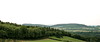
The above images may not be of the site on this page, but were taken nearby. They are loaded from Flickr so please click on them for image credits.
Click here to see more info for this site
Nearby sites
Click here to view sites on an interactive map of the areaKey: Red: member's photo, Blue: 3rd party photo, Yellow: other image, Green: no photo - please go there and take one, Grey: site destroyed
Download sites to:
KML (Google Earth)
GPX (GPS waypoints)
CSV (Garmin/Navman)
CSV (Excel)
To unlock full downloads you need to sign up as a Contributory Member. Otherwise downloads are limited to 50 sites.
Turn off the page maps and other distractions
Nearby sites listing. In the following links * = Image available
2.4km S 173° Druids Altar (Co. Laois) Stone Circle (S600910)
7.0km SSW 199° Druids Altar (Monamanry) Ring Cairn
8.2km NW 306° Rock of Dunamase Hillfort (S530982)
10.5km NW 316° The Heath (Laois)* Barrow Cemetery
11.1km SSW 196° Slatt Lower Stone Circle (S568827)
19.2km E 93° Moone High Cross* Ancient Cross (S7891192693)
20.5km ESE 115° Castledermot High Crosses* Ancient Cross
21.9km NE 38° St Brigid's Holy Well Kildare* Holy Well or Sacred Spring (N73061080)
22.8km SE 137° Browne’s Hill* Portal Tomb (S7538476873)
24.8km ENE 72° Brewel Hill Stone Circle (N833013)
25.2km ENE 67° Kilgowan* Standing Stone (Menhir)
26.5km ENE 58° Knockaulin Timber Circle (N820078)
27.0km ENE 60° Old Kilcullen High Cross Ancient Cross
28.0km ENE 77° Tournant Stone Circle (N870000)
29.1km E 99° Baltinglass* Passage Grave (S8855289249)
31.8km E 89° Castleruddery* Stone Circle (S9159394210)
32.5km E 98° Gates Of Heaven Burial Chamber or Dolmen
32.7km E 90° Castleruddery Stone Row / Alignment (S925937)
32.9km SE 133° Ardristan* Standing Stone (Menhir) (S8413871337)
34.0km E 98° Boleycarrigeen* Stone Circle
34.0km ESE 118° Haroldstown* Portal Tomb (S90087793)
34.6km ENE 74° Athgreany* Stone Circle (N930032)
35.5km ENE 69° Whiteleas Stone Circle
36.0km ENE 68° Broadleas* Stone Circle (N9292507609)
36.5km SE 125° Rathgall Destroyed Stone Circle Stone Circle (S900730)
View more nearby sites and additional images


 We would like to know more about this location. Please feel free to add a brief description and any relevant information in your own language.
 Wir möchten mehr über diese Stätte erfahren. Bitte zögern Sie nicht, eine kurze Beschreibung und relevante Informationen in Deutsch hinzuzufügen.
 Nous aimerions en savoir encore un peu sur les lieux. S'il vous plaît n'hesitez pas à ajouter une courte description et tous les renseignements pertinents dans votre propre langue.
 Quisieramos informarnos un poco más de las lugares. No dude en añadir una breve descripción y otros datos relevantes en su propio idioma.