<< Text Pages >> Qajartalik Petroglyphs - Rock Art in Canada
Submitted by bat400 on Thursday, 03 May 2007 Page Views: 11689
Rock ArtSite Name: Qajartalik Petroglyphs Alternative Name: Wakeham Island PetroglyphsCountry: Canada
NOTE: This site is 557.085 km away from the location you searched for.
Type: Rock Art
Nearest Village: Kangiqsujuaq
Latitude: 61.597200N Longitude: 71.9583W
Condition:
| 5 | Perfect |
| 4 | Almost Perfect |
| 3 | Reasonable but with some damage |
| 2 | Ruined but still recognisable as an ancient site |
| 1 | Pretty much destroyed, possibly visible as crop marks |
| 0 | No data. |
| -1 | Completely destroyed |
| 5 | Superb |
| 4 | Good |
| 3 | Ordinary |
| 2 | Not Good |
| 1 | Awful |
| 0 | No data. |
| 5 | Can be driven to, probably with disabled access |
| 4 | Short walk on a footpath |
| 3 | Requiring a bit more of a walk |
| 2 | A long walk |
| 1 | In the middle of nowhere, a nightmare to find |
| 0 | No data. |
| 5 | co-ordinates taken by GPS or official recorded co-ordinates |
| 4 | co-ordinates scaled from a detailed map |
| 3 | co-ordinates scaled from a bad map |
| 2 | co-ordinates of the nearest village |
| 1 | co-ordinates of the nearest town |
| 0 | no data |
Be the first person to rate this site - see the 'Contribute!' box in the right hand menu.
Internal Links:
External Links:
Cup and Ring marks / Rock Art in Nuqivik.
The petrogylphs found on this island are associated with the people of the Dorset culture who lived in eastern arctic regions around 800 AD. The carved figures are of faces that appear to be scowling or laughing, depending on your view point.
The Dorset culture disappeared from the area around 1200AD, replaced by the Thule people. The carved figures are of faces that appear to be scowling or laughing, depending on your view point. Qajartalik (formerly Wakeham) Island is an hour boat trip from the village of Kangiqsujuaq. The village itself is inaccessible by land, but has a small air field. (The location given is for the mainland village.)
The site had been suggested for nomination as a Unesco World Heritage site. The nominating process had not been completed because the area is under a sovereignty dispute.
The news item below describes the damage to the site and the suggestion that it was due to a conservative Christian segment of the Kangiqsujuaq population. However, other articles make it clear that the island has experienced vandalism before, and despite its remote location it is frequently visited by cruise ships with no effective supervision of visitors. The perpetrators of most recent vandalism remain unknown.
You may be viewing yesterday's version of this page. To see the most up to date information please register for a free account.
Do not use the above information on other web sites or publications without permission of the contributor.
Nearby Images from Flickr
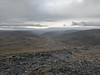
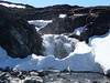
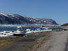
The above images may not be of the site on this page, but were taken nearby. They are loaded from Flickr so please click on them for image credits.
Click here to see more info for this site
Nearby sites
Click here to view sites on an interactive map of the areaKey: Red: member's photo, Blue: 3rd party photo, Yellow: other image, Green: no photo - please go there and take one, Grey: site destroyed
Download sites to:
KML (Google Earth)
GPX (GPS waypoints)
CSV (Garmin/Navman)
CSV (Excel)
To unlock full downloads you need to sign up as a Contributory Member. Otherwise downloads are limited to 50 sites.
Turn off the page maps and other distractions
Nearby sites listing. In the following links * = Image available
1271.1km NE 40° Sermermiut* Ancient Village or Settlement
1272.9km NE 40° Ilulissat Museum* Museum
1491.0km SE 131° L'Anse aux Meadows National Historic Site* Ancient Village or Settlement
1504.2km SE 137° Port au Choix National Historic Site* Ancient Village or Settlement
1645.1km S 178° Quebec ice dolmen* Modern Stone Circle etc
1674.0km SSE 164° Augustine Mound Round Barrow(s)
1712.3km NNW 337° Resolute Thule Houses Ancient Village or Settlement
1790.1km S 184° Charles De Gaulle Obelisk* Modern Stone Circle etc
1814.1km S 189° Canadian Museum of History* Museum
1862.5km SSE 152° Big Hill Dolmen Burial Chamber or Dolmen
1863.0km S 181° Balancing Stone Westfield Natural Stone / Erratic / Other Natural Feature
1868.5km S 185° Earthwood new stone circle Modern Stone Circle etc
1871.8km S 184° Earthwood Modern Stone Circle Modern Stone Circle etc
1876.3km SW 223° Triangle Island Mound, Isle Royale* Artificial Mound
1898.0km S 181° Elmore Balancing Rock* Natural Stone / Erratic / Other Natural Feature
1901.2km S 189° Maitland Tower* Modern Stone Circle etc
1905.0km S 169° Machias Bay Petroglyphs Rock Art
1906.6km SSE 152° Loch Lomond Circle Modern Stone Circle etc
1917.9km WSW 256° Kapakoskasewakak Lake stones Stone Row / Alignment
1921.5km SSW 197° Lewiston Mound State Park* Artificial Mound
1926.4km SW 216° Grand Island Ancient Village or Settlement
1931.8km SSW 195° Petroglyphs Provincial Park (Ontario)* Rock Art
1932.7km WSW 239° Bannock Point Petroforms* Stone Row / Alignment
1941.1km SSW 211° Old Fort Mackinac Mounds* Artificial Mound
1943.9km SSE 160° Sibley Rock Burial Chamber or Dolmen
View more nearby sites and additional images


 We would like to know more about this location. Please feel free to add a brief description and any relevant information in your own language.
 Wir möchten mehr über diese Stätte erfahren. Bitte zögern Sie nicht, eine kurze Beschreibung und relevante Informationen in Deutsch hinzuzufügen.
 Nous aimerions en savoir encore un peu sur les lieux. S'il vous plaît n'hesitez pas à ajouter une courte description et tous les renseignements pertinents dans votre propre langue.
 Quisieramos informarnos un poco más de las lugares. No dude en añadir una breve descripción y otros datos relevantes en su propio idioma.