<< Text Pages >> Blessington Desmesne - Stone Circle in Ireland (Republic of) in Co. Wicklow
Submitted by Tom_Bullock on Sunday, 14 July 2002 Page Views: 7418
Neolithic and Bronze AgeSite Name: Blessington Desmesne Alternative Name: Piper\'s StonesCountry: Ireland (Republic of)
NOTE: This site is 2.436 km away from the location you searched for.
County: Co. Wicklow Type: Stone Circle
Map Ref: N9713
Discovery Map Number: D56
Latitude: 53.158942N Longitude: 6.550611W
Condition:
| 5 | Perfect |
| 4 | Almost Perfect |
| 3 | Reasonable but with some damage |
| 2 | Ruined but still recognisable as an ancient site |
| 1 | Pretty much destroyed, possibly visible as crop marks |
| 0 | No data. |
| -1 | Completely destroyed |
| 5 | Superb |
| 4 | Good |
| 3 | Ordinary |
| 2 | Not Good |
| 1 | Awful |
| 0 | No data. |
| 5 | Can be driven to, probably with disabled access |
| 4 | Short walk on a footpath |
| 3 | Requiring a bit more of a walk |
| 2 | A long walk |
| 1 | In the middle of nowhere, a nightmare to find |
| 0 | No data. |
| 5 | co-ordinates taken by GPS or official recorded co-ordinates |
| 4 | co-ordinates scaled from a detailed map |
| 3 | co-ordinates scaled from a bad map |
| 2 | co-ordinates of the nearest village |
| 1 | co-ordinates of the nearest town |
| 0 | no data |
Internal Links:
External Links:
Ancient site in Wicklow
Have you visited this site? Please add a comment below.
You may be viewing yesterday's version of this page. To see the most up to date information please register for a free account.
Do not use the above information on other web sites or publications without permission of the contributor.
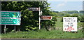
Nearby Images from Geograph Britain and Ireland:
©2008(licence)
©2009(licence)
©2008(licence)
©2010(licence)
©2010(licence)
The above images may not be of the site on this page, they are loaded from Geograph.
Please Submit an Image of this site or go out and take one for us!
Click here to see more info for this site
Nearby sites
Click here to view sites on an interactive map of the areaKey: Red: member's photo, Blue: 3rd party photo, Yellow: other image, Green: no photo - please go there and take one, Grey: site destroyed
Download sites to:
KML (Google Earth)
GPX (GPS waypoints)
CSV (Garmin/Navman)
CSV (Excel)
To unlock full downloads you need to sign up as a Contributory Member. Otherwise downloads are limited to 50 sites.
Turn off the page maps and other distractions
Nearby sites listing. In the following links * = Image available
6.3km ENE 73° Ballyfoyle Stone Circle (O0315)
6.3km NW 305° Punchestown* Standing Stone (Menhir) (N9172816558)
6.7km WNW 301° Craddockstown West* Standing Stone (Menhir) (N9116416282)
6.7km SW 218° Broadleas* Stone Circle (N9292507609)
7.5km SW 216° Whiteleas Stone Circle
8.3km NNW 337° Forenaghts Great* Standing Stone (Menhir) (N936206)
8.6km NE 56° Ballyfolan Stone Circle (O0418)
10.6km SSW 203° Athgreany* Stone Circle (N930032)
11.0km NNE 27° Slievethoul Barrow* Round Barrow(s) (O0186022839)
12.1km ENE 72° Seefin Passage Grave* Passage Grave
12.1km ENE 72° Seefingan* Cairn
13.1km NNE 29° Lugg Timber Circle Timber Circle (O032246)
13.4km NE 43° Knockanvinidee Stone Circle (O060230)
14.9km NNE 30° Boherboy* Standing Stones
15.1km WSW 248° Old Kilcullen High Cross Ancient Cross
15.8km ENE 58° St Anne's Well (Kilmesantan) Holy Well or Sacred Spring
15.8km WSW 252° Knockaulin Timber Circle (N820078)
16.4km SW 219° Tournant Stone Circle (N870000)
16.9km ENE 60° Piperstown Stone Circle Stone Circle (O115217)
16.9km WSW 238° Kilgowan* Standing Stone (Menhir)
18.0km SW 231° Brewel Hill Stone Circle (N833013)
18.2km S 177° The Long Stone (Knickeen)* Standing Stone (Menhir) (S983948)
19.5km SSW 197° Castleruddery* Stone Circle (S9159394210)
19.8km SSW 194° Castleruddery Stone Row / Alignment (S925937)
19.9km E 93° Baltynanima* Rock Art (O170123)
View more nearby sites and additional images


 We would like to know more about this location. Please feel free to add a brief description and any relevant information in your own language.
 Wir möchten mehr über diese Stätte erfahren. Bitte zögern Sie nicht, eine kurze Beschreibung und relevante Informationen in Deutsch hinzuzufügen.
 Nous aimerions en savoir encore un peu sur les lieux. S'il vous plaît n'hesitez pas à ajouter une courte description et tous les renseignements pertinents dans votre propre langue.
 Quisieramos informarnos un poco más de las lugares. No dude en añadir una breve descripción y otros datos relevantes en su propio idioma.