


<< Text Pages >> Salakee Down 3 - Chambered Tomb in England in Isles of Scilly
Submitted by paulcall on Sunday, 14 October 2007 Page Views: 4580
Neolithic and Bronze AgeSite Name: Salakee Down 3Country: England
NOTE: This site is 0.205 km away from the location you searched for.
County: Isles of Scilly Type: Chambered Tomb
Nearest Town: Hugh Town
Map Ref: SV92171016
Latitude: 49.912226N Longitude: 6.289372W
Condition:
| 5 | Perfect |
| 4 | Almost Perfect |
| 3 | Reasonable but with some damage |
| 2 | Ruined but still recognisable as an ancient site |
| 1 | Pretty much destroyed, possibly visible as crop marks |
| 0 | No data. |
| -1 | Completely destroyed |
| 5 | Superb |
| 4 | Good |
| 3 | Ordinary |
| 2 | Not Good |
| 1 | Awful |
| 0 | No data. |
| 5 | Can be driven to, probably with disabled access |
| 4 | Short walk on a footpath |
| 3 | Requiring a bit more of a walk |
| 2 | A long walk |
| 1 | In the middle of nowhere, a nightmare to find |
| 0 | No data. |
| 5 | co-ordinates taken by GPS or official recorded co-ordinates |
| 4 | co-ordinates scaled from a detailed map |
| 3 | co-ordinates scaled from a bad map |
| 2 | co-ordinates of the nearest village |
| 1 | co-ordinates of the nearest town |
| 0 | no data |
Internal Links:
External Links:
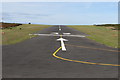
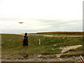
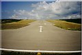
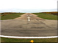
One of many chambered tombs on Salakee Down, beyond the airport on St Mary's, in Scilly Isles
These are thought to be overgrown with bracken and bramble or barely recognisable.
You may be viewing yesterday's version of this page. To see the most up to date information please register for a free account.
Do not use the above information on other web sites or publications without permission of the contributor.
Nearby Images from Geograph Britain and Ireland:
©2016(licence)
©2013(licence)
©2012(licence)
©2013(licence)
©2008(licence)
The above images may not be of the site on this page, they are loaded from Geograph.
Please Submit an Image of this site or go out and take one for us!
Click here to see more info for this site
Nearby sites
Key: Red: member's photo, Blue: 3rd party photo, Yellow: other image, Green: no photo - please go there and take one, Grey: site destroyed
Download sites to:
KML (Google Earth)
GPX (GPS waypoints)
CSV (Garmin/Navman)
CSV (Excel)
To unlock full downloads you need to sign up as a Contributory Member. Otherwise downloads are limited to 50 sites.
Turn off the page maps and other distractions
Nearby sites listing. In the following links * = Image available
122m ESE 122° Salakee Down 6 (2 cairns)* Chambered Tomb (SV92271009)
156m SSE 150° Salakee Down 5* Chambered Tomb (SV92241002)
170m SE 137° Salakee Down 4* Chambered Tomb (SV92281003)
174m NE 56° Salakee Down 2 Chambered Tomb (SV92321025)
276m WSW 254° Inner Blue Cairn* Cairn (SV91901010)
300m ESE 102° Giant's Castle* Hillfort (SV92461008)
341m WSW 251° Porth Minick* Ancient Village or Settlement (SV91841007)
407m NE 51° Salakee Down 1* Chambered Tomb (SV925104)
576m N 6° Higher Moor Cairns* Barrow Cemetery (SV92261073)
828m NE 46° Porth Hellick Down* Burial Chamber or Dolmen (SV928107)
905m WSW 250° Carn Leh* Ancient Village or Settlement (SV913099)
916m NNW 333° Rocky Hill* Ancient Cross (SV918110)
1.2km W 269° Carn Gwavel Souterrain (Fogou, Earth House) (SV910102)
1.3km SW 235° Peninnis Head* Cairn (SV911095)
1.4km WSW 239° Peninnis Head Boundary Misc. Earthwork (SV90970952)
1.4km SW 232° Peninnis Head Settlement* Ancient Village or Settlement (SV91050938)
1.4km NNW 340° Holy Vale Longstone* Standing Stone (Menhir) (SV91771147)
1.4km NE 38° Normandy Down* Chambered Cairn (SV931112)
1.5km WNW 299° Mount Flagon Menhir* Standing Stone (Menhir) (SV90931093)
1.5km NNE 24° Mount Todden Cairn* Chambered Cairn (SV9286011490)
1.5km N 350° Maypole Chambered Tomb (SV920117)
1.5km W 275° King Edward's Tower Chambered Cairn* Chambered Cairn (SV90631038)
1.6km W 275° Buzza Hill* Burial Chamber or Dolmen (SV90601038)
1.6km NNE 27° Mount Todden* Modern Stone Circle etc (SV9297011553)
1.7km NNW 336° Town Lane (St Mary's) Cist (SV91571175)
View more nearby sites and additional images


 We would like to know more about this location. Please feel free to add a brief description and any relevant information in your own language.
 Wir möchten mehr über diese Stätte erfahren. Bitte zögern Sie nicht, eine kurze Beschreibung und relevante Informationen in Deutsch hinzuzufügen.
 Nous aimerions en savoir encore un peu sur les lieux. S'il vous plaît n'hesitez pas à ajouter une courte description et tous les renseignements pertinents dans votre propre langue.
 Quisieramos informarnos un poco más de las lugares. No dude en añadir una breve descripción y otros datos relevantes en su propio idioma.