<< Text Pages >> Armadale Bay Cairn - Cairn in Scotland in Isle of Skye
Submitted by SolarMegalith on Saturday, 11 August 2012 Page Views: 2617
Neolithic and Bronze AgeSite Name: Armadale Bay CairnCountry: Scotland
NOTE: This site is 1.816 km away from the location you searched for.
County: Isle of Skye Type: Cairn
Map Ref: NG63680390
Latitude: 57.065321N Longitude: 5.899754W
Condition:
| 5 | Perfect |
| 4 | Almost Perfect |
| 3 | Reasonable but with some damage |
| 2 | Ruined but still recognisable as an ancient site |
| 1 | Pretty much destroyed, possibly visible as crop marks |
| 0 | No data. |
| -1 | Completely destroyed |
| 5 | Superb |
| 4 | Good |
| 3 | Ordinary |
| 2 | Not Good |
| 1 | Awful |
| 0 | No data. |
| 5 | Can be driven to, probably with disabled access |
| 4 | Short walk on a footpath |
| 3 | Requiring a bit more of a walk |
| 2 | A long walk |
| 1 | In the middle of nowhere, a nightmare to find |
| 0 | No data. |
| 5 | co-ordinates taken by GPS or official recorded co-ordinates |
| 4 | co-ordinates scaled from a detailed map |
| 3 | co-ordinates scaled from a bad map |
| 2 | co-ordinates of the nearest village |
| 1 | co-ordinates of the nearest town |
| 0 | no data |
Internal Links:
External Links:
Cairn in Isle of Skye
Partly robbed (especially in southern and eastern part) cairn of 25 m diameter and 3.5 m high.
Read More at ScotlandsPlaces.
You may be viewing yesterday's version of this page. To see the most up to date information please register for a free account.
Do not use the above information on other web sites or publications without permission of the contributor.
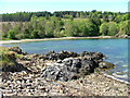
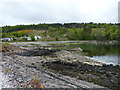
Nearby Images from Geograph Britain and Ireland:
©2006(licence)
©2013(licence)
©2012(licence)

©2024(licence)
©2019(licence)
The above images may not be of the site on this page, they are loaded from Geograph.
Please Submit an Image of this site or go out and take one for us!
Click here to see more info for this site
Nearby sites
Key: Red: member's photo, Blue: 3rd party photo, Yellow: other image, Green: no photo - please go there and take one, Grey: site destroyed
Download sites to:
KML (Google Earth)
GPX (GPS waypoints)
CSV (Garmin/Navman)
CSV (Excel)
To unlock full downloads you need to sign up as a Contributory Member. Otherwise downloads are limited to 50 sites.
Turn off the page maps and other distractions
Nearby sites listing. In the following links * = Image available
334m ESE 104° Cists near Armadale Pier Burial Chamber or Dolmen (NG640038)
951m SSW 204° Dun Acardinon* Stone Fort or Dun (NG63250305)
2.0km NNE 25° Dun Ela* Stone Fort or Dun (NG64640569)
3.0km SW 215° Dun Chlo (Tormore)* Stone Fort or Dun (NG618015)
3.9km NE 34° Dun Faich Stone Fort or Dun (NG66020697)
4.3km SW 223° Dun A'Chleirich* Stone Fort or Dun (NG60590091)
5.0km SW 223° Dun Ban (Sleat)* Stone Fort or Dun (NG60030042)
6.4km NE 43° Dun Choinnich* Broch or Nuraghe (NG68290834)
6.4km E 89° Dun Ban (Doune)* Stone Fort or Dun (NG70110362)
7.0km W 274° Dun Geilbt* Stone Fort or Dun (NG56750480)
7.2km NNE 32° Dun Knock (Toravaig)* Stone Fort or Dun (NG679098)
7.9km NW 322° Cnoc an Temple* Burial Chamber or Dolmen (NG591104)
8.2km N 351° Meal-da-Bheinn* Stone Circle (NG629121)
9.2km NNW 337° Inver Aulavaig 2* Cairn (NG6059112629)
9.3km NNW 336° Inver Aulavaig 1* Cairn (NG60441259)
9.3km NE 40° Dun Ban (Camascross) Stone Fort or Dun (NG70121065)
9.5km NNW 346° Teampuill Chaon* Early Christian Sculptured Stone (NG61831321)
9.7km NNW 345° Tobar Chaon* Holy Well or Sacred Spring (NG61711340)
12.5km NNW 347° Dun Boreraig Fort* Hillfort (NG615162)
12.6km N 349° Dun Boreraig Stone* Standing Stone (Menhir) (NG61951638)
13.1km NW 306° Dun Grugaig (Skye)* Stone Fort or Dun (NG53541229)
13.9km NW 315° Dun Liath (Elgol)* Broch or Nuraghe (NG54331427)
14.0km N 2° Heaste Stone Standing Stone (Menhir) (NG6505117847)
14.1km NW 313° Allt Na Cille Souterrain (Fogou, Earth House) (NG539141)
14.2km NNW 340° Dun Kearstack* Hillfort (NG596175)
View more nearby sites and additional images


 We would like to know more about this location. Please feel free to add a brief description and any relevant information in your own language.
 Wir möchten mehr über diese Stätte erfahren. Bitte zögern Sie nicht, eine kurze Beschreibung und relevante Informationen in Deutsch hinzuzufügen.
 Nous aimerions en savoir encore un peu sur les lieux. S'il vous plaît n'hesitez pas à ajouter une courte description et tous les renseignements pertinents dans votre propre langue.
 Quisieramos informarnos un poco más de las lugares. No dude en añadir una breve descripción y otros datos relevantes en su propio idioma.