<< Text Pages >> Toscaig (Applecross) - Standing Stones in Scotland in Highlands
Submitted by Anne T on Thursday, 11 January 2018 Page Views: 2063
Neolithic and Bronze AgeSite Name: Toscaig (Applecross)Country: Scotland
NOTE: This site is 4.631 km away from the location you searched for.
County: Highlands Type: Standing Stones
Nearest Village: Toscaig
Map Ref: NG712385
Latitude: 57.379243N Longitude: 5.807886W
Condition:
| 5 | Perfect |
| 4 | Almost Perfect |
| 3 | Reasonable but with some damage |
| 2 | Ruined but still recognisable as an ancient site |
| 1 | Pretty much destroyed, possibly visible as crop marks |
| 0 | No data. |
| -1 | Completely destroyed |
| 5 | Superb |
| 4 | Good |
| 3 | Ordinary |
| 2 | Not Good |
| 1 | Awful |
| 0 | No data. |
| 5 | Can be driven to, probably with disabled access |
| 4 | Short walk on a footpath |
| 3 | Requiring a bit more of a walk |
| 2 | A long walk |
| 1 | In the middle of nowhere, a nightmare to find |
| 0 | No data. |
| 5 | co-ordinates taken by GPS or official recorded co-ordinates |
| 4 | co-ordinates scaled from a detailed map |
| 3 | co-ordinates scaled from a bad map |
| 2 | co-ordinates of the nearest village |
| 1 | co-ordinates of the nearest town |
| 0 | no data |
Be the first person to rate this site - see the 'Contribute!' box in the right hand menu.
Internal Links:
External Links:
Standing Stones in Highlands
The Northern Antiquarian (TNA) features a brief mention of these stones in their entry for Toscaig, Applecross, Ross & Cromarty.
TNA says: "The Cambridge biologist J. Havelock Fidler described finding three standing stones in the gorgeous little remote hamlet of Toscaig in his book Ley Lines (1983), which neither the Applecross Local History Society, myself, nor anyone else has been able to locate (the OS grid reference cited above is simply an approximation of their locality). In an updated version of his work, Mr Fidler seems to indicate they can be found a short distance south-east of the village, at the end of an alignment which is supposed to start at Fearnmore (NG 724 605), at the northern edge of the peninsula. If they exist, could anyone perhaps enlighten us as to their whereabouts…?"
Note: Does anyone know if these stones exist? Do you have an accurate grid reference, photographs, illustrations or information to add?
You may be viewing yesterday's version of this page. To see the most up to date information please register for a free account.
Do not use the above information on other web sites or publications without permission of the contributor.
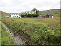
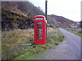
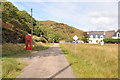
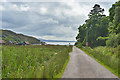
Nearby Images from Geograph Britain and Ireland:
©2013(licence)
©2009(licence)
©2010(licence)
©2017(licence)
©2017(licence)
The above images may not be of the site on this page, they are loaded from Geograph.
Please Submit an Image of this site or go out and take one for us!
Click here to see more info for this site
Nearby sites
Key: Red: member's photo, Blue: 3rd party photo, Yellow: other image, Green: no photo - please go there and take one, Grey: site destroyed
Download sites to:
KML (Google Earth)
GPX (GPS waypoints)
CSV (Garmin/Navman)
CSV (Excel)
To unlock full downloads you need to sign up as a Contributory Member. Otherwise downloads are limited to 50 sites.
Turn off the page maps and other distractions
Nearby sites listing. In the following links * = Image available
4.6km N 351° Torr Mor (Applecross) Ancient Village or Settlement (NG70764313)
5.5km N 355° Applecross* Stone Circle (NG7144)
11.2km SSE 165° Sligeanach Kildonan Stone Row / Alignment (NG735275)
12.1km W 263° Hallaig* Stone Row / Alignment (NG591377)
12.5km SE 124° Loch Achaidh na h-Inich* Crannog (NG81173095)
12.5km ENE 78° Lag An Duin Broch or Nuraghe (NG83624044)
12.6km SSW 195° Pabay Chapel Ancient Temple (NG67362651)
12.8km ESE 120° Carn na Sean-chreige* Hillfort (NG81893146)
13.7km WSW 249° Eyre Point* Burial Chamber or Dolmen (NG581343)
14.0km WSW 249° Eyre Standing Stone Standing Stone (Menhir) (NG57753432)
14.1km WSW 252° Eyre Stone Rows* Stone Row / Alignment (NG57493488)
14.4km S 187° Tobar Ashik* Holy Well or Sacred Spring (NG6873324291)
15.4km W 260° Inverarish Stone Row / Alignment (NG55903668)
15.6km W 276° Storab Burn Stone Circle (NG557410)
15.8km SE 130° Dun Kirkton Stone Fort or Dun (NG82722768)
15.8km SSW 194° Achadh A'chuirn* Chambered Cairn (NG66422343)
15.8km W 259° Dun Borodale* Stone Fort or Dun (NG55473633)
15.9km SSW 203° Corry cist, cairn and souterrain Cist (NG641242)
16.2km SE 130° Angels' Hill, Kirkton* Hillfort (NG83142745)
16.2km SE 130° Lochalsh* Stone Circle (NG831274)
16.3km SSW 202° Corry chambered cairn* Chambered Cairn (NG6416623779)
16.5km ESE 120° Gleann Udalain Cairn Cairn (NG85092942)
16.6km W 261° Raasay* Class II Pictish Symbol Stone (NG54673677)
17.5km SE 125° Dun Gleann Udalain Stone Fort or Dun (NG85062773)
18.1km WSW 258° Dunan An Aisilidh* Stone Fort or Dun (NG53203571)
View more nearby sites and additional images


 We would like to know more about this location. Please feel free to add a brief description and any relevant information in your own language.
 Wir möchten mehr über diese Stätte erfahren. Bitte zögern Sie nicht, eine kurze Beschreibung und relevante Informationen in Deutsch hinzuzufügen.
 Nous aimerions en savoir encore un peu sur les lieux. S'il vous plaît n'hesitez pas à ajouter une courte description et tous les renseignements pertinents dans votre propre langue.
 Quisieramos informarnos un poco más de las lugares. No dude en añadir una breve descripción y otros datos relevantes en su propio idioma.