<< Our Photo Pages >> Duart Stone Setting - Standing Stones in Scotland in Isle of Mull
Submitted by enkidu41 on Thursday, 03 March 2005 Page Views: 5278
Neolithic and Bronze AgeSite Name: Duart Stone SettingCountry: Scotland
NOTE: This site is 2.47 km away from the location you searched for.
County: Isle of Mull Type: Standing Stones
Map Ref: NM727342
Latitude: 56.445024N Longitude: 5.68947W
Condition:
| 5 | Perfect |
| 4 | Almost Perfect |
| 3 | Reasonable but with some damage |
| 2 | Ruined but still recognisable as an ancient site |
| 1 | Pretty much destroyed, possibly visible as crop marks |
| 0 | No data. |
| -1 | Completely destroyed |
| 5 | Superb |
| 4 | Good |
| 3 | Ordinary |
| 2 | Not Good |
| 1 | Awful |
| 0 | No data. |
| 5 | Can be driven to, probably with disabled access |
| 4 | Short walk on a footpath |
| 3 | Requiring a bit more of a walk |
| 2 | A long walk |
| 1 | In the middle of nowhere, a nightmare to find |
| 0 | No data. |
| 5 | co-ordinates taken by GPS or official recorded co-ordinates |
| 4 | co-ordinates scaled from a detailed map |
| 3 | co-ordinates scaled from a bad map |
| 2 | co-ordinates of the nearest village |
| 1 | co-ordinates of the nearest town |
| 0 | no data |
Be the first person to rate this site - see the 'Contribute!' box in the right hand menu.
Internal Links:
External Links:
I have visited· I would like to visit
tom_bullock has visited here
")
You may be viewing yesterday's version of this page. To see the most up to date information please register for a free account.
Do not use the above information on other web sites or publications without permission of the contributor.
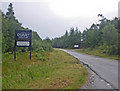
Nearby Images from Geograph Britain and Ireland:
©2010(licence)
©2010(licence)
©2005(licence)
©2007(licence)
©2010(licence)
The above images may not be of the site on this page, they are loaded from Geograph.
Please Submit an Image of this site or go out and take one for us!
Click here to see more info for this site
Nearby sites
Key: Red: member's photo, Blue: 3rd party photo, Yellow: other image, Green: no photo - please go there and take one, Grey: site destroyed
Download sites to:
KML (Google Earth)
GPX (GPS waypoints)
CSV (Garmin/Navman)
CSV (Excel)
To unlock full downloads you need to sign up as a Contributory Member. Otherwise downloads are limited to 50 sites.
Turn off the page maps and other distractions
Nearby sites listing. In the following links * = Image available
51m W 278° Duart Standing Stone* Standing Stone (Menhir) (NM72653421)
4.9km NW 323° Scallastle* Stone Row / Alignment (NM6998438286)
5.0km SSE 166° Port Donain Cairn* Cairn (NM73672932)
5.1km SSE 165° Port Donain Chambered Cairn* Chambered Cairn (NM73752925)
5.3km ENE 77° Eilean Musdile (Lismore) Standing Stone (Menhir) (NM779351)
6.8km ENE 72° Dun Chruban* Stone Fort or Dun (NM79243598)
7.6km ENE 69° An Dun 2 (Lismore)* Stone Fort or Dun (NM79983651)
8.2km ENE 63° Aon Garbh Cairns* Cairn (NM80213751)
8.4km ENE 68° Fiart Dun* Stone Fort or Dun (NM80673687)
8.4km ENE 62° Aon Garbh Cist* Cist (NM80393772)
9.1km ENE 64° An Dun Broch* Broch or Nuraghe (NM81133768)
9.9km ENE 59° Barr Mor* Cairn (NM81493886)
10.2km ESE 111° Slatrach Cairn Cairn (NM82043002)
10.3km ENE 63° Kilcheran Dun* Stone Fort or Dun (NM82213834)
10.4km ESE 113° Sidhean Riabhach* Cist (NM82092959)
10.9km ENE 62° Kilcheran Fort* Hillfort (NM82663877)
11.4km NE 55° Dun Cuilein* Stone Fort or Dun (NM82504018)
12.1km ENE 61° Balygrundle South* Cairn (NM83653946)
12.4km ENE 59° Balygrundle North* Cairn (NM83673997)
12.4km ENE 59° Dun Mor (Lismore)* Stone Fort or Dun (NM83724003)
12.5km ENE 61° Dun Vamha Chradha* Cairn (NM84023958)
12.6km SE 127° Dun Gallanach* Stone Fort or Dun (NM823260)
12.8km E 99° Dunollie Stone Fort or Dun (NM85223148)
12.9km SE 125° Dun Ormidale* Stone Fort or Dun (NM82902630)
12.9km ESE 101° Oban cup marked stone* Rock Art (NM85243097)
View more nearby sites and additional images


 We would like to know more about this location. Please feel free to add a brief description and any relevant information in your own language.
 Wir möchten mehr über diese Stätte erfahren. Bitte zögern Sie nicht, eine kurze Beschreibung und relevante Informationen in Deutsch hinzuzufügen.
 Nous aimerions en savoir encore un peu sur les lieux. S'il vous plaît n'hesitez pas à ajouter une courte description et tous les renseignements pertinents dans votre propre langue.
 Quisieramos informarnos un poco más de las lugares. No dude en añadir una breve descripción y otros datos relevantes en su propio idioma.