<< Text Pages >> Barnakill - Rock Art in Scotland in Argyll
Submitted by davidmorgan on Sunday, 05 April 2015 Page Views: 2009
Rock ArtSite Name: BarnakillCountry: Scotland
NOTE: This site is 2.433 km away from the location you searched for.
County: Argyll Type: Rock Art
Nearest Village: Crinan
Map Ref: NR82199154
Latitude: 56.066954N Longitude: 5.500695W
Condition:
| 5 | Perfect |
| 4 | Almost Perfect |
| 3 | Reasonable but with some damage |
| 2 | Ruined but still recognisable as an ancient site |
| 1 | Pretty much destroyed, possibly visible as crop marks |
| 0 | No data. |
| -1 | Completely destroyed |
| 5 | Superb |
| 4 | Good |
| 3 | Ordinary |
| 2 | Not Good |
| 1 | Awful |
| 0 | No data. |
| 5 | Can be driven to, probably with disabled access |
| 4 | Short walk on a footpath |
| 3 | Requiring a bit more of a walk |
| 2 | A long walk |
| 1 | In the middle of nowhere, a nightmare to find |
| 0 | No data. |
| 5 | co-ordinates taken by GPS or official recorded co-ordinates |
| 4 | co-ordinates scaled from a detailed map |
| 3 | co-ordinates scaled from a bad map |
| 2 | co-ordinates of the nearest village |
| 1 | co-ordinates of the nearest town |
| 0 | no data |
Internal Links:
External Links:
Rock Art in Argyll
A possible Early Bronze Age carving of two hands on a 1.5m long boulder.
Canmore site no. 39566
You may be viewing yesterday's version of this page. To see the most up to date information please register for a free account.
Do not use the above information on other web sites or publications without permission of the contributor.
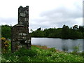
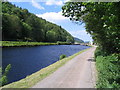
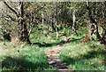
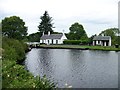
Nearby Images from Geograph Britain and Ireland:
©2005(licence)

©2011(licence)
©2008(licence)
©2010(licence)
©2013(licence)
The above images may not be of the site on this page, they are loaded from Geograph.
Please Submit an Image of this site or go out and take one for us!
Click here to see more info for this site
Nearby sites
Key: Red: member's photo, Blue: 3rd party photo, Yellow: other image, Green: no photo - please go there and take one, Grey: site destroyed
Download sites to:
KML (Google Earth)
GPX (GPS waypoints)
CSV (Garmin/Navman)
CSV (Excel)
To unlock full downloads you need to sign up as a Contributory Member. Otherwise downloads are limited to 50 sites.
Turn off the page maps and other distractions
Nearby sites listing. In the following links * = Image available
1.7km ESE 103° Cairnbaan 2* Rock Art (NR8387791056)
1.9km ESE 103° Cairnbaan 1* Rock Art (NR8398891027)
2.0km ESE 103° Dun Chuain* Stone Fort or Dun (NR841910)
2.0km ESE 112° Carn Ban (Lochgilphead)* Cairn (NR840907)
2.3km ENE 65° Dun Mor, Dunamuck* Stone Fort or Dun (NR8435792420)
2.4km ENE 78° Dunamuck Cairn* Cairn (NR84579192)
2.5km NNE 33° Dunadd Fort* Hillfort (NR8367693573)
2.6km NE 40° Dunadd Recumbent Stone* Standing Stone (Menhir) (NR83979343)
2.7km NE 36° Dunadd Standing Stone* Standing Stone (Menhir) (NR8386993612)
2.7km ENE 71° Leacaichluaine* Standing Stones (NR84839232)
2.8km ENE 67° Dunamuck South* Standing Stones (NR8484192493)
2.8km NNW 330° Crinan Moss Cairn Cairn (NR80909408)
2.9km ENE 59° Dunamuck North* Standing Stones (NR8471392912)
2.9km NNW 329° Crinan Moss Stones* Standing Stones (NR80839409)
3.2km ESE 102° Dun Na Maraig* Stone Fort or Dun (NR85259072)
3.4km E 99° Achnabreck Forest Rock Art* Rock Art (NR8556390815)
3.5km ESE 102° Achnabreck* Rock Art (NR8555090671)
3.5km WSW 246° Gartnagreanoch* Chambered Cairn (NR789903)
3.6km ESE 109° Achnabreck Stone* Standing Stone (Menhir) (NR8553790197)
3.6km ESE 101° Achnabreck Eastern Rock* Rock Art (NR8572290645)
3.8km ESE 112° Achnabreac* Standing Stones (NR85638992)
3.9km WNW 303° Crinan Woods Cup Stone* Rock Art (NR79019382)
4.0km WSW 255° Kilmory Oib Enclosure* Standing Stones (NR78289070)
4.1km ENE 59° Kilmichael Glassary 1* Rock Art (NR8579793496)
4.1km ENE 58° Kilmichael Glassary 2* Rock Art (NR8580993545)
View more nearby sites and additional images


 We would like to know more about this location. Please feel free to add a brief description and any relevant information in your own language.
 Wir möchten mehr über diese Stätte erfahren. Bitte zögern Sie nicht, eine kurze Beschreibung und relevante Informationen in Deutsch hinzuzufügen.
 Nous aimerions en savoir encore un peu sur les lieux. S'il vous plaît n'hesitez pas à ajouter une courte description et tous les renseignements pertinents dans votre propre langue.
 Quisieramos informarnos un poco más de las lugares. No dude en añadir una breve descripción y otros datos relevantes en su propio idioma.