


<< Text Pages >> St Aidan's Church (Solva) - Early Christian Sculptured Stone in Wales in Pembrokeshire
Submitted by Sunny100 on Friday, 25 March 2011 Page Views: 6730
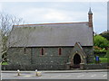
Early Medieval (Dark Age)Site Name: St Aidan''s Church (Solva) Alternative Name: Maen Dewi, St David's StoneCountry: Wales
NOTE: This site is 0.562 km away from the location you searched for.
County: Pembrokeshire Type: Early Christian Sculptured Stone
Nearest Town: St David's Nearest Village: Solva
Map Ref: SM799244
Latitude: 51.874623N Longitude: 5.198874W
Condition:
| 5 | Perfect |
| 4 | Almost Perfect |
| 3 | Reasonable but with some damage |
| 2 | Ruined but still recognisable as an ancient site |
| 1 | Pretty much destroyed, possibly visible as crop marks |
| 0 | No data. |
| -1 | Completely destroyed |
| 5 | Superb |
| 4 | Good |
| 3 | Ordinary |
| 2 | Not Good |
| 1 | Awful |
| 0 | No data. |
| 5 | Can be driven to, probably with disabled access |
| 4 | Short walk on a footpath |
| 3 | Requiring a bit more of a walk |
| 2 | A long walk |
| 1 | In the middle of nowhere, a nightmare to find |
| 0 | No data. |
| 5 | co-ordinates taken by GPS or official recorded co-ordinates |
| 4 | co-ordinates scaled from a detailed map |
| 3 | co-ordinates scaled from a bad map |
| 2 | co-ordinates of the nearest village |
| 1 | co-ordinates of the nearest town |
| 0 | no data |
Internal Links:
External Links:
Early Christian Sculptured Stone in Pembrokeshire (Sir Benfro)
Solva is some 3 miles east of St David's. In the church of St Aidan (Maedoc) beside the A487 there is an early Christinanized stone called 'Maen Dewi' - St David's Stone. It has an early Christian ring-cross carved onto it, but could, in fact, be a an older, prehistoric stone.
The stone was brought to St Aidan's church in 1925 after being discovered in use as a gatepost at St Elvis farm about a mile and half east of here. It had stood beside the second entrance to the farm for some considerable time without anyone realising what it was. On the stone there is an incised ring cross - a thin linear cross that is mainly concentrated within a round circle; however the lower arm or shaft extends downwards - the whole cross measures 8'x16' - and is probably a Christianized stone.
The artefact has long been associated with St David, patron St of Wales, and may have once stood beside St Aelbyw's holy well in St Elvis farmyard. This well is considered to be the one where David was baptised in about 500 AD by St Ailbhe, bishop of Munster, in Ireland. It probably stood in the old church of St Teilo which is now a ruin in the farmyard. The ruined church was said to measure 35 feet east to west and 17 feet across, but after 1850 it fell into decay and the stone and an old font were brought for safety to St Aidan's in Solva.
You may be viewing yesterday's version of this page. To see the most up to date information please register for a free account.
Do not use the above information on other web sites or publications without permission of the contributor.
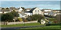
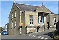
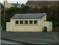
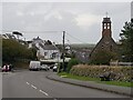
Nearby Images from Geograph Britain and Ireland:
©2005(licence)
©2016(licence)
©2015(licence)
©2022(licence)
©2013(licence)
The above images may not be of the site on this page, they are loaded from Geograph.
Please Submit an Image of this site or go out and take one for us!
Click here to see more info for this site
Nearby sites
Key: Red: member's photo, Blue: 3rd party photo, Yellow: other image, Green: no photo - please go there and take one, Grey: site destroyed
Download sites to:
KML (Google Earth)
GPX (GPS waypoints)
CSV (Garmin/Navman)
CSV (Excel)
To unlock full downloads you need to sign up as a Contributory Member. Otherwise downloads are limited to 50 sites.
Turn off the page maps and other distractions
Nearby sites listing. In the following links * = Image available
587m SE 146° Solva Gribin Fort* Promontory Fort / Cliff Castle (SM80212390)
969m NW 313° Llanungar-Fawr Standing Stone Standing Stone (Menhir) (SM7922025093)
1.0km WNW 292° Nine Wells possible Standing Stone 4 Standing Stone (Menhir) (SM7895824821)
1.1km WNW 296° Nine Wells Standing Stone 2 Standing Stone (Menhir) (SM7894824912)
1.1km WNW 293° Nine Wells Standing Stone 3 Standing Stone (Menhir) (SM7890524883)
1.2km WNW 294° Nine Wells Standing Stone 1 Standing Stone (Menhir) (SM7883524931)
1.2km WSW 258° Porth-y-Rhaw* Promontory Fort / Cliff Castle (SM787242)
1.4km WNW 292° Nine Wells Cromlech Standing Stone (Menhir) (SM7865624977)
1.4km ESE 107° St Elvis Farm* Chambered Tomb (SM81202394)
1.4km ESE 102° St Aelbyw's Well (St Elvis) Holy Well or Sacred Spring (SM81242405)
3.0km NNE 22° Lecha Dolmen Chambered Tomb (SM81152711)
3.1km ESE 117° Dinas Fach* Promontory Fort / Cliff Castle (SM82572290)
3.4km NE 53° Tremaenhir Standing Stones* Standing Stones (SM8268926318)
3.5km WNW 290° Trecenny Stone* Standing Stone (Menhir) (SM7665725755)
3.5km NNE 30° Llanhowel Church* Early Christian Sculptured Stone (SM818274)
3.6km ENE 71° Ffynnon Dewi (Solva) Holy Well or Sacred Spring (SM83352544)
3.7km W 263° Penpleidiau fort* Hillfort (SM762241)
3.9km NW 320° Maen Dewi* Standing Stone (Menhir) (SM775275)
4.4km W 278° Pembrokeshire National Park Visitors Centre* Museum (SM756252)
4.4km W 279° Cocyn Round* Misc. Earthwork (SM7559325258)
4.7km W 281° Ffynnon-Y-Cwcwll Holy Well or Sacred Spring (SM7533725498)
4.8km W 279° St David's Cathedral* Ancient Cross (SM75202536)
4.8km W 267° St Non's Well (Pembrokeshire)* Holy Well or Sacred Spring (SM75102437)
4.8km NNE 31° White House (Treglemais)* Chambered Tomb (SM82582839)
4.8km W 267° St Non's Chapel* Early Christian Sculptured Stone (SM7507524345)
View more nearby sites and additional images


 We would like to know more about this location. Please feel free to add a brief description and any relevant information in your own language.
 Wir möchten mehr über diese Stätte erfahren. Bitte zögern Sie nicht, eine kurze Beschreibung und relevante Informationen in Deutsch hinzuzufügen.
 Nous aimerions en savoir encore un peu sur les lieux. S'il vous plaît n'hesitez pas à ajouter une courte description et tous les renseignements pertinents dans votre propre langue.
 Quisieramos informarnos un poco más de las lugares. No dude en añadir una breve descripción y otros datos relevantes en su propio idioma.