<< Our Photo Pages >> Llain (near Mathry) - Standing Stone (Menhir) in Wales in Pembrokeshire
Submitted by DavidHoyle on Friday, 05 February 2021 Page Views: 482
Neolithic and Bronze AgeSite Name: Llain (near Mathry)Country: Wales
NOTE: This site is 1.104 km away from the location you searched for.
County: Pembrokeshire Type: Standing Stone (Menhir)
Map Ref: SM8931129938
Latitude: 51.927979N Longitude: 5.065759W
Condition:
| 5 | Perfect |
| 4 | Almost Perfect |
| 3 | Reasonable but with some damage |
| 2 | Ruined but still recognisable as an ancient site |
| 1 | Pretty much destroyed, possibly visible as crop marks |
| 0 | No data. |
| -1 | Completely destroyed |
| 5 | Superb |
| 4 | Good |
| 3 | Ordinary |
| 2 | Not Good |
| 1 | Awful |
| 0 | No data. |
| 5 | Can be driven to, probably with disabled access |
| 4 | Short walk on a footpath |
| 3 | Requiring a bit more of a walk |
| 2 | A long walk |
| 1 | In the middle of nowhere, a nightmare to find |
| 0 | No data. |
| 5 | co-ordinates taken by GPS or official recorded co-ordinates |
| 4 | co-ordinates scaled from a detailed map |
| 3 | co-ordinates scaled from a bad map |
| 2 | co-ordinates of the nearest village |
| 1 | co-ordinates of the nearest town |
| 0 | no data |
Be the first person to rate this site - see the 'Contribute!' box in the right hand menu.
Internal Links:
External Links:
 (PID:231528)")
Visible on the OS Map - not had chance to visit yet. 51.927969 -5.065754
You may be viewing yesterday's version of this page. To see the most up to date information please register for a free account.
 (PID:231527)")
Do not use the above information on other web sites or publications without permission of the contributor.
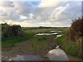
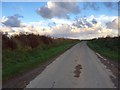
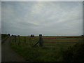
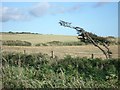
Nearby Images from Geograph Britain and Ireland:
©2017(licence)
©2017(licence)
©2010(licence)
©2007(licence)
©2017(licence)
The above images may not be of the site on this page, they are loaded from Geograph.
Please Submit an Image of this site or go out and take one for us!
Click here to see more info for this site
Nearby sites
Key: Red: member's photo, Blue: 3rd party photo, Yellow: other image, Green: no photo - please go there and take one, Grey: site destroyed
Download sites to:
KML (Google Earth)
GPX (GPS waypoints)
CSV (Garmin/Navman)
CSV (Excel)
To unlock full downloads you need to sign up as a Contributory Member. Otherwise downloads are limited to 50 sites.
Turn off the page maps and other distractions
Nearby sites listing. In the following links * = Image available
1.2km S 188° Tre-Howell Burial Chamber or Dolmen (SM891288)
1.2km SSE 153° Clyn Ffwrn Standing Stone (Menhir) (SM89792888)
1.2km SW 219° Trehale House Standing Stone (Menhir) (SM88542906)
1.3km SSW 211° Trehale Stone* Standing Stone (Menhir) (SM88582883)
1.4km SW 235° Trehale House Standing Stone Standing Stone (Menhir) (SM88152920)
1.6km WSW 244° Blaen-Llyn* Standing Stone (Menhir) (SM87882931)
1.6km S 174° St Edren's Cross* Early Christian Sculptured Stone (SM894283)
2.4km NW 322° Mathry Church* Early Christian Sculptured Stone (SM879319)
3.1km NW 304° Trewalter Llwyd* Chambered Tomb (SM868318)
3.2km WNW 301° Trewalter Llwyd Standing Stone* Standing Stone (Menhir) (SM86603174)
3.3km ESE 117° BrynGwyn Stone Standing Stone (Menhir) (SM9223728297)
3.4km ESE 109° Ty-newydd-grug* Standing Stone (Menhir) (SM9247228708)
4.1km WSW 250° Treffynnon* Chambered Tomb (SM85362866)
4.2km S 190° Castle Hill Enclosure Hillfort (SM88422585)
4.3km NE 40° Jordanston* Round Barrow(s) (SM922331)
4.4km E 95° Letterston III Stone Circle (SM937294)
4.5km ESE 117° St Lawrence Camp Promontory Fort / Cliff Castle (SM93212771)
4.7km NE 34° Castell Hendre-Wen Ancient Village or Settlement (SM92083370)
4.8km SW 226° Llandeloy Holy Well* Holy Well or Sacred Spring (SM857267)
5.1km NNE 12° Ffyst Samson* Chambered Tomb (SM90613491)
5.1km NNW 334° Castell Coch (Abercastle)* Promontory Fort / Cliff Castle (SM87243465)
5.3km SSE 148° Barnards Hill Tumulus Round Barrow(s) (SM91962536)
5.4km SSE 168° Hayscastle Tump Round Barrow(s) (SM90232463)
5.5km W 275° Mesur-y-dorth Stone* Early Christian Sculptured Stone (SM838307)
5.6km S 175° Rhyndaston-Fawr* Standing Stone (Menhir) (SM89592433)
View more nearby sites and additional images


 We would like to know more about this location. Please feel free to add a brief description and any relevant information in your own language.
 Wir möchten mehr über diese Stätte erfahren. Bitte zögern Sie nicht, eine kurze Beschreibung und relevante Informationen in Deutsch hinzuzufügen.
 Nous aimerions en savoir encore un peu sur les lieux. S'il vous plaît n'hesitez pas à ajouter une courte description et tous les renseignements pertinents dans votre propre langue.
 Quisieramos informarnos un poco más de las lugares. No dude en añadir una breve descripción y otros datos relevantes en su propio idioma.