Featured: Explore Scotland (and everywhere else) with our Megalithic Portal iPhone app

Explore Scotland (and everywhere else) with our Megalithic Portal iPhone app

The Significance of Monuments

The Significance of Monuments

Who's Online

There are currently, 250 guests and 0 members online.

You are a guest. To join in, please register for free by clicking here

Sponsors

<< Text Pages >> Brownslade Farm - Round Barrow(s) in Wales in Pembrokeshire

Submitted by vicky on Friday, 26 October 2007  Page Views: 10244

Neolithic and Bronze AgeSite Name: Brownslade Farm Alternative Name: Brownslade Barrow
Country: Wales
NOTE: This site is 1.503 km away from the location you searched for.

County: Pembrokeshire Type: Round Barrow(s)
 Nearest Village: Castlemartin
Map Ref: SR905973  Landranger Map Number: 158
Latitude: 51.635391N  Longitude: 5.028787W
Condition:
5Perfect
4Almost Perfect
3Reasonable but with some damage
2Ruined but still recognisable as an ancient site
1Pretty much destroyed, possibly visible as crop marks
0No data.
-1Completely destroyed
no data Ambience:
5Superb
4Good
3Ordinary
2Not Good
1Awful
0No data.
no data Access:
5Can be driven to, probably with disabled access
4Short walk on a footpath
3Requiring a bit more of a walk
2A long walk
1In the middle of nowhere, a nightmare to find
0No data.
no data Accuracy:
5co-ordinates taken by GPS or official recorded co-ordinates
4co-ordinates scaled from a detailed map
3co-ordinates scaled from a bad map
2co-ordinates of the nearest village
1co-ordinates of the nearest town
0no data
3
Be the first person to rate this site - see the 'Contribute!' box in the right hand menu.

Internal Links:
External Links:

Round barrow in Pembrokeshire. Partially excavated in the 1880s and is believed to have prehistoric Bronze Age origins.

Has been under threat from badger burrowing.

Note: Brownslade Barrow project win MOD conservation Award, see latest comment
You may be viewing yesterday's version of this page. To see the most up to date information please register for a free account.


Do not use the above information on other web sites or publications without permission of the contributor.

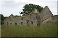
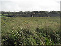
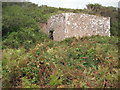
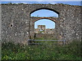
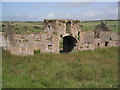
Nearby Images from Geograph Britain and Ireland:
SR9097 : Abandoned buildings, Brownslade Farm by Simon Mortimer
by Simon Mortimer
©2013(licence)
SR9097 : Brownslade Farm by Tom Stamp
by Tom Stamp
©2012(licence)
SR9097 : Lime Kiln by Tom Stamp
by Tom Stamp
©2012(licence)
SR9097 : Brownslade Farm by Tom Stamp
by Tom Stamp
©2012(licence)
SR9097 : Brownslade Farm by Tom Stamp
by Tom Stamp
©2012(licence)

The above images may not be of the site on this page, they are loaded from Geograph.
Please Submit an Image of this site or go out and take one for us!


Click here to see more info for this site

Nearby sites

Click here to view sites on an interactive OS map

Key: Red: member's photo, Blue: 3rd party photo, Yellow: other image, Green: no photo - please go there and take one, Grey: site destroyed

Download sites to:
KML (Google Earth)
GPX (GPS waypoints)
CSV (Garmin/Navman)
CSV (Excel)

To unlock full downloads you need to sign up as a Contributory Member. Otherwise downloads are limited to 50 sites.


Turn off the page maps and other distractions

Nearby sites listing. In the following links * = Image available
 727m SSW 194° Castle Lady Valley Hillfort (SR903966)
 804m WSW 238° Linney Round Barrow(s) (SR898969)
 1.6km W 275° Linney Burrows Round Barrow(s) (SR889975)
 2.3km SW 224° Hobbyhorse Bay* Promontory Fort / Cliff Castle (SR888957)
 3.5km E 84° Merrion Court* Hillfort (SR940975)
 3.7km SE 135° Flimston Castle* Promontory Fort / Cliff Castle (SR930946)
 3.7km NNW 334° Kilpaison Burrows Round Barrow(s) (SM890007)
 3.7km NNE 32° Wallaston Green* Barrow Cemetery (SM926004)
 3.8km NE 45° Corston Beacon* Round Barrow(s) (SR933999)
 4.0km NNW 330° The Devil's Quoit* Burial Chamber or Dolmen (SM88650084)
 4.3km SE 132° Crocksydam Camp Hillfort (SR936943)
 4.9km ENE 58° Dry Burrows* Barrow Cemetery (SR948997)
 5.5km ENE 57° Pennybridge Stone Circle (SM953001)
 5.7km NW 310° Pickard Head Hillfort (SM863011)
 5.8km E 97° Devil's Quoit (St Twynnells)* Standing Stone (Menhir) (SR96239638)
 6.1km NNE 14° Pwllcrochan Hillfort (SM922032)
 6.2km SE 126° Buckspool Down Camp* Hillfort (SR954934)
 6.4km E 101° Harold Stone (Bosherton)* Standing Stone (Menhir) (SR96769586)
 6.5km N 0° Oil Refinery Hillfort (SM908038)
 7.0km ESE 108° Bosherston* Hillfort (SR971948)
 7.3km ENE 59° Quoits Wood Ancient Village or Settlement (SM9696000845)
 7.4km NW 305° Whitedole Bay Hillfort (SM846018)
 7.4km ESE 110° Freynslake Round Barrow(s) (SR974945)
 7.4km ENE 61° Bowett Wood Camp Ancient Village or Settlement (SM9713500678)
 7.6km ESE 123° St Govan's Well* Holy Well or Sacred Spring (SR96719294)
View more nearby sites and additional images

<< Trinity Well (Trewern)

Puthurmalai >>

Please add your thoughts on this site

Great Crowns of Stone: The Recumbent Stone Circles of Scotland

Great Crowns of Stone: The Recumbent Stone Circles of Scotland

Sponsors

Auto-Translation (Google)

Translate from English into:

"Brownslade Farm" | Login/Create an Account | 5 News and Comments
  
Go back to top of page    Comments are owned by the poster. We aren't responsible for their content.
Brownslade Barrow photos by Andy B on Friday, 26 October 2007
(User Info | Send a Message)
Photos of the site here:
http://www.acadat.com/projects/BrownsladeBarrow.htm
[ Reply to This ]

Badgers and bones win MOD conservation Award by Andy B on Friday, 26 October 2007
(User Info | Send a Message)
A project to protect a bronze age burial site on MOD land from a clan of Badgers, while resettling the badgers at the same time, has won the MOD's annual Sanctuary Awards.

The Awards are held to recognise both groups and individual efforts towards conservation of MOD land in the UK or overseas. They are run by MOD's Defence Estates.

At the Awards ceremony held today 17 October 2007, at London's Imperial War Museum, the Sanctuary Award and Silver Otter trophy was presented to the South Pembrokeshire Ranges Recording Advisory Group (SPRRAG) for their work in preserving the Brownslade Barrow archaeological monument at Castlemartin Range and resettling a large badger population in the area.

The Barrow is a Bronze Age burial mound designated as a Scheduled Ancient Monument. In 2001 range staff noticed human bones on the ground close to the designated area and that Badgers living in the area were disturbing the bones. Action was required to prevent further disturbance and stop the badgers reaching the protected area. The project involved arranging for licences to resettle the badgers, constructing a new sett, working with specialist ecologists to ensure that all the badgers had moved and then arranging for archaeologists to carry out excavation.

Over 1,000 bone fragments were discovered and are being analysed by specialists at the University of Lampeter. The Sanctuary Award Board felt that this project was an excellent example of MOD's stewardship of the rural estate. It also demonstrates highly effective partnership working between SPRRAG, Defence Training Estate, the National Park Authority, Cambria Archaeology, the Countryside Council for Wales and the Badger Consultancy, amongst others.

Marcus Yeo, Director of Resources and External Affairs, Joint Nature Conservation Committee and a judge for the award, said:

"The standard and variety of entries this year was once again extremely high and it was a very hard decision to choose the overall winner. I was very pleased to be involved in the decision making which shows just how a government department can provide significant outcomes for conservation."

This year's runner up was the Defence Geographic Centre in Feltham whose innovative recycling project has seen an increase in recycling figures at the site to 77 per cent.

Special Contribution Awards were also given to Peter Gay who has been an active member of the Cinque Ports Training Area Conservation Group in Kent, for over 25 years and Mr Bob Crump for heritage and conservation work at MOD facilities on the Essex coast.

Peter Gay's exceptional knowledge of the Cinque Ports' training area's flora and fauna and monitoring of the orchids on the chalk hills has been of great help when planning management and explosive ordnance clearance. His enthusiasm and knowledge are an inspiration to people of all ages.

Bob Crump was very much the driving force behind the establishment of the Foulness Heritage Centre, which has been an outstanding success and displays artefacts showing up to 2000 years of life on the MOD owned Island.

The members of the Sanctuary Award Board for 2007 were Martin Coulson, Head of Land and Property Policy, Defence Estates, Bob Morris, Head of the Environmental Support Team, Defence Estates and Pippa Morrison, Biodiversity Adviser, Defence Estates. Marcus Yeo, Director of Resources and External Affairs, Joint Nature Conservation Committee, acted as external judge.

The awards were presented by Under-Secretary of State for Defence Derek Twigg who said:

"I am delighted to be presenting the Sanctuary Awards today. They highlight the outstanding work done by both volunteers and MOD staff across the Defence estate. We are fortunate indeed to have so many dedicated people involved."

RAF Honington/RAF Barnham Conservation Group were Highly Commended by the Judges for their work to restore a Site of Special Sci

Read the rest of this post...
[ Reply to This ]

Re: Brownslade Farm by PAB on Sunday, 29 April 2007
(User Info | Send a Message)
Bones from Brownslade Barrow (not my title!).

The Spring 2007 Newsletter on the CBA site mentioned by Shropshire Traveller has an update on last summer's excavations on this site:

http://www.britarch.ac.uk/cbawales/Newsletters/newsletter33/newsletter33.html


[ Reply to This ]

Re: Brownslade Farm by Andy B on Monday, 24 July 2006
(User Info | Send a Message)
Also a photo at Pembrokeshire TV.
[ Reply to This ]

Barrow's Secrets Revealed by Andy B on Monday, 24 July 2006
(User Info | Send a Message)
Archaeologists will take advantage of a summer lull in firing at the MOD's Castlemartin Range this August, to spend time unravelling the mysteries of Brownslade Barrow.

The site, situated on part of the Castlemartin Army Training Estate, was first excavated over a century ago. It is believed to originate from 2300 - 650BC, an era known as the prehistoric Bronze Age.

Brownslade Barrow is cited as one of Pembrokeshire’s most interesting and important historical sites; it has evidence of multiple use and the quality of remains found there during recent excavations are much better preserved than at other sites in the county.

"It was partially excavated in the 1880s and is believed to have prehistoric Bronze Age origins,“ said Polly Groom, the National Park Authority’s Archaeologist

“Evidence was found of later re-use, with burials presumed to date from the early Medieval period.

"Two very recent trial investigations on site revealed over 100 pieces of human bone, from at least six individuals. Radiocarbon dates put them within the early Medieval period (5th - 11th centuries AD). The remains may occupy a time span of up to 500 years.

"The site is really unusual in having good preservation; mostly in Pembrokeshire the soils are so acidic that the preservation of remains is very poor. This makes Brownslade even more important and interesting."

The site is currently being damaged by badger burrowing, so this summer’s excavations will allow information to be retrieved before it is destroyed completely.

Information, pictures and updates will be posted online in a regular ‘dig-diary’ throughout the summer - visible on http://www.cambria.org.uk. [It doesn't say where though - Ed]


http://pembrokeshiretv.com/content/templates/v6-article.asp?articleid=2605
[ Reply to This ]

Your Name: Anonymous [ Register Now ]
Subject:


Add your comment or contribution to this page. Spam or offensive posts are deleted immediately, don't even bother

<<< What is five plus one as a number? (Please type the answer to this question in the little box on the left)
You can also embed videos and other things. For Youtube please copy and paste the 'embed code'.
For Google Street View please include Street View in the text.
Create a web link like this: <a href="https://www.megalithic.co.uk">This is a link</a>  

Allowed HTML is:
<p> <b> <i> <a> <img> <em> <br> <strong> <blockquote> <tt> <li> <ol> <ul> <object> <param> <embed> <iframe>

We would like to know more about this location. Please feel free to add a brief description and any relevant information in your own language.
Wir möchten mehr über diese Stätte erfahren. Bitte zögern Sie nicht, eine kurze Beschreibung und relevante Informationen in Deutsch hinzuzufügen.
Nous aimerions en savoir encore un peu sur les lieux. S'il vous plaît n'hesitez pas à ajouter une courte description et tous les renseignements pertinents dans votre propre langue.
Quisieramos informarnos un poco más de las lugares. No dude en añadir una breve descripción y otros datos relevantes en su propio idioma.