<< Text Pages >> Bruthach Na Garbh Choille - Ancient Village or Settlement in Scotland in Highlands
Submitted by Andy B on Wednesday, 01 September 2010 Page Views: 3107
Multi-periodSite Name: Bruthach Na Garbh ChoilleCountry: Scotland
NOTE: This site is 14.725 km away from the location you searched for.
County: Highlands Type: Ancient Village or Settlement
Nearest Village: Lochbroom
Map Ref: NH120856
Latitude: 57.820355N Longitude: 5.166994W
Condition:
| 5 | Perfect |
| 4 | Almost Perfect |
| 3 | Reasonable but with some damage |
| 2 | Ruined but still recognisable as an ancient site |
| 1 | Pretty much destroyed, possibly visible as crop marks |
| 0 | No data. |
| -1 | Completely destroyed |
| 5 | Superb |
| 4 | Good |
| 3 | Ordinary |
| 2 | Not Good |
| 1 | Awful |
| 0 | No data. |
| 5 | Can be driven to, probably with disabled access |
| 4 | Short walk on a footpath |
| 3 | Requiring a bit more of a walk |
| 2 | A long walk |
| 1 | In the middle of nowhere, a nightmare to find |
| 0 | No data. |
| 5 | co-ordinates taken by GPS or official recorded co-ordinates |
| 4 | co-ordinates scaled from a detailed map |
| 3 | co-ordinates scaled from a bad map |
| 2 | co-ordinates of the nearest village |
| 1 | co-ordinates of the nearest town |
| 0 | no data |
Be the first person to rate this site - see the 'Contribute!' box in the right hand menu.
Internal Links:
External Links:
Ancient Village or Settlement in Highlands
Centred at NH 120 856, on the brink of the steep E slopes of Strath Beag, is a settlement of three circular stone-walled huts (A - C) and traces of contemporary cultivation.
Hut 'A' measures 8.0m in internal diameter. Both inner and outer wall faces are visible intermittently, indicating a wall thickness of 1.5m, widening to 2.6m at the clubbed entrance in the SE. The latter, though obscured by tumble, appears to have been about 1.5m wide.
'B' situated in a saddle, measures c. 12.5m in diameter between the centres of a denuded wall of indeterminate thickness. The outer face of stones placed edgewise is visible in the S arc. The position of the entrance is not apparent.
'C' survives as a platform built up on a S-facing slope, surrounded by a denuded wall in which only the discontinuous outer face of stones on edge can be seen, giving an overall diameter of 11.6m. The ill-defined entrance is in the SE.
In the vicinity of the huts, and particularly on the slopes to the SE of hut 'A', are several clearance heaps and occasional field walls, but no measurable cultivation plots.
Source: Scotland's Places
You may be viewing yesterday's version of this page. To see the most up to date information please register for a free account.
Do not use the above information on other web sites or publications without permission of the contributor.
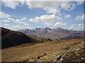
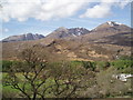
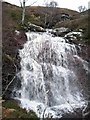
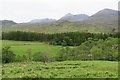
Nearby Images from Geograph Britain and Ireland:
©2008(licence)
©2008(licence)
©2006(licence)
©2018(licence)
©2005(licence)
The above images may not be of the site on this page, they are loaded from Geograph.
Please Submit an Image of this site or go out and take one for us!
Click here to see more info for this site
Nearby sites
Key: Red: member's photo, Blue: 3rd party photo, Yellow: other image, Green: no photo - please go there and take one, Grey: site destroyed
Download sites to:
KML (Google Earth)
GPX (GPS waypoints)
CSV (Garmin/Navman)
CSV (Excel)
To unlock full downloads you need to sign up as a Contributory Member. Otherwise downloads are limited to 50 sites.
Turn off the page maps and other distractions
Nearby sites listing. In the following links * = Image available
5.3km NNE 30° Dun An Ruigh Ruadh* Stone Fort or Dun (NH14939008)
6.2km NNE 18° Dun Lagaidh* Stone Fort or Dun (NH14239135)
6.7km NE 45° Allt Raon A'Chroisg Broch or Nuraghe (NH16959008)
7.1km NW 323° Beinn Ghobhlach Standing Stone* Standing Stone (Menhir) (NH080915)
13.5km NNW 347° Isle Martin Cross Stone* Ancient Cross (NH096989)
15.2km N 354° Dun Canna* Stone Fort or Dun (NC11160080)
16.8km WNW 294° Stones near Mungasdale Natural Stone / Erratic / Other Natural Feature (NG9686393111)
16.9km NNE 13° An Dun, Strath Canaird Stone Fort or Dun (NC16530196)
23.0km SW 232° Isle Maree* Holy Well or Sacred Spring (NG93107236)
23.1km NNW 334° Achlochan Broch* Broch or Nuraghe (NC029069)
24.4km SSW 198° Tobar Mhoire* Holy Well or Sacred Spring (NH033628)
24.9km WNW 291° Mellon Udrigle Hut Circle* Ancient Village or Settlement (NG891957)
26.3km WSW 257° Inverewe* Class I Pictish Symbol Stone (NG860809)
28.3km NNE 19° Glacbain* Cairn (NC2231112011)
28.8km NE 37° Cnoc Chaornaidh South-east* Chambered Cairn (NC30320793)
28.9km NE 36° Cnoc Chaornaidh Central* Cairn (NC30170818)
28.9km NE 35° Cnoc Chaornaidh North West* Chambered Cairn (NC299084)
29.0km NNE 21° Ledmore* Chambered Cairn (NC23821215)
29.1km NNE 26° Loch Borralan West* Chambered Cairn (NC2603811142)
29.2km NNE 25° Loch Borralan Crannog* Crannog (NC25741138)
29.2km NNE 26° Loch Borralan East* Chambered Cairn (NC26241118)
29.2km NNE 27° Altnacealgach* Chambered Cairn (NC2652811033)
29.8km NNE 20° Cam Loch B Chambered Cairn (NC23431314)
29.8km NNE 20° Cam Loch A Cairn (NC23501312)
30.0km NNW 337° Brae of Achnahaird Stone Fort or Dun (NC01701380)
View more nearby sites and additional images


 We would like to know more about this location. Please feel free to add a brief description and any relevant information in your own language.
 Wir möchten mehr über diese Stätte erfahren. Bitte zögern Sie nicht, eine kurze Beschreibung und relevante Informationen in Deutsch hinzuzufügen.
 Nous aimerions en savoir encore un peu sur les lieux. S'il vous plaît n'hesitez pas à ajouter une courte description et tous les renseignements pertinents dans votre propre langue.
 Quisieramos informarnos un poco más de las lugares. No dude en añadir una breve descripción y otros datos relevantes en su propio idioma.