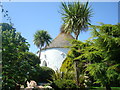
<< Our Photo Pages >> Veryan Well - Holy Well or Sacred Spring in England in Cornwall
Submitted by Thorgrim on Monday, 29 March 2004 Page Views: 4942
Springs and Holy WellsSite Name: Veryan WellCountry: England County: Cornwall Type: Holy Well or Sacred Spring
Nearest Town: Truro Nearest Village: Veryan
Map Ref: SW9157839571 Landranger Map Number: 204
Latitude: 50.219342N Longitude: 4.923002W
Condition:
| 5 | Perfect |
| 4 | Almost Perfect |
| 3 | Reasonable but with some damage |
| 2 | Ruined but still recognisable as an ancient site |
| 1 | Pretty much destroyed, possibly visible as crop marks |
| 0 | No data. |
| -1 | Completely destroyed |
| 5 | Superb |
| 4 | Good |
| 3 | Ordinary |
| 2 | Not Good |
| 1 | Awful |
| 0 | No data. |
| 5 | Can be driven to, probably with disabled access |
| 4 | Short walk on a footpath |
| 3 | Requiring a bit more of a walk |
| 2 | A long walk |
| 1 | In the middle of nowhere, a nightmare to find |
| 0 | No data. |
| 5 | co-ordinates taken by GPS or official recorded co-ordinates |
| 4 | co-ordinates scaled from a detailed map |
| 3 | co-ordinates scaled from a bad map |
| 2 | co-ordinates of the nearest village |
| 1 | co-ordinates of the nearest town |
| 0 | no data |
Internal Links:
External Links:
I have visited· I would like to visit
lucasn visited - their rating: Cond: 4 Amb: 3 Access: 5
")
Have you visited this site? Please add a comment below.
You may be viewing yesterday's version of this page. To see the most up to date information please register for a free account.
")
")
Do not use the above information on other web sites or publications without permission of the contributor.
davidmorgan has found this location on Google Street View:
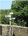
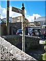
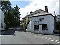
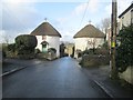
Nearby Images from Geograph Britain and Ireland:
©2012(licence)
©2019(licence)
©2009(licence)
©2017(licence)
©2012(licence)
The above images may not be of the site on this page, they are loaded from Geograph.
Please Submit an Image of this site or go out and take one for us!
Click here to see more info for this site
Nearby sites
Key: Red: member's photo, Blue: 3rd party photo, Yellow: other image, Green: no photo - please go there and take one, Grey: site destroyed
Download sites to:
KML (Google Earth)
GPX (GPS waypoints)
CSV (Garmin/Navman)
CSV (Excel)
To unlock full downloads you need to sign up as a Contributory Member. Otherwise downloads are limited to 50 sites.
Turn off the page maps and other distractions
Nearby sites listing. In the following links * = Image available
976m SSW 197° Veryan Barrow* Chambered Tomb (SW9126338647)
1.0km SW 219° Veryan castle* Ancient Village or Settlement (SW909388)
3.3km NW 317° St Ruan's Well (Ruan Lanihorne)* Holy Well or Sacred Spring (SW894421)
4.0km WSW 237° Dingerein Castle* Ancient Village or Settlement (SW88183752)
5.6km N 10° St Cuby's Well (Tregony)* Holy Well or Sacred Spring (SW928450)
6.2km SW 222° St Gerrans church cross* Ancient Cross (SW8727535158)
6.3km ENE 73° Standing Stone to the East of Porthluney Bay* Standing Stone (Menhir) (SW97654114)
7.1km W 269° Tolverne Holy Well or Sacred Spring (SW845397)
7.2km SW 235° Ventongassick* Holy Well or Sacred Spring (SW8546035685)
7.3km N 5° Golden Camp* Hillfort (SW92454685)
7.6km WNW 302° St Clement's Well* Holy Well or Sacred Spring (SW853438)
7.7km WSW 238° St Just's Well* Holy Well or Sacred Spring (SW849358)
7.7km NNW 334° Trelowthas Cross* Ancient Cross (SW885466)
7.7km WNW 297° Malpas Tumulus* Round Barrow(s) (SW848433)
7.8km WNW 302° Ignioc Stone* Ancient Cross (SW851439)
7.8km W 274° Round Wood* Promontory Fort / Cliff Castle (SW83754038)
8.5km E 89° Dodman Point* Promontory Fort / Cliff Castle (SX00143932)
8.7km N 359° Carvossa* Ancient Village or Settlement (SW918483)
9.1km W 260° Feock Church Cross* Ancient Cross (SW8248038417)
9.3km W 262° Feock Holy Well* Holy Well or Sacred Spring (SW8229038664)
9.4km SW 224° St Mawe's Well* Holy Well or Sacred Spring (SW8470833103)
9.6km SW 217° St Anthony's Well (St Anthony Head) Holy Well or Sacred Spring (SW855321)
9.9km N 11° St Naunter's Holy Well Remnant.* Holy Well or Sacred Spring (SW938492)
9.9km N 350° Ventonglidder Holy Well or Sacred Spring (SW9015149402)
10.0km NW 307° Truro Eastern District Centre Neolithic Enclosure* Causewayed Enclosure (SW838459)
View more nearby sites and additional images


 We would like to know more about this location. Please feel free to add a brief description and any relevant information in your own language.
 Wir möchten mehr über diese Stätte erfahren. Bitte zögern Sie nicht, eine kurze Beschreibung und relevante Informationen in Deutsch hinzuzufügen.
 Nous aimerions en savoir encore un peu sur les lieux. S'il vous plaît n'hesitez pas à ajouter une courte description et tous les renseignements pertinents dans votre propre langue.
 Quisieramos informarnos un poco más de las lugares. No dude en añadir una breve descripción y otros datos relevantes en su propio idioma.