<< Text Pages >> Dail Langwell - Broch or Nuraghe in Scotland in Sutherland
Submitted by coldrum on Friday, 02 October 2009 Page Views: 2602
Iron Age and Later PrehistorySite Name: Dail LangwellCountry: Scotland
NOTE: This site is 6.043 km away from the location you searched for.
County: Sutherland Type: Broch or Nuraghe
Map Ref: NC41161121
Latitude: 58.061430N Longitude: 4.693882W
Condition:
| 5 | Perfect |
| 4 | Almost Perfect |
| 3 | Reasonable but with some damage |
| 2 | Ruined but still recognisable as an ancient site |
| 1 | Pretty much destroyed, possibly visible as crop marks |
| 0 | No data. |
| -1 | Completely destroyed |
| 5 | Superb |
| 4 | Good |
| 3 | Ordinary |
| 2 | Not Good |
| 1 | Awful |
| 0 | No data. |
| 5 | Can be driven to, probably with disabled access |
| 4 | Short walk on a footpath |
| 3 | Requiring a bit more of a walk |
| 2 | A long walk |
| 1 | In the middle of nowhere, a nightmare to find |
| 0 | No data. |
| 5 | co-ordinates taken by GPS or official recorded co-ordinates |
| 4 | co-ordinates scaled from a detailed map |
| 3 | co-ordinates scaled from a bad map |
| 2 | co-ordinates of the nearest village |
| 1 | co-ordinates of the nearest town |
| 0 | no data |
Be the first person to rate this site - see the 'Contribute!' box in the right hand menu.
Internal Links:
External Links:
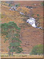
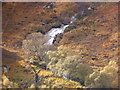
Broch in Sutherland
The remains of a broch set on the slope of the hill. It stands to a height of 3.5m on the NW and has an overall diameter of 17.8m.
Canmore
You may be viewing yesterday's version of this page. To see the most up to date information please register for a free account.
Do not use the above information on other web sites or publications without permission of the contributor.
Nearby Images from Geograph Britain and Ireland:
©2011(licence)
©2011(licence)
©2010(licence)

©2010(licence)
©2005(licence)
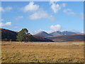
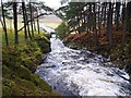
The above images may not be of the site on this page, they are loaded from Geograph.
Please Submit an Image of this site or go out and take one for us!
Click here to see more info for this site
Nearby sites
Key: Red: member's photo, Blue: 3rd party photo, Yellow: other image, Green: no photo - please go there and take one, Grey: site destroyed
Download sites to:
KML (Google Earth)
GPX (GPS waypoints)
CSV (Garmin/Navman)
CSV (Excel)
To unlock full downloads you need to sign up as a Contributory Member. Otherwise downloads are limited to 50 sites.
Turn off the page maps and other distractions
Nearby sites listing. In the following links * = Image available
10.1km S 175° Langwell Farm Cairn (NC416011)
10.3km S 177° Torr Chorcain Vitrified Fort (NC412009)
11.3km WSW 251° Cnoc Chaornaidh South-east* Chambered Cairn (NC30320793)
11.4km WSW 252° Cnoc Chaornaidh Central* Cairn (NC30170818)
11.6km WSW 254° Cnoc Chaornaidh North West* Chambered Cairn (NC299084)
12.2km ENE 68° Shinness* Broch or Nuraghe (NC52731526)
12.6km SE 132° Durcha Broch or Nuraghe (NC50170239)
13.8km E 96° Sallachadh Broch* Broch or Nuraghe (NC549092)
14.3km SE 144° Carn Mor 2 Broch or Nuraghe (NH49039926)
14.6km W 267° Altnacealgach* Chambered Cairn (NC2652811033)
14.9km W 268° Loch Borralan East* Chambered Cairn (NC26241118)
15.1km W 267° Loch Borralan West* Chambered Cairn (NC2603811142)
15.4km W 268° Loch Borralan Crannog* Crannog (NC25741138)
15.4km WNW 290° Allt nan Uamh Bone Caves* Cave or Rock Shelter (NC268170)
15.6km SE 142° Carn Mor 3 Broch or Nuraghe (NH50399853)
16.5km W 278° Ledbeg River* Chambered Cairn (NC24891411)
16.6km ESE 103° Ferry Wood* Broch or Nuraghe (NC57190679)
16.8km ESE 117° Druim Baile Fuir West Ancient Village or Settlement (NC55780289)
17.0km ESE 117° Achany Stone Circle* Stone Circle (NC560029)
17.0km ESE 117° Druim Baile Fuir North Cairn (NC56030292)
17.0km ESE 116° Gruids Wood Cairn (NC56200307)
17.3km E 96° Savalmore Burnt Mound Artificial Mound (NC58350881)
17.3km W 271° Ledmore* Chambered Cairn (NC23821215)
17.5km ESE 108° The Ord* Ancient Village or Settlement (NC577052)
17.7km W 274° Cam Loch A Cairn (NC23501312)
View more nearby sites and additional images


 We would like to know more about this location. Please feel free to add a brief description and any relevant information in your own language.
 Wir möchten mehr über diese Stätte erfahren. Bitte zögern Sie nicht, eine kurze Beschreibung und relevante Informationen in Deutsch hinzuzufügen.
 Nous aimerions en savoir encore un peu sur les lieux. S'il vous plaît n'hesitez pas à ajouter une courte description et tous les renseignements pertinents dans votre propre langue.
 Quisieramos informarnos un poco más de las lugares. No dude en añadir una breve descripción y otros datos relevantes en su propio idioma.