<< Our Photo Pages >> Priest's Well (Strathfillan) - Holy Well or Sacred Spring in Scotland in Stirling
Submitted by KiwiBetsy on Tuesday, 12 September 2006 Page Views: 8834
Springs and Holy WellsSite Name: Priest's Well (Strathfillan)Country: Scotland County: Stirling Type: Holy Well or Sacred Spring
Nearest Town: Tyndrum
Map Ref: NN36022845
Latitude: 56.419698N Longitude: 4.66001W
Condition:
| 5 | Perfect |
| 4 | Almost Perfect |
| 3 | Reasonable but with some damage |
| 2 | Ruined but still recognisable as an ancient site |
| 1 | Pretty much destroyed, possibly visible as crop marks |
| 0 | No data. |
| -1 | Completely destroyed |
| 5 | Superb |
| 4 | Good |
| 3 | Ordinary |
| 2 | Not Good |
| 1 | Awful |
| 0 | No data. |
| 5 | Can be driven to, probably with disabled access |
| 4 | Short walk on a footpath |
| 3 | Requiring a bit more of a walk |
| 2 | A long walk |
| 1 | In the middle of nowhere, a nightmare to find |
| 0 | No data. |
| 5 | co-ordinates taken by GPS or official recorded co-ordinates |
| 4 | co-ordinates scaled from a detailed map |
| 3 | co-ordinates scaled from a bad map |
| 2 | co-ordinates of the nearest village |
| 1 | co-ordinates of the nearest town |
| 0 | no data |
Internal Links:
External Links:
 (PID:24068)")
To request a healing, pilgrims looking for mental health were required to walk around the well three times and then throw in a pebble. Maybe they tried this more gentle approach before resorting to the nearby St Fillan’s Holy Pool for cure.
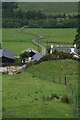
St Fillan built a priory on land that today is part of Kirkton Farm in Auchtertyre near Tyndrum. A burn runs down the valley behind the present Kirkton Farmhouse and near the burn is Priest’s Well. This well was the original water supply to the priory and is said to have been blessed by St Fillan but does not appear to have been dedicated to him. There is record of a site nearer the house which is now completely gone having also been called Priest’s Well. The botanist on hand the day we visited in June 2006 was helpful and knowledgeable about the properties history and took us to the well.
There are two wells recorded near this location. See Canmore ID 23863 for Priest's Well (Strathfillan) at NN 3604 2859 and Canmore ID 23844 which is for a cairn, 90 metres away, now know nto be a natural feature at NN 360 286.
Priests Holy Well is described as "a spring with carefully built stonework showing signs of great age. This is the old water supply to St. Fillan's Priory." The 1962 entry says that "according to the farmer Priest's Well is some 150m higher up the burn .... which of the two represent the Priest's Well could not be ascertained."
You may be viewing yesterday's version of this page. To see the most up to date information please register for a free account.
Do not use the above information on other web sites or publications without permission of the contributor.
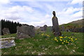
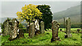
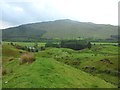
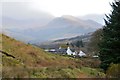
Nearby Images from Geograph Britain and Ireland:
©2016(licence)
©2023(licence)
©2015(licence)
©2018(licence)
©2007(licence)
The above images may not be of the site on this page, they are loaded from Geograph.
Please Submit an Image of this site or go out and take one for us!
Click here to see more info for this site
Nearby sites
Key: Red: member's photo, Blue: 3rd party photo, Yellow: other image, Green: no photo - please go there and take one, Grey: site destroyed
Download sites to:
KML (Google Earth)
GPX (GPS waypoints)
CSV (Garmin/Navman)
CSV (Excel)
To unlock full downloads you need to sign up as a Contributory Member. Otherwise downloads are limited to 50 sites.
Turn off the page maps and other distractions
Nearby sites listing. In the following links * = Image available
620m W 272° Auchtertyre Cairn (NN354285)
1.0km WNW 287° St Fillan's Holy Pool* Holy Well or Sacred Spring (NN35032880)
10.9km SSW 202° Inverarnon Stone Circle (NN316185)
12.1km NE 50° Tomochrocher (Glen Lochay) Rock Art (NN4566735827)
14.4km N 6° Tigh Nam Bodach Modern Stone Circle etc (NN38054271)
15.7km N 11° MacRee's Cairn (Glen Meurain) Cairn (NN39594375)
16.2km ESE 122° Bealach Driseach* Modern Stone Circle etc (NN49511940)
17.8km NE 55° Allt Ghaordaidh Standing Stone (Menhir) (NN51013807)
18.0km NE 41° Bhacain* Standing Stone (Menhir) (NN4829041678)
18.1km ENE 65° Corrycharmaig 3 (Glen Lochay) Rock Art (NN52783549)
18.3km ENE 61° East Tullich Enclosure (Glen Lochay) Ancient Village or Settlement (NN52363685)
18.4km ENE 64° Corrycharmaig East 2 (Glen Lochay) Rock Art (NN52943588)
18.5km ENE 57° Caisteal Samhraidh (Killin) Standing Stone (Menhir) (NN519380)
18.5km ENE 63° Tullich Rock Art Rock Art (NN52813634)
18.5km ENE 64° Corrycharmaig East 3 (Glen Lochay) Rock Art (NN5305635877)
18.5km ENE 64° Corrycharmaig East 4 (Glen Lochay) Rock Art (NN53103582)
18.6km NE 42° Caisteal Mhic Neill (Cashlie) Ancient Village or Settlement (NN49024178)
18.6km ENE 64° Duncroisk 2 (Glen Lochay) Rock Art (NN53133584)
18.7km ENE 65° Duncroisk* Rock Art (NN53223582)
18.8km ENE 63° Duncroisk 1 (Glen Lochay) Rock Art (NN53113640)
18.9km ENE 69° Murlaganmore 2 (Killin) Rock Art (NN53953455)
18.9km ENE 62° Tirai* Standing Stone (Menhir) (NN53083670)
18.9km ENE 63° Duncroisk Crosses Ancient Cross (NN53253641)
18.9km ENE 69° Murlaganmore (Killin) Rock Art (NN54023455)
19.1km E 84° Mid Lix (Killin) Rock Art (NN55132987)
View more nearby sites and additional images


 We would like to know more about this location. Please feel free to add a brief description and any relevant information in your own language.
 Wir möchten mehr über diese Stätte erfahren. Bitte zögern Sie nicht, eine kurze Beschreibung und relevante Informationen in Deutsch hinzuzufügen.
 Nous aimerions en savoir encore un peu sur les lieux. S'il vous plaît n'hesitez pas à ajouter une courte description et tous les renseignements pertinents dans votre propre langue.
 Quisieramos informarnos un poco más de las lugares. No dude en añadir una breve descripción y otros datos relevantes en su propio idioma.