<< Text Pages >> Bury Down Fort - Hillfort in England in Cornwall
Submitted by Andy B on Monday, 23 February 2004 Page Views: 6518
Iron Age and Later PrehistorySite Name: Bury Down FortCountry: England
NOTE: This site is 2.353 km away from the location you searched for.
County: Cornwall Type: Hillfort
Map Ref: SX251859 Landranger Map Number: 201
Latitude: 50.646467N Longitude: 4.475221W
Condition:
| 5 | Perfect |
| 4 | Almost Perfect |
| 3 | Reasonable but with some damage |
| 2 | Ruined but still recognisable as an ancient site |
| 1 | Pretty much destroyed, possibly visible as crop marks |
| 0 | No data. |
| -1 | Completely destroyed |
| 5 | Superb |
| 4 | Good |
| 3 | Ordinary |
| 2 | Not Good |
| 1 | Awful |
| 0 | No data. |
| 5 | Can be driven to, probably with disabled access |
| 4 | Short walk on a footpath |
| 3 | Requiring a bit more of a walk |
| 2 | A long walk |
| 1 | In the middle of nowhere, a nightmare to find |
| 0 | No data. |
| 5 | co-ordinates taken by GPS or official recorded co-ordinates |
| 4 | co-ordinates scaled from a detailed map |
| 3 | co-ordinates scaled from a bad map |
| 2 | co-ordinates of the nearest village |
| 1 | co-ordinates of the nearest town |
| 0 | no data |
Be the first person to rate this site - see the 'Contribute!' box in the right hand menu.
Internal Links:
External Links:
Hillfort in Cornwall
SX25188596
You may be viewing yesterday's version of this page. To see the most up to date information please register for a free account.
Do not use the above information on other web sites or publications without permission of the contributor.
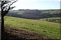
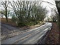
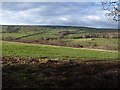
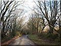
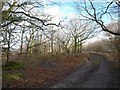
Nearby Images from Geograph Britain and Ireland:
©2008(licence)
©2008(licence)
©2008(licence)
©2008(licence)
©2008(licence)
The above images may not be of the site on this page, they are loaded from Geograph.
Please Submit an Image of this site or go out and take one for us!
Click here to see more info for this site
Nearby sites
Key: Red: member's photo, Blue: 3rd party photo, Yellow: other image, Green: no photo - please go there and take one, Grey: site destroyed
Download sites to:
KML (Google Earth)
GPX (GPS waypoints)
CSV (Garmin/Navman)
CSV (Excel)
To unlock full downloads you need to sign up as a Contributory Member. Otherwise downloads are limited to 50 sites.
![]()
Turn off the page maps and other distractions
Nearby sites listing. In the following links * = Image available
2.2km ENE 72° Egloskerry* Holy Well or Sacred Spring (SX272865)
2.9km SW 227° Laneast* Ancient Cross (SX229840)
3.0km SW 226° Jordan's Well* Holy Well or Sacred Spring (SX229839)
4.2km SSE 147° Polyphant Cross* Ancient Cross (SX2727882324)
4.9km WSW 248° St Clether Crosses* Ancient Cross (SX205842)
4.9km WSW 254° St Clether's Well* Holy Well or Sacred Spring (SX203847)
5.0km NE 35° St Paternus's Well* Holy Well or Sacred Spring (SX2813889895)
5.0km SSW 212° Altarnun Cross B* Ancient Cross (SX22318170)
5.1km SSW 209° St Nonna's Well* Holy Well or Sacred Spring (SX2243981533)
5.1km W 277° Tregulland Barrow Cup Marks (Trenglos) Rock Art (SX20018674)
5.4km SSW 209° Altarnun Cross* Ancient Cross (SX223813)
5.7km SSE 154° Blaunder's Well* Holy Well or Sacred Spring (SX274807)
5.7km SSE 153° Lewannick* Sculptured Stone (SX275807)
6.5km WSW 251° Tregonger Crossroads Cross* Ancient Cross (SX189840)
6.8km WSW 239° Bray Down camp* Ancient Village or Settlement (SX191826)
6.9km E 90° St Stephen's Well* Holy Well or Sacred Spring (SX320857)
6.9km NW 313° Warbstow Bury* Hillfort (SX20149075)
7.0km S 183° Upton Castle* Artificial Mound (SX2454178961)
7.0km SW 222° Westmoorgate cairn* Cairn (SX2020680866)
7.1km SW 221° Westmoorgate circle* Stone Circle (SX20258073)
7.1km SW 225° West Moor Possible Menhir* Standing Stone (Menhir) (SX1987081077)
7.2km SSW 196° Tregune Menhir* Standing Stone (Menhir) (SX2286379095)
7.2km WNW 293° Wilsey Down Tumuli* Barrow Cemetery (SX18608896)
7.2km WSW 237° Bray Down Cairns* Cairn (SX18908216)
7.4km SSW 209° Spettigue Menhir* Standing Stone (Menhir) (SX21307952)
View more nearby sites and additional images


 We would like to know more about this location. Please feel free to add a brief description and any relevant information in your own language.
 Wir möchten mehr über diese Stätte erfahren. Bitte zögern Sie nicht, eine kurze Beschreibung und relevante Informationen in Deutsch hinzuzufügen.
 Nous aimerions en savoir encore un peu sur les lieux. S'il vous plaît n'hesitez pas à ajouter une courte description et tous les renseignements pertinents dans votre propre langue.
 Quisieramos informarnos un poco más de las lugares. No dude en añadir una breve descripción y otros datos relevantes en su propio idioma.