<< Text Pages >> Craigie Hill Fort - Hillfort in Scotland in South Ayrshire
Submitted by AstroGeologist on Sunday, 19 May 2019 Page Views: 1631
Iron Age and Later PrehistorySite Name: Craigie Hill Fort Alternative Name: Craigie Hill DunCountry: Scotland
NOTE: This site is 4.951 km away from the location you searched for.
County: South Ayrshire Type: Hillfort
Nearest Town: Kilmarnock Nearest Village: Craigie
Map Ref: NS42243276
Latitude: 55.562913N Longitude: 4.503124W
Condition:
| 5 | Perfect |
| 4 | Almost Perfect |
| 3 | Reasonable but with some damage |
| 2 | Ruined but still recognisable as an ancient site |
| 1 | Pretty much destroyed, possibly visible as crop marks |
| 0 | No data. |
| -1 | Completely destroyed |
| 5 | Superb |
| 4 | Good |
| 3 | Ordinary |
| 2 | Not Good |
| 1 | Awful |
| 0 | No data. |
| 5 | Can be driven to, probably with disabled access |
| 4 | Short walk on a footpath |
| 3 | Requiring a bit more of a walk |
| 2 | A long walk |
| 1 | In the middle of nowhere, a nightmare to find |
| 0 | No data. |
| 5 | co-ordinates taken by GPS or official recorded co-ordinates |
| 4 | co-ordinates scaled from a detailed map |
| 3 | co-ordinates scaled from a bad map |
| 2 | co-ordinates of the nearest village |
| 1 | co-ordinates of the nearest town |
| 0 | no data |
Internal Links:
External Links:
Destroyed Hillfort in South Ayrshire
Craigie Hill Fort was located on the rounded summit of Craigie Hill in the Ayrshire countryside.
It was situated over 152m above sea level, and had an oval shape to it, with an approx NE~SW alignment, measuring approx 80m x 70m.
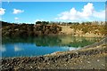
It was only recognized as a HillFort in 1953 after the site was turned into a quarry, back then a single rampart was still visible - formed by a stony scarp 1.8m high. This was best preserved around the Western half of the circuit, on the SW perimeter. No trace of the rampart survived on the SE, or the NE, which was already being quarried.
By 1982 a large Southerly extension of Craigiehill Quarry had destroyed all traces of the HillFort.
It was located just over 1/2km away from Craigie Dun.
For more information : Canmore ID 42869
You may be viewing yesterday's version of this page. To see the most up to date information please register for a free account.
Do not use the above information on other web sites or publications without permission of the contributor.
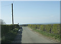
Nearby Images from Geograph Britain and Ireland:
©2017(licence)
©2021(licence)
©2011(licence)
©2011(licence)
©2019(licence)
The above images may not be of the site on this page, they are loaded from Geograph.
Please Submit an Image of this site or go out and take one for us!
Click here to see more info for this site
Nearby sites
Key: Red: member's photo, Blue: 3rd party photo, Yellow: other image, Green: no photo - please go there and take one, Grey: site destroyed
Download sites to:
KML (Google Earth)
GPX (GPS waypoints)
CSV (Garmin/Navman)
CSV (Excel)
To unlock full downloads you need to sign up as a Contributory Member. Otherwise downloads are limited to 50 sites.
Turn off the page maps and other distractions
Nearby sites listing. In the following links * = Image available
550m E 92° Craigie Broch Broch or Nuraghe (NS42793272)
600m ESE 109° Craigie Dun Hillfort (NS42803254)
628m SE 134° Witches Stane (Craigie) Natural Stone / Erratic / Other Natural Feature (NS42683231)
4.3km ESE 123° Loch Lee Crannog* Crannog (NS45753027)
5.8km S 170° Tarbolton Cist* Cist (NS4327)
6.1km WNW 285° Dun Donald Hillfort (NS36363451)
6.2km W 266° Harpercroft Hillfort Hillfort (NS36003252)
6.3km W 268° Wardlaw Hill Fort Hillfort (NS35923276)
6.7km W 275° Kemp Law* Stone Fort or Dun (NS35583364)
7.0km SSE 157° Tarbolton Tumulus Cairn (NS4469926247)
7.0km SSE 157° Coilsfield (Tarbolton) Rock Art (NS44692624)
7.3km WNW 298° Drybridge* Standing Stone (Menhir) (NS35923644)
7.6km WNW 301° Dundonald Cursus Cursus (NS35893690)
7.6km WNW 301° Drybridge Neolithic Village Ancient Village or Settlement (NS3582336852)
8.1km SW 230° The Muckle Stane (Monkton)* Natural Stone / Erratic / Other Natural Feature (NS3578027790)
9.0km NW 306° Dreghorn Neolithic Village Ancient Village or Settlement (NS35183830)
10.1km ENE 63° Molmont Stone Circle (NS514371)
10.8km N 354° Buiston Crannog* Crannog (NS41554352)
11.0km SW 221° Bruce's Well (Prestwick)* Holy Well or Sacred Spring (NS3467624801)
11.0km NW 315° Lawthorn Mount Barrow Cemetery (NS34654078)
11.0km WNW 290° Shewalton Moor Ancient Village or Settlement (NS320370)
11.2km ENE 74° Gallow Law (Hillend) Cairn (NS5313535382)
11.4km SE 127° Ballochmyle* Rock Art (NS5111725565)
11.8km WNW 298° Grannie Stane* Natural Stone / Erratic / Other Natural Feature (NS3196038711)
12.0km NW 315° Sourlie Hill Modern Stone Circle etc (NS3398041490)
View more nearby sites and additional images


 We would like to know more about this location. Please feel free to add a brief description and any relevant information in your own language.
 Wir möchten mehr über diese Stätte erfahren. Bitte zögern Sie nicht, eine kurze Beschreibung und relevante Informationen in Deutsch hinzuzufügen.
 Nous aimerions en savoir encore un peu sur les lieux. S'il vous plaît n'hesitez pas à ajouter une courte description et tous les renseignements pertinents dans votre propre langue.
 Quisieramos informarnos un poco más de las lugares. No dude en añadir una breve descripción y otros datos relevantes en su propio idioma.