<< Text Pages >> Grianan Cup and Ring marked Stone - Rock Art in Scotland in Highlands
Submitted by Klingon on Sunday, 11 September 2005 Page Views: 4898
Rock ArtSite Name: Grianan Cup and Ring marked Stone Alternative Name: Lochan HakelCountry: Scotland
NOTE: This site is 4.055 km away from the location you searched for.
County: Highlands Type: Rock Art
Nearest Town: Tongue Nearest Village: Kinloch
Map Ref: NC56935262
Latitude: 58.438384N Longitude: 4.452426W
Condition:
| 5 | Perfect |
| 4 | Almost Perfect |
| 3 | Reasonable but with some damage |
| 2 | Ruined but still recognisable as an ancient site |
| 1 | Pretty much destroyed, possibly visible as crop marks |
| 0 | No data. |
| -1 | Completely destroyed |
| 5 | Superb |
| 4 | Good |
| 3 | Ordinary |
| 2 | Not Good |
| 1 | Awful |
| 0 | No data. |
| 5 | Can be driven to, probably with disabled access |
| 4 | Short walk on a footpath |
| 3 | Requiring a bit more of a walk |
| 2 | A long walk |
| 1 | In the middle of nowhere, a nightmare to find |
| 0 | No data. |
| 5 | co-ordinates taken by GPS or official recorded co-ordinates |
| 4 | co-ordinates scaled from a detailed map |
| 3 | co-ordinates scaled from a bad map |
| 2 | co-ordinates of the nearest village |
| 1 | co-ordinates of the nearest town |
| 0 | no data |
Be the first person to rate this site - see the 'Contribute!' box in the right hand menu.
Internal Links:
External Links:
Cup and Ring marks / Rock Art in Highlands
Canmore site no. 5375.
You may be viewing yesterday's version of this page. To see the most up to date information please register for a free account.
Do not use the above information on other web sites or publications without permission of the contributor.
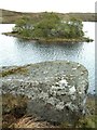
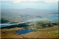
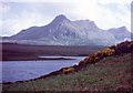
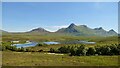
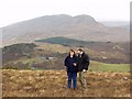
Nearby Images from Geograph Britain and Ireland:
©2005(licence)
©2022(licence)
©2008(licence)
©2021(licence)
©2005(licence)
The above images may not be of the site on this page, they are loaded from Geograph.
Please Submit an Image of this site or go out and take one for us!
Click here to see more info for this site
Nearby sites
Key: Red: member's photo, Blue: 3rd party photo, Yellow: other image, Green: no photo - please go there and take one, Grey: site destroyed
Download sites to:
KML (Google Earth)
GPX (GPS waypoints)
CSV (Garmin/Navman)
CSV (Excel)
To unlock full downloads you need to sign up as a Contributory Member. Otherwise downloads are limited to 50 sites.
Turn off the page maps and other distractions
Nearby sites listing. In the following links * = Image available
730m W 278° Kinloch Lodge Carved Stone Sculptured Stone (NC5620952749)
734m W 275° Kinloch Cup marked Stone* Rock Art (NC5619952707)
1.8km WNW 281° Dun Mhaigh* Broch or Nuraghe (NC55225303)
2.0km W 268° Kinloch Chambered Cairn Chambered Cairn (NC54975262)
8.0km NE 38° Dallcharn Broch or Nuraghe (NC62105875)
9.5km NNE 26° Scullomie Broch or Nuraghe (NC615610)
10.3km WNW 287° Creagan na Speireig Cairn (NC47205603)
10.9km WNW 296° Lochside Cairn Cairn (NC47265772)
11.0km NE 54° Borgie Stone Rows* Multiple Stone Rows / Avenue (NC66135874)
11.4km N 356° West Strathan* Broch or Nuraghe (NC56456401)
11.4km WNW 296° Arnaboll Cairn Cairn (NC46875806)
11.5km N 355° West Strathan Carving (Melness) Rock Art (NC5642864084)
11.8km WNW 300° Arnaboll Hut Circle (1) Cairn (NC46915893)
11.9km WNW 301° Arnaboll Hut Circle (2) Cairn (NC46895903)
12.6km NE 56° Borgie Souterrain* Souterrain (Fogou, Earth House) (NC67625929)
12.6km NW 308° Weirs Hut Circle (1) Cairn (NC47276079)
12.8km NW 309° Weirs Hut Circle (2) Cairn (NC47236104)
13.4km WNW 303° Heilam Hut Circle (1) Cairn (NC45916026)
13.4km WNW 291° Camus An Duin Broch or Nuraghe (NC44595797)
13.4km WNW 303° Heilam Hut Circle (2) Cairn (NC45896036)
13.5km NW 304° Heilam Broch* Broch or Nuraghe (NC46026056)
13.5km SW 234° Dun Dornaigil* Broch or Nuraghe (NC457450)
13.6km WNW 303° Heilam Hut Circle (3) Cairn (NC45876052)
13.9km WNW 302° Heilam Hut Circle (4) Cairn (NC45426042)
14.2km NE 47° Torrisdail Broch or Nuraghe (NC67736185)
View more nearby sites and additional images


 We would like to know more about this location. Please feel free to add a brief description and any relevant information in your own language.
 Wir möchten mehr über diese Stätte erfahren. Bitte zögern Sie nicht, eine kurze Beschreibung und relevante Informationen in Deutsch hinzuzufügen.
 Nous aimerions en savoir encore un peu sur les lieux. S'il vous plaît n'hesitez pas à ajouter une courte description et tous les renseignements pertinents dans votre propre langue.
 Quisieramos informarnos un poco más de las lugares. No dude en añadir una breve descripción y otros datos relevantes en su propio idioma.