<< Text Pages >> Ty-Mathiau - Stone Row / Alignment in Wales in Carmarthenshire
Submitted by Anne T on Saturday, 07 May 2016 Page Views: 1322
Neolithic and Bronze AgeSite Name: Ty-MathiauCountry: Wales
NOTE: This site is 2.224 km away from the location you searched for.
County: Carmarthenshire Type: Stone Row / Alignment
Map Ref: SN35483452
Latitude: 51.984708N Longitude: 4.397177W
Condition:
| 5 | Perfect |
| 4 | Almost Perfect |
| 3 | Reasonable but with some damage |
| 2 | Ruined but still recognisable as an ancient site |
| 1 | Pretty much destroyed, possibly visible as crop marks |
| 0 | No data. |
| -1 | Completely destroyed |
| 5 | Superb |
| 4 | Good |
| 3 | Ordinary |
| 2 | Not Good |
| 1 | Awful |
| 0 | No data. |
| 5 | Can be driven to, probably with disabled access |
| 4 | Short walk on a footpath |
| 3 | Requiring a bit more of a walk |
| 2 | A long walk |
| 1 | In the middle of nowhere, a nightmare to find |
| 0 | No data. |
| 5 | co-ordinates taken by GPS or official recorded co-ordinates |
| 4 | co-ordinates scaled from a detailed map |
| 3 | co-ordinates scaled from a bad map |
| 2 | co-ordinates of the nearest village |
| 1 | co-ordinates of the nearest town |
| 0 | no data |
Be the first person to rate this site - see the 'Contribute!' box in the right hand menu.
Internal Links:
External Links:
Stone Row / Alignment in Carmarthenshire
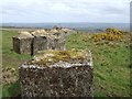
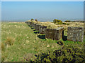
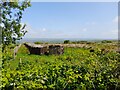
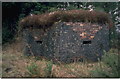
Ty-Mathiau Stone Row consists of at least three stones covering a distance of 75 metres aligned north-east to south-west. The stones are separated by a modern road.
The Coflein record for Ty-Mathiau NPRN 412091 tells us that this stone alignment lies to the north east of Bwlchclawdd, although the grid reference puts the site to the south-west.
The Archwilio record PRN 42512 says this Bronze Age Stone Row lies c. 275 metres south east of Ty-Matiau farm (which agrees with UK Grid Finder).
The size of stones is unknown, although the orientation is 45 degrees and the site is at an altitude of 269 metres. The stone row is associated with cairns in the surrounding landscape.
Note: Have you visited this site? Are you able to provide further information? Do you have a photograph you can contribute?
You may be viewing yesterday's version of this page. To see the most up to date information please register for a free account.
Do not use the above information on other web sites or publications without permission of the contributor.
Nearby Images from Geograph Britain and Ireland:
©2008(licence)
©2009(licence)
©2023(licence)
©2005(licence)
©2010(licence)
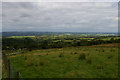
The above images may not be of the site on this page, they are loaded from Geograph.
Please Submit an Image of this site or go out and take one for us!
Click here to see more info for this site
Nearby sites
Key: Red: member's photo, Blue: 3rd party photo, Yellow: other image, Green: no photo - please go there and take one, Grey: site destroyed
Download sites to:
KML (Google Earth)
GPX (GPS waypoints)
CSV (Garmin/Navman)
CSV (Excel)
To unlock full downloads you need to sign up as a Contributory Member. Otherwise downloads are limited to 50 sites.
![]()
Turn off the page maps and other distractions
Nearby sites listing. In the following links * = Image available
2.5km ESE 116° Clawdd Mawr* Misc. Earthwork (SN37743335)
2.7km SE 133° Cerrig Llwydion (Carms)* Chambered Tomb (SN374326)
3.8km ESE 104° Crug-Glas Round Barrow(s) (SN39113349)
4.0km E 101° Crug-Bach Barrow (Rhos) Round Barrow(s) (SN39393363)
4.4km E 95° Carreg Wen Standing Stone Standing Stone (Menhir) (SN399340)
4.4km E 95° Carn-Wen Round Barrow(s) (SN39903397)
5.1km SE 125° Crug Bach* Round Barrow(s) (SN39603147)
5.2km E 98° Gareg Hir* Standing Stone (Menhir) (SN40603367)
5.2km ESE 117° Crug Gwyn* Cairn (SN40063204)
5.3km NNE 23° Ffynnon Geler (Llangeler)* Holy Well or Sacred Spring (SN377393)
5.3km SW 230° Crugievan* Round Barrow(s) (SN3124931238)
5.4km ESE 108° Crugiau Fach* Barrow Cemetery (SN40543270)
5.5km ESE 104° Crug Gilfach Fach Round Barrow(s) (SN40783299)
5.6km NE 52° Aelybryn* Standing Stone (Menhir) (SN40053785)
5.6km ENE 72° Blaennantrhys Cairn 1* Cairn (SN40933607)
5.7km ENE 72° Blaennantrhys Cairn 2 Ring Cairn (SN40943607)
5.7km ENE 72° Cross Hands (Hebron)* Standing Stone (Menhir) (SN410361)
5.8km WNW 286° Ban-Y-Felin Burnt Mound Misc. Earthwork (SN29963633)
5.8km ENE 74° Blaennantrhys Cairn 3* Cairn (SN41123592)
6.0km ENE 74° Yr Hen Llech Chambered Tomb (SN413360)
6.3km NE 47° Ffynnon Fair (Carmarthenshire) Holy Well or Sacred Spring (SN40263864)
6.5km WSW 239° Crug Glas Cairn* Cairn (SN298314)
6.6km N 355° Felin Cwrws Hillfort (SN351411)
7.2km W 268° Hen Caerau Misc. Earthwork (SN283345)
7.5km NE 46° Cross Hands (Hebron)* Barrow Cemetery (SN411395)
View more nearby sites and additional images


 We would like to know more about this location. Please feel free to add a brief description and any relevant information in your own language.
 Wir möchten mehr über diese Stätte erfahren. Bitte zögern Sie nicht, eine kurze Beschreibung und relevante Informationen in Deutsch hinzuzufügen.
 Nous aimerions en savoir encore un peu sur les lieux. S'il vous plaît n'hesitez pas à ajouter une courte description et tous les renseignements pertinents dans votre propre langue.
 Quisieramos informarnos un poco más de las lugares. No dude en añadir una breve descripción y otros datos relevantes en su propio idioma.