 with our Megalithic Portal iPhone app")


<< Other Photo Pages >> Ffynnon Dewi (Plwmp) - Holy Well or Sacred Spring in Wales in Ceredigion
Submitted by geoffstickland on Monday, 19 January 2009 Page Views: 4603
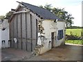
Springs and Holy WellsSite Name: Ffynnon Dewi (Plwmp) Alternative Name: Ffynnon DdewiCountry: Wales
NOTE: This site is 0.792 km away from the location you searched for.
County: Ceredigion Type: Holy Well or Sacred Spring
Nearest Village: Plwmp
Map Ref: SN3854452988
Latitude: 52.151505N Longitude: 4.361339W
Condition:
| 5 | Perfect |
| 4 | Almost Perfect |
| 3 | Reasonable but with some damage |
| 2 | Ruined but still recognisable as an ancient site |
| 1 | Pretty much destroyed, possibly visible as crop marks |
| 0 | No data. |
| -1 | Completely destroyed |
| 5 | Superb |
| 4 | Good |
| 3 | Ordinary |
| 2 | Not Good |
| 1 | Awful |
| 0 | No data. |
| 5 | Can be driven to, probably with disabled access |
| 4 | Short walk on a footpath |
| 3 | Requiring a bit more of a walk |
| 2 | A long walk |
| 1 | In the middle of nowhere, a nightmare to find |
| 0 | No data. |
| 5 | co-ordinates taken by GPS or official recorded co-ordinates |
| 4 | co-ordinates scaled from a detailed map |
| 3 | co-ordinates scaled from a bad map |
| 2 | co-ordinates of the nearest village |
| 1 | co-ordinates of the nearest town |
| 0 | no data |
Internal Links:
External Links:
I have visited· I would like to visit
geoffstickland has visited here
 (PID:183174)")
Coflein site no. 303785. Page originally by Coldrum.
You may be viewing yesterday's version of this page. To see the most up to date information please register for a free account.
 (PID:183173)")
Do not use the above information on other web sites or publications without permission of the contributor.
davidmorgan has found this location on Google Street View:
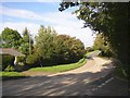
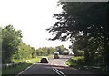
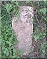
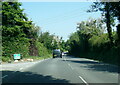
Nearby Images from Geograph Britain and Ireland:
©2007(licence)
©2013(licence)
©2017(licence)
©2023(licence)
©2007(licence)
The above images may not be of the site on this page, they are loaded from Geograph.
Please Submit an Image of this site or go out and take one for us!
Click here to see more info for this site
Nearby sites
Key: Red: member's photo, Blue: 3rd party photo, Yellow: other image, Green: no photo - please go there and take one, Grey: site destroyed
Download sites to:
KML (Google Earth)
GPX (GPS waypoints)
CSV (Garmin/Navman)
CSV (Excel)
To unlock full downloads you need to sign up as a Contributory Member. Otherwise downloads are limited to 50 sites.
Turn off the page maps and other distractions
Nearby sites listing. In the following links * = Image available
1.5km SSE 168° Crug Las Round Cairn (SN38805154)
2.1km SE 137° Blaengowonfawr Round Barrow(s) (SN39905142)
2.4km ESE 109° Mynachlog-Uchaf Misc. Earthwork (SN40795215)
2.4km E 92° Crug Cou Round Barrow(s) (SN40975284)
2.6km S 188° Crug Du* Ring Cairn (SN38075039)
2.7km E 86° Llwyn Crwn Barrow Round Barrow(s) (SN41275311)
3.1km W 266° Castell Crugiau Ancient Village or Settlement (SN35395285)
3.1km NW 322° Felin Llwyn-Dafydd Promontory Fort / Cliff Castle (SN36685553)
3.2km SSW 196° Crug-Bach Barrow Round Barrow(s) (SN37554995)
4.4km SSW 213° Caerau Promontory Fort / Cliff Castle (SN36054940)
5.1km NW 308° Gaer Wen Hillfort (SN34635630)
5.2km ENE 76° Banc Rhosgoch Fach* Stone Row / Alignment (SN43625409)
5.7km NNW 332° Castell Bach (Pen y Graig)* Ancient Village or Settlement (SN36045809)
6.0km NE 36° Cross of Gurhirt (Llanarth)* Early Christian Sculptured Stone (SN42295775)
6.4km E 100° Whilgarn Cairn (SN44815172)
6.6km SW 215° Pensarngerrig* Standing Stones (SN346477)
7.2km WNW 283° Pendinas Lochtyn* Hillfort (SN31565486)
7.5km WNW 288° Ynys Lochtyn* Ancient Village or Settlement (SN31475552)
8.1km W 269° Garreg Standing Stones Standing Stones (SN304531)
8.4km W 264° Gaer Lwyd Hillfort (SN30145240)
8.7km ENE 72° Cwm Castell Hillfort (SN4694055440)
9.0km WSW 252° Castell Nadolig Hillfort (SN29855040)
9.1km E 98° Castell Moeddyn Fach Ancient Village or Settlement (SN47495143)
9.7km WSW 259° Corbalengi Stone* Sculptured Stone (SN2890151375)
10.0km E 94° Castell Moeddyn Ancient Village or Settlement (SN48495195)
View more nearby sites and additional images


 We would like to know more about this location. Please feel free to add a brief description and any relevant information in your own language.
 Wir möchten mehr über diese Stätte erfahren. Bitte zögern Sie nicht, eine kurze Beschreibung und relevante Informationen in Deutsch hinzuzufügen.
 Nous aimerions en savoir encore un peu sur les lieux. S'il vous plaît n'hesitez pas à ajouter une courte description et tous les renseignements pertinents dans votre propre langue.
 Quisieramos informarnos un poco más de las lugares. No dude en añadir una breve descripción y otros datos relevantes en su propio idioma.