


<< Text Pages >> Frigan Field System - Misc. Earthwork in Wales in Anglesey
Submitted by coldrum on Wednesday, 27 January 2010 Page Views: 3915
Multi-periodSite Name: Frigan Field SystemCountry: Wales County: Anglesey Type: Misc. Earthwork
Map Ref: SH488837
Latitude: 53.328553N Longitude: 4.271842W
Condition:
| 5 | Perfect |
| 4 | Almost Perfect |
| 3 | Reasonable but with some damage |
| 2 | Ruined but still recognisable as an ancient site |
| 1 | Pretty much destroyed, possibly visible as crop marks |
| 0 | No data. |
| -1 | Completely destroyed |
| 5 | Superb |
| 4 | Good |
| 3 | Ordinary |
| 2 | Not Good |
| 1 | Awful |
| 0 | No data. |
| 5 | Can be driven to, probably with disabled access |
| 4 | Short walk on a footpath |
| 3 | Requiring a bit more of a walk |
| 2 | A long walk |
| 1 | In the middle of nowhere, a nightmare to find |
| 0 | No data. |
| 5 | co-ordinates taken by GPS or official recorded co-ordinates |
| 4 | co-ordinates scaled from a detailed map |
| 3 | co-ordinates scaled from a bad map |
| 2 | co-ordinates of the nearest village |
| 1 | co-ordinates of the nearest town |
| 0 | no data |
Be the first person to rate this site - see the 'Contribute!' box in the right hand menu.
Internal Links:
External Links:
Curvilinear field enclosures in Anglesey (Sir Ynys Mon)
"Traces of curvilinear field enclosures on knoll above more heavily improved pasture. Fields possible radiate out from core hut group or settled enclosure. Likely prehistoric date. Air photo discovery."
Source: Coflein.
You may be viewing yesterday's version of this page. To see the most up to date information please register for a free account.
Do not use the above information on other web sites or publications without permission of the contributor.
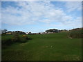
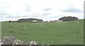
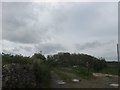
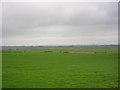
Nearby Images from Geograph Britain and Ireland:
©2009(licence)
©2008(licence)
©2009(licence)
©2005(licence)
©2009(licence)
The above images may not be of the site on this page, they are loaded from Geograph.
Please Submit an Image of this site or go out and take one for us!
Click here to see more info for this site
Nearby sites
Key: Red: member's photo, Blue: 3rd party photo, Yellow: other image, Green: no photo - please go there and take one, Grey: site destroyed
Download sites to:
KML (Google Earth)
GPX (GPS waypoints)
CSV (Garmin/Navman)
CSV (Excel)
To unlock full downloads you need to sign up as a Contributory Member. Otherwise downloads are limited to 50 sites.
Turn off the page maps and other distractions
Nearby sites listing. In the following links * = Image available
1.2km NNE 32° Parciau Hillfort Hillfort (SH4945384676)
1.4km N 355° Tyddyn Isaf Burnt Mound Misc. Earthwork (SH4873185067)
1.4km N 6° Bwlch-Y-Dafarn Enclosed Settlement Ancient Village or Settlement (SH4900085103)
1.5km NE 44° Ffynnon Allgo Holy Well or Sacred Spring (SH4989684774)
1.6km N 9° Bwlch-Y-Dafarn Settlement Enclosure Ancient Village or Settlement (SH4910585235)
1.7km NE 52° Cae Marh Ancient Village or Settlement (SH5016784694)
2.0km ESE 112° St Mary (Tynygongl) Ancient Cross (SH50658290)
2.0km NNE 12° Bwlch-Y-Dafarn Ancient Village or Settlement (SH4929285663)
2.1km N 0° Rhos Lligwy Burnt Mound Misc. Earthwork (SH4888185780)
2.1km NW 326° Ponc y Garreg Hir* Standing Stone (Menhir) (SH47668549)
2.2km NE 34° Llanallgo Roundhouse Ancient Village or Settlement (SH5008185471)
2.2km N 5° Coed Newydd Burnt Mounds Misc. Earthwork (SH4904885932)
2.5km ESE 119° Pant-Y-Saer* Chambered Tomb (SH5097182401)
2.6km NNE 18° Din Lligwy* Ancient Village or Settlement (SH4970286134)
2.7km NNE 28° Lligwy Burial Chamber* Chambered Tomb (SH50138604)
2.7km W 262° Maen Addwyn* Standing Stone (Menhir) (SH461834)
2.7km NNE 24° Parc Salmon Roundhouse Ancient Village or Settlement (SH4999086149)
2.9km W 268° Llanfihangel Tre'r Beirdd Cross* Ancient Cross (SH4588783693)
3.2km ESE 110° Benllech Chambered Tomb Chambered Tomb (SH518825)
3.3km SE 125° Coed y Glyn Burial Chamber* Chambered Tomb (SH5141381728)
3.3km ESE 115° Caru Benllech Mini Cromlech (modern)* Modern Stone Circle etc (SH5178782173)
3.6km WSW 259° Llech Golman* Standing Stone (Menhir) (SH452831)
3.9km W 275° Ffynnon Gybi* Holy Well or Sacred Spring (SH44908414)
3.9km W 275° Ffynnon Deiniol* Holy Well or Sacred Spring (SH44908416)
3.9km W 275° Clorach Wells* Not Known (by us) (SH4487584177)
View more nearby sites and additional images


 We would like to know more about this location. Please feel free to add a brief description and any relevant information in your own language.
 Wir möchten mehr über diese Stätte erfahren. Bitte zögern Sie nicht, eine kurze Beschreibung und relevante Informationen in Deutsch hinzuzufügen.
 Nous aimerions en savoir encore un peu sur les lieux. S'il vous plaît n'hesitez pas à ajouter une courte description et tous les renseignements pertinents dans votre propre langue.
 Quisieramos informarnos un poco más de las lugares. No dude en añadir una breve descripción y otros datos relevantes en su propio idioma.