


<< Our Photo Pages >> Standing Stone West of Lon Fel - Standing Stone (Menhir) in Wales in Gwynedd
Submitted by TAlanJones on Saturday, 09 July 2022 Page Views: 581
Neolithic and Bronze AgeSite Name: Standing Stone West of Lon FelCountry: Wales
NOTE: This site is 0.599 km away from the location you searched for.
County: Gwynedd Type: Standing Stone (Menhir)
Nearest Town: Criccieth Nearest Village: Llanystumdwy
Map Ref: SH4921037995
Latitude: 52.918148N Longitude: 4.244192W
Condition:
| 5 | Perfect |
| 4 | Almost Perfect |
| 3 | Reasonable but with some damage |
| 2 | Ruined but still recognisable as an ancient site |
| 1 | Pretty much destroyed, possibly visible as crop marks |
| 0 | No data. |
| -1 | Completely destroyed |
| 5 | Superb |
| 4 | Good |
| 3 | Ordinary |
| 2 | Not Good |
| 1 | Awful |
| 0 | No data. |
| 5 | Can be driven to, probably with disabled access |
| 4 | Short walk on a footpath |
| 3 | Requiring a bit more of a walk |
| 2 | A long walk |
| 1 | In the middle of nowhere, a nightmare to find |
| 0 | No data. |
| 5 | co-ordinates taken by GPS or official recorded co-ordinates |
| 4 | co-ordinates scaled from a detailed map |
| 3 | co-ordinates scaled from a bad map |
| 2 | co-ordinates of the nearest village |
| 1 | co-ordinates of the nearest town |
| 0 | no data |
Internal Links:
External Links:
I have visited· I would like to visit
elad13 visited on 20th Sep 2022 - their rating: Cond: 4 Amb: 4 Access: 3
")
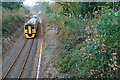
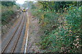
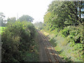
The stone lies at the end of a field and close to a small wood. A small building housing a mast stands a few metres to the SW and the railway track passes a few metres further on.
The stone is visible from the road and the site can be reached via a gate but this is private land and permission should be sought to enter the field. The proportions of the stone are similar to that of the Bron Eifion stone. It stands at 1.2m with a width of 1m and a depth of 0.65m.
Interestingly, a possible cist burial has been discovered in the next field to the west.
You may be viewing yesterday's version of this page. To see the most up to date information please register for a free account.
")
")
")
")
Do not use the above information on other web sites or publications without permission of the contributor.
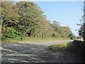
Nearby Images from Geograph Britain and Ireland:
©2007(licence)
©2007(licence)
©2010(licence)
©2010(licence)
©2010(licence)
The above images may not be of the site on this page, they are loaded from Geograph.
Please Submit an Image of this site or go out and take one for us!
Click here to see more info for this site
Nearby sites
Key: Red: member's photo, Blue: 3rd party photo, Yellow: other image, Green: no photo - please go there and take one, Grey: site destroyed
Download sites to:
KML (Google Earth)
GPX (GPS waypoints)
CSV (Garmin/Navman)
CSV (Excel)
To unlock full downloads you need to sign up as a Contributory Member. Otherwise downloads are limited to 50 sites.
Turn off the page maps and other distractions
Nearby sites listing. In the following links * = Image available
232m NW 321° Bron Eifion Standing Stone* Standing Stone (Menhir) (SH4907038180)
1.7km NNE 33° Moel Ednyfed Hillfort* Hillfort (SH5018039370)
1.9km E 82° Caer-Dyni* Burial Chamber or Dolmen (SH51103821)
2.4km NNE 20° Bryn Braich y Saint Carved Stone* Rock Art (SH5012040232)
2.5km NE 39° Braich y Saint Stones* Standing Stones (SH5086239902)
3.0km NNW 341° Rhoslan* Burial Chamber or Dolmen (SH48344088)
3.4km N 10° Ystum Cegid Isaf* Chambered Tomb (SH49884132)
3.8km NW 312° Betws Fawr* Standing Stone (Menhir) (SH4647540610)
3.8km ENE 62° Trefllys* Standing Stone (Menhir) (SH52663968)
4.2km E 90° The Treflys Stone* Sculptured Stone (SH53453785)
4.7km NNE 18° Bryniau'r Tyddyn* Standing Stone (Menhir) (SH50784240)
4.8km NNE 32° Garnedd-hir Modern Dolmen* Modern Stone Circle etc (SH5192441988)
4.9km NNE 14° Craig-Y-Tyddyn Camp* Hillfort (SH50594272)
4.9km E 84° Enclosed Hut Group near Ty Mawr* Ancient Village or Settlement (SH5413038370)
5.1km E 84° Cist Cerrig* Portal Tomb (SH54333841)
5.4km E 85° Hut Circle East of Cist Gerrig* Ancient Village or Settlement (SH5460038330)
5.5km E 80° Hut Circle West of Moel Y Gest Ancient Village or Settlement (SH547388)
5.7km E 79° Moel Y Gest Hillfort* Hillfort (SH549389)
6.0km N 5° Garndolbenmaen Round Hut* Ancient Village or Settlement (SH499440)
6.1km ENE 78° Hut Circle North of Moel Y Gest* Ancient Village or Settlement (SH552391)
6.1km NNE 13° Castell Caerau* Hillfort (SH508439)
6.2km N 9° Gyrn Goch Cairn* Cairn (SH504441)
6.4km ENE 59° Cairns east of Graig Y Gesail* Cairn (SH548411)
6.4km ENE 57° Hut Circle near Graig Y Gesail* Ancient Village or Settlement (SH547413)
6.5km ENE 63° Hut circles west of Allt Wen* Ancient Village or Settlement (SH551408)
View more nearby sites and additional images


 We would like to know more about this location. Please feel free to add a brief description and any relevant information in your own language.
 Wir möchten mehr über diese Stätte erfahren. Bitte zögern Sie nicht, eine kurze Beschreibung und relevante Informationen in Deutsch hinzuzufügen.
 Nous aimerions en savoir encore un peu sur les lieux. S'il vous plaît n'hesitez pas à ajouter une courte description et tous les renseignements pertinents dans votre propre langue.
 Quisieramos informarnos un poco más de las lugares. No dude en añadir una breve descripción y otros datos relevantes en su propio idioma.