<< Text Pages >> St Andrew's Well (Borgue) - Holy Well or Sacred Spring in Scotland in Dumfries and Galloway
Submitted by Anne T on Friday, 24 June 2022 Page Views: 468
Springs and Holy WellsSite Name: St Andrew's Well (Borgue)Country: Scotland
NOTE: This site is 0.286 km away from the location you searched for.
County: Dumfries and Galloway Type: Holy Well or Sacred Spring
Nearest Town: Borgue Nearest Village: Kirkandrews
Map Ref: NX6024148037
Latitude: 54.807658N Longitude: 4.176055W
Condition:
| 5 | Perfect |
| 4 | Almost Perfect |
| 3 | Reasonable but with some damage |
| 2 | Ruined but still recognisable as an ancient site |
| 1 | Pretty much destroyed, possibly visible as crop marks |
| 0 | No data. |
| -1 | Completely destroyed |
| 5 | Superb |
| 4 | Good |
| 3 | Ordinary |
| 2 | Not Good |
| 1 | Awful |
| 0 | No data. |
| 5 | Can be driven to, probably with disabled access |
| 4 | Short walk on a footpath |
| 3 | Requiring a bit more of a walk |
| 2 | A long walk |
| 1 | In the middle of nowhere, a nightmare to find |
| 0 | No data. |
| 5 | co-ordinates taken by GPS or official recorded co-ordinates |
| 4 | co-ordinates scaled from a detailed map |
| 3 | co-ordinates scaled from a bad map |
| 2 | co-ordinates of the nearest village |
| 1 | co-ordinates of the nearest town |
| 0 | no data |
Be the first person to rate this site - see the 'Contribute!' box in the right hand menu.
Internal Links:
External Links:
Holy Well or Sacred Spring in Dumfries and Galloway
Located about 180m south east of the now ruined Kirkandrews Old Church and Burial Ground at NX 6006 4811, this well is included here because of its close association with the church. An incised 12th century cross fragment possibly came from the churchyard, and is now in the forecourt of Kirkcudbright Museum (see Canmore Site ID 319606 for more information). It is not known if the water from this well was used for baptismal purposes.
Information about this well has been collected by the Can You Dig It: Lost Wells of Galloway project, who tell us that this well first appeared on the 1st edition Ordnance Survey 6-inch map of 1854, but 'it does not appear on mapping after this".
Nick Coombey, the LWoG researcher quotes from the OS name book, which describes this as: "a small spring well on the farm of Ingliston, and situated a short distance S. East of Kirkandrews Church (in ruins) from which probably it took its name."
If anyone has visited this well and has photographs, we'd welcome contributions to this site page. Or if you have any information about whether its' waters were used for baptismal, healing or restorative purposes, please let us know by adding a comment here. Thank you.
The Lost Wells of Galloway project is a community project, "setting out to map and better understand lost wells in Galloway, considering how we relate to these historic features now and how this has changed over time".
You may be viewing yesterday's version of this page. To see the most up to date information please register for a free account.
Do not use the above information on other web sites or publications without permission of the contributor.
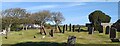
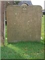
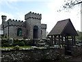
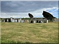
Nearby Images from Geograph Britain and Ireland:
©2020(licence)
©2010(licence)
©2014(licence)
©2021(licence)
©2012(licence)
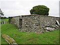
The above images may not be of the site on this page, they are loaded from Geograph.
Please Submit an Image of this site or go out and take one for us!
Click here to see more info for this site
Nearby sites
Key: Red: member's photo, Blue: 3rd party photo, Yellow: other image, Green: no photo - please go there and take one, Grey: site destroyed
Download sites to:
KML (Google Earth)
GPX (GPS waypoints)
CSV (Garmin/Navman)
CSV (Excel)
To unlock full downloads you need to sign up as a Contributory Member. Otherwise downloads are limited to 50 sites.
Turn off the page maps and other distractions
Nearby sites listing. In the following links * = Image available
335m NNE 14° Tongue Croft* Rock Art (NX60334836)
699m SSW 205° Barn Heugh* Hillfort (NX59934741)
921m WNW 283° Castle Haven* Stone Fort or Dun (NX5934748270)
3.3km WNW 295° Ardwall Island Chapel & Burial Ground* Cairn (NX57254956)
4.1km E 101° Clauchandolly 1* Rock Art (NX64244714)
4.2km E 101° Clauchandolly 6 Rock Art (NX64384711)
4.3km E 99° Clauchandolly 8* Rock Art (NX64474722)
4.5km ESE 122° Brighouse* Standing Stone (Menhir) (NX64024555)
6.4km WNW 303° Mossyard 6* Rock Art (NX5497951658)
6.6km WNW 299° Mossyard 1* Rock Art (NX54525141)
6.8km NW 304° Mossyard* Rock Art (NX54695204)
6.9km NW 309° Newton Cairn* Chambered Cairn (NX55065256)
7.1km E 81° Monk's Well (Kirkcudbright) Holy Well or Sacred Spring (NX6730048892)
7.8km NE 45° Ingle Stone (Ingleston)* Natural Stone / Erratic / Other Natural Feature (NX6597753324)
7.8km NNW 329° Stone Triangle (Lagganmullan)* Modern Stone Circle etc (NX5641154896)
7.9km NNW 330° Lagganmullan 8* Rock Art (NX56475503)
7.9km NNW 330° Lagganmullan 9* Rock Art (NX56465504)
8.1km NNW 349° Trusty's Hill* Hillfort (NX58895601)
8.1km NNW 349° Anwoth* Class I Pictish Symbol Stone (NX58895601)
8.1km ESE 104° Torrs 2* Rock Art (NX68054586)
8.1km NE 42° Arden Fort* Hillfort (NX65875395)
8.2km ESE 108° Torrs 3* Rock Art (NX67924522)
8.2km ENE 73° Butter Well (Kirkcudbright) Holy Well or Sacred Spring (NX6821250148)
8.2km NNW 328° Lagganmullan 4* Rock Art (NX56095516)
8.3km NW 309° High Auchenlarie* Stone Circle (NX53955342)
View more nearby sites and additional images


 We would like to know more about this location. Please feel free to add a brief description and any relevant information in your own language.
 Wir möchten mehr über diese Stätte erfahren. Bitte zögern Sie nicht, eine kurze Beschreibung und relevante Informationen in Deutsch hinzuzufügen.
 Nous aimerions en savoir encore un peu sur les lieux. S'il vous plaît n'hesitez pas à ajouter une courte description et tous les renseignements pertinents dans votre propre langue.
 Quisieramos informarnos un poco más de las lugares. No dude en añadir una breve descripción y otros datos relevantes en su propio idioma.