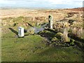
<< Our Photo Pages >> Holy Well (Cefn Bryn) - Holy Well or Sacred Spring in Wales in West Glamorgan
Submitted by vicky on Monday, 29 March 2004 Page Views: 7151
Springs and Holy WellsSite Name: Holy Well (Cefn Bryn)Country: Wales
NOTE: This site is 0.755 km away from the location you searched for.
County: West Glamorgan Type: Holy Well or Sacred Spring
Nearest Village: Cefn Bryn
Map Ref: SS49769003 Landranger Map Number: 180
Latitude: 51.589035N Longitude: 4.170122W
Condition:
| 5 | Perfect |
| 4 | Almost Perfect |
| 3 | Reasonable but with some damage |
| 2 | Ruined but still recognisable as an ancient site |
| 1 | Pretty much destroyed, possibly visible as crop marks |
| 0 | No data. |
| -1 | Completely destroyed |
| 5 | Superb |
| 4 | Good |
| 3 | Ordinary |
| 2 | Not Good |
| 1 | Awful |
| 0 | No data. |
| 5 | Can be driven to, probably with disabled access |
| 4 | Short walk on a footpath |
| 3 | Requiring a bit more of a walk |
| 2 | A long walk |
| 1 | In the middle of nowhere, a nightmare to find |
| 0 | No data. |
| 5 | co-ordinates taken by GPS or official recorded co-ordinates |
| 4 | co-ordinates scaled from a detailed map |
| 3 | co-ordinates scaled from a bad map |
| 2 | co-ordinates of the nearest village |
| 1 | co-ordinates of the nearest town |
| 0 | no data |
Be the first person to rate this site - see the 'Contribute!' box in the right hand menu.
Internal Links:
External Links:
 (PID:66196)")
Have you visited this site? Please add a comment below.
You may be viewing yesterday's version of this page. To see the most up to date information please register for a free account.
 (PID:66198)")
 (PID:66197)")
Do not use the above information on other web sites or publications without permission of the contributor.
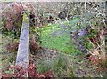
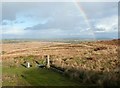
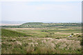
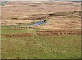
Nearby Images from Geograph Britain and Ireland:
©2012(licence)
©2012(licence)
©2012(licence)
©2006(licence)
©2012(licence)
The above images may not be of the site on this page, they are loaded from Geograph.
Please Submit an Image of this site or go out and take one for us!
Click here to see more info for this site
Nearby sites
Key: Red: member's photo, Blue: 3rd party photo, Yellow: other image, Green: no photo - please go there and take one, Grey: site destroyed
Download sites to:
KML (Google Earth)
GPX (GPS waypoints)
CSV (Garmin/Navman)
CSV (Excel)
To unlock full downloads you need to sign up as a Contributory Member. Otherwise downloads are limited to 50 sites.
Turn off the page maps and other distractions
Nearby sites listing. In the following links * = Image available
530m WNW 288° Cefn Bryn Cairn 2* Ring Cairn (SS49269021)
532m WNW 299° Cefn Bryn Cairn 3* Ring Cairn (SS493903)
808m NW 308° Maen Ceti* Chambered Tomb (SS49149055)
808m NW 304° Maen Ceti cairn Ring Cairn (SS491905)
908m NW 304° Cefn Bryn Great Cairn* Round Cairn (SS49029056)
981m NW 313° Cefn Bryn Cairn 1* Ring Cairn (SS4906690726)
1.3km WNW 285° Cefn Bryn SW Cairn* Ring Cairn (SS4854990395)
1.3km SE 128° Talbot Road Cairn 2 Ring Cairn (SS50758921)
1.3km SE 128° Talbot Road Cairn 1* Ring Cairn (SS50758920)
1.6km SE 139° Nicholaston Long Cairn* Chambered Tomb (SS50768879)
1.6km SE 131° Nicholaston Hall Cairn Cairn (SS50948894)
1.8km W 266° Reynoldston Millennium Stone* Modern Stone Circle etc (SS47958997)
1.9km NE 43° Pen-y-Crug Barrow* Round Barrow(s) (SS51099137)
2.2km N 358° Llanrhidian Upper Stone* Standing Stone (Menhir) (SS49769221)
2.2km N 358° Llanrhidian Lower Stone* Standing Stone (Menhir) (SS49769223)
2.2km NNW 330° Oldwalls (E) Standing Stone* Standing Stone (Menhir) (SS48689200)
2.3km ESE 109° Cefn Bryn Burnt Mound 2 Misc. Earthwork (SS51888922)
2.3km ESE 109° Cefn Bryn Burnt Mound Misc. Earthwork (SS51898922)
2.3km ESE 109° Cefn Bryn Ring Cairn Ring Cairn (SS51918922)
2.4km NW 324° Oldwalls (W) Standing Stone* Standing Stone (Menhir) (SS48429197)
2.4km NNE 19° Cil ifor Top* Hillfort (SS506923)
2.6km ESE 115° Cefn Bryn Cairn 1* Cairn (SS52068889)
2.7km ESE 114° Cefn Bryn Beacon 1 Cairn (SS52198886)
2.7km ESE 114° Cefn Bryn Beacon 2 Cairn (SS52238886)
2.7km NW 305° Ty'r-Coed* Standing Stone (Menhir) (SS47579168)
View more nearby sites and additional images


 We would like to know more about this location. Please feel free to add a brief description and any relevant information in your own language.
 Wir möchten mehr über diese Stätte erfahren. Bitte zögern Sie nicht, eine kurze Beschreibung und relevante Informationen in Deutsch hinzuzufügen.
 Nous aimerions en savoir encore un peu sur les lieux. S'il vous plaît n'hesitez pas à ajouter une courte description et tous les renseignements pertinents dans votre propre langue.
 Quisieramos informarnos un poco más de las lugares. No dude en añadir una breve descripción y otros datos relevantes en su propio idioma.