


<< Our Photo Pages >> Blaen-Ceiment - Round Barrow(s) in Wales in Carmarthenshire
Submitted by PJK7009 on Sunday, 13 December 2015 Page Views: 1529
Neolithic and Bronze AgeSite Name: Blaen-CeimentCountry: Wales County: Carmarthenshire Type: Round Barrow(s)
Map Ref: SN58594216
Latitude: 52.059720N Longitude: 4.064059W
Condition:
| 5 | Perfect |
| 4 | Almost Perfect |
| 3 | Reasonable but with some damage |
| 2 | Ruined but still recognisable as an ancient site |
| 1 | Pretty much destroyed, possibly visible as crop marks |
| 0 | No data. |
| -1 | Completely destroyed |
| 5 | Superb |
| 4 | Good |
| 3 | Ordinary |
| 2 | Not Good |
| 1 | Awful |
| 0 | No data. |
| 5 | Can be driven to, probably with disabled access |
| 4 | Short walk on a footpath |
| 3 | Requiring a bit more of a walk |
| 2 | A long walk |
| 1 | In the middle of nowhere, a nightmare to find |
| 0 | No data. |
| 5 | co-ordinates taken by GPS or official recorded co-ordinates |
| 4 | co-ordinates scaled from a detailed map |
| 3 | co-ordinates scaled from a bad map |
| 2 | co-ordinates of the nearest village |
| 1 | co-ordinates of the nearest town |
| 0 | no data |
Internal Links:
External Links:
")
Coflein says: Circular mound located approx. 500m north of Blaen-Ceiment farm. The mound has a depression in the centre and is possibly a burnt mound. The site was discovered through aerial reconnaissance by RCAHMW on 15th December 2008 and has not been visited on the ground. L. Osborne, 9th May 2012.
You may be viewing yesterday's version of this page. To see the most up to date information please register for a free account.
Do not use the above information on other web sites or publications without permission of the contributor.
Nearby Images from Geograph Britain and Ireland:
©2016(licence)
©2022(licence)
©2009(licence)
©2015(licence)
©2009(licence)
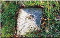
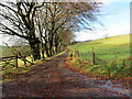
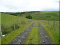
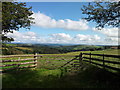
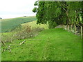
The above images may not be of the site on this page, they are loaded from Geograph.
Please Submit an Image of this site or go out and take one for us!
Click here to see more info for this site
Nearby sites
Key: Red: member's photo, Blue: 3rd party photo, Yellow: other image, Green: no photo - please go there and take one, Grey: site destroyed
Download sites to:
KML (Google Earth)
GPX (GPS waypoints)
CSV (Garmin/Navman)
CSV (Excel)
To unlock full downloads you need to sign up as a Contributory Member. Otherwise downloads are limited to 50 sites.
Turn off the page maps and other distractions
Nearby sites listing. In the following links * = Image available
564m W 260° Cefn Blaenau* Cairn (SN58034208)
3.7km WSW 244° Pant Teg* Standing Stone (Menhir) (SN552406)
3.9km SW 227° Crug-Y-Bwdran* Round Barrow(s) (SN55633957)
4.8km SW 234° Carreg Hir (Llanybydder)* Standing Stone (Menhir) (SN54613940)
5.2km WSW 239° Mynydd Llanbyther* Stone Row / Alignment (SN5402639607)
5.7km WSW 241° Crugiau Edryd* Barrow Cemetery (SN535395)
5.8km NE 40° Hirfaen Gwyddog* Standing Stone (Menhir) (SN62454645)
6.3km NE 36° Bryn Goleu* Cairn (SN62434712)
6.3km N 352° Lampeter Gorsedd Circle* Modern Stone Circle etc (SN57854841)
6.3km N 9° Bryn Maen Caerau* Ancient Village or Settlement (SN59704836)
6.3km W 280° Pen-Y-Gaer (Llanybydder)* Hillfort (SN52394342)
6.4km WSW 255° Blaen Plwyf round cairn* Round Cairn (SN52344068)
6.5km SSW 211° Crug Cnwc Round Barrow(s) (SN55103667)
6.5km WSW 257° Goetre Derlwyn Barrow Cemetery (SN52174089)
6.8km WSW 258° Goetre Derlwyn de Barrow Cemetery (SN51874093)
6.8km NNE 30° Caer Cadwgan Hillfort (SN62234796)
6.9km W 259° Pen Wern Barrow Cemetery (SN51744105)
7.1km N 354° Castell Olwen* Hillfort (SN5801949254)
7.5km WSW 243° Mynydd Llanllwni* Round Barrow(s) (SN518389)
7.6km WSW 242° Crug-y-biswal* Round Barrow(s) (SN518388)
7.9km ESE 102° Carreg Pumsaint* Standing Stone (Menhir) (SN66334035)
8.0km N 4° Castell Allt-Goch* Hillfort (SN59335012)
8.0km ESE 102° Dolaucothi* Ancient Mine, Quarry or other Industry (SN66384025)
8.3km NE 45° Carreg Y Bwci* Cairn (SN646479)
8.5km NNE 31° Tir Ifan (Cellan)* Misc. Earthwork (SN63134931)
View more nearby sites and additional images


 We would like to know more about this location. Please feel free to add a brief description and any relevant information in your own language.
 Wir möchten mehr über diese Stätte erfahren. Bitte zögern Sie nicht, eine kurze Beschreibung und relevante Informationen in Deutsch hinzuzufügen.
 Nous aimerions en savoir encore un peu sur les lieux. S'il vous plaît n'hesitez pas à ajouter une courte description et tous les renseignements pertinents dans votre propre langue.
 Quisieramos informarnos un poco más de las lugares. No dude en añadir una breve descripción y otros datos relevantes en su propio idioma.