

<< Text Pages >> St Ninian's Well (Parton) - Holy Well or Sacred Spring in Scotland in Dumfries and Galloway
Submitted by Anne T on Wednesday, 29 June 2022 Page Views: 661
Springs and Holy WellsSite Name: St Ninian's Well (Parton)Country: Scotland
NOTE: This site is 7 km away from the location you searched for.
County: Dumfries and Galloway Type: Holy Well or Sacred Spring
Nearest Town: Castle Douglas / New Galloway Nearest Village: Parton
Map Ref: NX7079369806
Latitude: 55.005991N Longitude: 4.02177W
Condition:
| 5 | Perfect |
| 4 | Almost Perfect |
| 3 | Reasonable but with some damage |
| 2 | Ruined but still recognisable as an ancient site |
| 1 | Pretty much destroyed, possibly visible as crop marks |
| 0 | No data. |
| -1 | Completely destroyed |
| 5 | Superb |
| 4 | Good |
| 3 | Ordinary |
| 2 | Not Good |
| 1 | Awful |
| 0 | No data. |
| 5 | Can be driven to, probably with disabled access |
| 4 | Short walk on a footpath |
| 3 | Requiring a bit more of a walk |
| 2 | A long walk |
| 1 | In the middle of nowhere, a nightmare to find |
| 0 | No data. |
| 5 | co-ordinates taken by GPS or official recorded co-ordinates |
| 4 | co-ordinates scaled from a detailed map |
| 3 | co-ordinates scaled from a bad map |
| 2 | co-ordinates of the nearest village |
| 1 | co-ordinates of the nearest town |
| 0 | no data |
Be the first person to rate this site - see the 'Contribute!' box in the right hand menu.
Internal Links:
External Links:
Holy Well or Sacred Spring in Dumfries and Galloway
Researched by the Can You Dig It: Lost Wells of Galloway (LWoG) project, Sue Taylor tells us: "St Ninian's Well is located at Chapelbrae in the grounds of the former Parton estate on the east bank of the Dee, and close to a ruined estate chapel: Dumfries and Galloway HER record MDG4176 and Canmore Site ID 64593 (Parton House, Roman Catholic Church); Canmore Site ID 213985 (Parton House, Priest's House) and Dumfries and Galloway HER record MDG24291); and an ice house: Canmore Site ID 213986 (Parton House, Ice House) and Dumfries and Galloway HER record MDG22194.
Sue, the LWoG researcher, adds: "(the well) first appears as an unnamed spring on the 1st edition Ordnance Survey 6-inch map of 1852 and appears named on mapping from at least the 1950s. It continues to appear named through to current mapping (2022). From the 2nd edition OS 6-inch map of 1895, the site is shown within a small enclosure, which is still marked on current mapping (2022)".
Sue Taylor also managed to speak to a local resident, who told her: "The Glendonwyns of Parton were closely linked with Robert the Bruce ... the well alcove bears the inscription 'Fons Sancti Niniani' .... no idea of the well's age, but the well and baptisms will be linked to the Catholic Chapel rather than St Inan's .... the inscription is on a granite block and tehre is the remains of an iron fence and arch around the well .... apparently they used to baptise people int he well, and we have what is left of the cup used to pour water on children's heads."
Sue also carried out a site visit in 2021, and located the well within an area of trees. She says: "It is fairly overgrown but the well is still visible as a small pond with at least two steps leading into it on one side and a small section of wall also present along another side. Set into the wall, the small alcove with Latin inscription is still present as described. The enclosing wall and metal gate are also still present, although the latter is bent and no longer attached. Corresponds with the entry MDG13151 in the Dumfries and Galloway HER".
If anyone has any photographs of the well they would like to contribute, we'd be delighted to see them. Similarly, if you have any more information about the well, and if its waters were used for any healing or restorative purposes, please leave us a comment on this site page - thank you.
The Lost Wells of Galloway project is a community project, "setting out to map and better understand lost wells in Galloway, considering how we relate to these historic features now and how this has changed over time".
You may be viewing yesterday's version of this page. To see the most up to date information please register for a free account.
Do not use the above information on other web sites or publications without permission of the contributor.
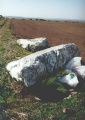
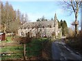
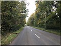
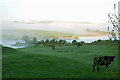
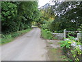
Nearby Images from Geograph Britain and Ireland:
©2008(licence)
©2023(licence)
©2007(licence)
©2013(licence)
©2013(licence)
The above images may not be of the site on this page, they are loaded from Geograph.
Please Submit an Image of this site or go out and take one for us!
Click here to see more info for this site
Nearby sites
Key: Red: member's photo, Blue: 3rd party photo, Yellow: other image, Green: no photo - please go there and take one, Grey: site destroyed
Download sites to:
KML (Google Earth)
GPX (GPS waypoints)
CSV (Garmin/Navman)
CSV (Excel)
To unlock full downloads you need to sign up as a Contributory Member. Otherwise downloads are limited to 50 sites.
Turn off the page maps and other distractions
Nearby sites listing. In the following links * = Image available
6.9km W 278° Loch Stroan Stone Circle (NX640709)
7.2km SE 141° Greenlaw Cairn (NX75186404)
7.7km SW 230° Lochenbreck Well (Balmaghie) Holy Well or Sacred Spring (NX6479065025)
8.2km WNW 294° Cairn Edward Well (Kells) Holy Well or Sacred Spring (NX6343073408)
8.2km ESE 119° St Michael's Well (Crossmichael) Holy Well or Sacred Spring (NX7783865566)
8.3km SSE 153° Little Wood Hill* Causewayed Enclosure (NX7433862318)
8.6km SW 230° Spa Well (Balmaghie) Holy Well or Sacred Spring (NX6400964416)
8.9km WNW 296° Milldown Well (Kells) Holy Well or Sacred Spring (NX6287273982)
9.4km SE 133° Ernespie* Stone Circle (NX77476321)
9.4km S 191° Giant's Dike* Hillfort (NX68736065)
9.5km SSW 207° Lairdmannoch* Stone Circle (NX66286143)
10.6km NW 321° Lady's Well (Balmaclellan) Holy Well or Sacred Spring (NX6435678263)
11.4km NW 313° Physic Well (Kells) Holy Well or Sacred Spring (NX6270677877)
11.6km NW 322° Dalarran Holm* Standing Stone (Menhir) (NX6388179164)
12.2km SSE 156° Gelston White Cairn* Cairn (NX75555850)
12.7km S 173° St Ringan's Well (Kelton) Holy Well or Sacred Spring (NX71905713)
12.7km SE 129° Rumbling Well (Buittle) Holy Well or Sacred Spring (NX8050061547)
12.8km S 184° Holy Well (Parton) Holy Well or Sacred Spring (NX696570)
12.9km S 180° Park of Tongland Marked Stone Rock Art (NX70475685)
13.1km E 80° Green Island (Milton Loch)* Misc. Earthwork (NX83857164)
13.2km E 79° Milton Loch NW* Crannog (NX83887188)
13.2km E 81° Milton Loch Central* Crannog (NX83947149)
13.3km SE 126° Slot Well (Buittle) Holy Well or Sacred Spring (NX8134861618)
13.4km SSW 195° Fairies Well (Tongland) Holy Well or Sacred Spring (NX6695556911)
13.5km E 82° Milton Loch SE* Crannog (NX84287120)
View more nearby sites and additional images


 We would like to know more about this location. Please feel free to add a brief description and any relevant information in your own language.
 Wir möchten mehr über diese Stätte erfahren. Bitte zögern Sie nicht, eine kurze Beschreibung und relevante Informationen in Deutsch hinzuzufügen.
 Nous aimerions en savoir encore un peu sur les lieux. S'il vous plaît n'hesitez pas à ajouter une courte description et tous les renseignements pertinents dans votre propre langue.
 Quisieramos informarnos un poco más de las lugares. No dude en añadir una breve descripción y otros datos relevantes en su propio idioma.