<< Our Photo Pages >> Ponta Delgada - Modern Stone Circle etc in Portugal in The Azores
Submitted by Alta-Falisa on Wednesday, 22 July 2015 Page Views: 4253
Modern SitesSite Name: Ponta DelgadaCountry: Portugal
NOTE: This site is 12.053 km away from the location you searched for.
Distrito: The Azores Type: Modern Stone Circle etc
Nearest Town: Ponta Delgada Nearest Village: Lagoa
Latitude: 37.749600N Longitude: 25.6214W
Condition:
| 5 | Perfect |
| 4 | Almost Perfect |
| 3 | Reasonable but with some damage |
| 2 | Ruined but still recognisable as an ancient site |
| 1 | Pretty much destroyed, possibly visible as crop marks |
| 0 | No data. |
| -1 | Completely destroyed |
| 5 | Superb |
| 4 | Good |
| 3 | Ordinary |
| 2 | Not Good |
| 1 | Awful |
| 0 | No data. |
| 5 | Can be driven to, probably with disabled access |
| 4 | Short walk on a footpath |
| 3 | Requiring a bit more of a walk |
| 2 | A long walk |
| 1 | In the middle of nowhere, a nightmare to find |
| 0 | No data. |
| 5 | co-ordinates taken by GPS or official recorded co-ordinates |
| 4 | co-ordinates scaled from a detailed map |
| 3 | co-ordinates scaled from a bad map |
| 2 | co-ordinates of the nearest village |
| 1 | co-ordinates of the nearest town |
| 0 | no data |
Internal Links:
External Links:
")
To open a window on the megalithic constructions in the Azores Islands.
This modern monument stands on São Miguel Island, on the outskirts of Ponta Delgada, direction Lagoa, and overlooks the Atlantic Ocean.
It is now proven that the Azores islands were inhabited before their re-discovery in the 15th century. Just as examples, dolmen and cup-marks have been found on Terceira : http://www.megalithic.co.uk/article.php?sid=37436 (non vidi).
You may be viewing yesterday's version of this page. To see the most up to date information please register for a free account.
Do not use the above information on other web sites or publications without permission of the contributor.
Nearby Images from Flickr

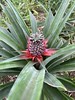

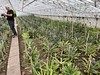
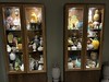

The above images may not be of the site on this page, but were taken nearby. They are loaded from Flickr so please click on them for image credits.
Click here to see more info for this site
Nearby sites
Click here to view sites on an interactive map of the areaKey: Red: member's photo, Blue: 3rd party photo, Yellow: other image, Green: no photo - please go there and take one, Grey: site destroyed
Download sites to:
KML (Google Earth)
GPX (GPS waypoints)
CSV (Garmin/Navman)
CSV (Excel)
To unlock full downloads you need to sign up as a Contributory Member. Otherwise downloads are limited to 50 sites.
Turn off the page maps and other distractions
Nearby sites listing. In the following links * = Image available
173.9km NW 307° Grota do Medo Ancient Village or Settlement
522.0km WNW 292° Rocha dos Bordoes* Natural Stone / Erratic / Other Natural Feature
1220.5km SE 142° El Calvario 2* Rock Art
1220.8km SE 142° El Calvario 1* Rock Art
1222.3km SE 142° Cuevas de Buracas Petroglyphs* Rock Art
1223.4km SE 142° Casa del Baile* Rock Art
1225.1km SE 142° Parque Cultural La Zarza* Museum
1225.4km SE 142° La Zarzita* Rock Art
1225.4km SE 142° La Zarza* Rock Art
1229.1km SE 142° Los Mojones* Ancient Village or Settlement
1230.2km SE 142° Cueva del Flaire* Cave or Rock Shelter
1231.0km SE 142° Roque de Los Muchachos* Natural Stone / Erratic / Other Natural Feature
1231.3km SE 142° Pared de Roberto* Rock Art
1233.3km SE 142° La Ciudad* Ancient Village or Settlement
1233.6km SE 142° Taburiente Petroglyphs (2)* Rock Art
1233.6km SE 142° Taburiente Petroglyphs (1)* Rock Art
1235.1km SE 142° Rogue de Idafe* Rock Art
1235.7km SE 143° La Passada* Rock Art
1236.5km SE 142° Era de los Guanches* Rock Art
1238.4km SE 142° Tamarahoya 2c* Rock Art
1238.6km SE 142° Tamarahoya 2* Rock Art
1238.7km SE 142° Tamarahoya* Rock Art
1238.7km SE 142° Museo Arqueológico Benahoarita* Museum
1240.1km SE 142° La Fajana* Rock Art
1240.3km SE 142° El Cementerio* Rock Art
View more nearby sites and additional images


 We would like to know more about this location. Please feel free to add a brief description and any relevant information in your own language.
 Wir möchten mehr über diese Stätte erfahren. Bitte zögern Sie nicht, eine kurze Beschreibung und relevante Informationen in Deutsch hinzuzufügen.
 Nous aimerions en savoir encore un peu sur les lieux. S'il vous plaît n'hesitez pas à ajouter une courte description et tous les renseignements pertinents dans votre propre langue.
 Quisieramos informarnos un poco más de las lugares. No dude en añadir una breve descripción y otros datos relevantes en su propio idioma.