

<< Our Photo Pages >> Clach na h' Iobairt. - Standing Stone (Menhir) in Scotland in Perth and Kinross
Submitted by cosmic on Friday, 26 March 2004 Page Views: 9417
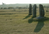
Neolithic and Bronze AgeSite Name: Clach na h' Iobairt. Alternative Name: Bridge Of TiltCountry: Scotland County: Perth and Kinross Type: Standing Stone (Menhir)
Nearest Town: Pitlochry Nearest Village: Blair Atholl
Map Ref: NN87626526 Landranger Map Number: 43
Latitude: 56.765335N Longitude: 3.840073W
Condition:
| 5 | Perfect |
| 4 | Almost Perfect |
| 3 | Reasonable but with some damage |
| 2 | Ruined but still recognisable as an ancient site |
| 1 | Pretty much destroyed, possibly visible as crop marks |
| 0 | No data. |
| -1 | Completely destroyed |
| 5 | Superb |
| 4 | Good |
| 3 | Ordinary |
| 2 | Not Good |
| 1 | Awful |
| 0 | No data. |
| 5 | Can be driven to, probably with disabled access |
| 4 | Short walk on a footpath |
| 3 | Requiring a bit more of a walk |
| 2 | A long walk |
| 1 | In the middle of nowhere, a nightmare to find |
| 0 | No data. |
| 5 | co-ordinates taken by GPS or official recorded co-ordinates |
| 4 | co-ordinates scaled from a detailed map |
| 3 | co-ordinates scaled from a bad map |
| 2 | co-ordinates of the nearest village |
| 1 | co-ordinates of the nearest town |
| 0 | no data |
Internal Links:
External Links:
")
The stone is inside the caravan park right against the fence between the 7th and 8th caravans down the East side. (cosmic)
You may be viewing yesterday's version of this page. To see the most up to date information please register for a free account.
")
")
Do not use the above information on other web sites or publications without permission of the contributor.
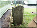
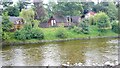
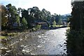
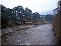
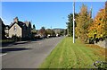
Nearby Images from Geograph Britain and Ireland:
©2008(licence)
©2022(licence)
©2023(licence)
©2007(licence)
©2023(licence)
The above images may not be of the site on this page, they are loaded from Geograph.
Please Submit an Image of this site or go out and take one for us!
Click here to see more info for this site
Nearby sites
Key: Red: member's photo, Blue: 3rd party photo, Yellow: other image, Green: no photo - please go there and take one, Grey: site destroyed
Download sites to:
KML (Google Earth)
GPX (GPS waypoints)
CSV (Garmin/Navman)
CSV (Excel)
To unlock full downloads you need to sign up as a Contributory Member. Otherwise downloads are limited to 50 sites.
Turn off the page maps and other distractions
Nearby sites listing. In the following links * = Image available
1.9km SE 131° Strathgroy Standing Stone (Menhir) (NN8964)
2.5km S 184° Fincastle Farm* Standing Stones (NN87376274)
2.6km SSE 150° Blair Atholl E* Stone Circle (NN88876295)
3.8km ESE 121° Claverhouse's Stone* Standing Stone (Menhir) (NN90826319)
4.9km SW 227° Na Carraigean Edintean* Stone Circle (NN839620)
5.5km W 275° Clach na h-Iobairt* Standing Stone (Menhir) (NN82146590)
6.0km W 269° Whooping Cough Stone (Struan) Natural Stone / Erratic / Other Natural Feature (NN816653)
6.7km W 269° Struan Pictish Stone* Class I Pictish Symbol Stone (NN80896534)
7.9km SE 135° Craigiedun* Stone Circle (NN930595)
8.3km SE 138° Faskally Cottages* Stone Circle (NN930589)
8.8km SE 130° Dane's Stone* Standing Stone (Menhir) (NN9425559414)
9.1km SE 128° Balnakeilly* Standing Stone (Menhir) (NN94655944)
9.3km SE 133° Cnoc Dubh Stone Circle (NN94245871)
9.6km SE 136° Tobar Argan* Holy Well or Sacred Spring (NN941582)
10.3km W 261° Kinaldy Standing Stone (Menhir) (NN774639)
10.7km SSE 151° Clachan An Diridh* Stone Circle (NN92515574)
10.9km SE 138° Dunfallandy Cairn* Cairn (NN94745700)
11.1km S 169° Pitcastle Standing Stones (NN895543)
11.1km SSE 168° Findynate Farm* Standing Stones (NN89645430)
11.2km SE 140° Dunfallandy stone* Class II Pictish Symbol Stone (NN946565)
11.4km SSE 161° Clach Na Buidseach Rock Art (NN91085435)
12.1km S 174° Tobairandonaich* Rock Art (NN88665320)
12.6km S 175° Derculich Passage Grave (NN884527)
12.8km SSE 158° Haugh Of Grandtully Farm* Standing Stone (Menhir) (NN92035319)
13.0km SSE 155° Pitnacree* Standing Stone (Menhir) (NN92875337)
View more nearby sites and additional images


 We would like to know more about this location. Please feel free to add a brief description and any relevant information in your own language.
 Wir möchten mehr über diese Stätte erfahren. Bitte zögern Sie nicht, eine kurze Beschreibung und relevante Informationen in Deutsch hinzuzufügen.
 Nous aimerions en savoir encore un peu sur les lieux. S'il vous plaît n'hesitez pas à ajouter une courte description et tous les renseignements pertinents dans votre propre langue.
 Quisieramos informarnos un poco más de las lugares. No dude en añadir una breve descripción y otros datos relevantes en su propio idioma.