<< Text Pages >> Crieff Cursus - Cursus in Scotland in Perth and Kinross
Submitted by EssexMan on Wednesday, 07 April 2010 Page Views: 3748
Neolithic and Bronze AgeSite Name: Crieff CursusCountry: Scotland
NOTE: This site is 2.174 km away from the location you searched for.
County: Perth and Kinross Type: Cursus
Nearest Town: Crieff Nearest Village: Crieff
Map Ref: NN86531897 Landranger Map Number: 58
Latitude: 56.349424N Longitude: 3.83763W
Condition:
| 5 | Perfect |
| 4 | Almost Perfect |
| 3 | Reasonable but with some damage |
| 2 | Ruined but still recognisable as an ancient site |
| 1 | Pretty much destroyed, possibly visible as crop marks |
| 0 | No data. |
| -1 | Completely destroyed |
| 5 | Superb |
| 4 | Good |
| 3 | Ordinary |
| 2 | Not Good |
| 1 | Awful |
| 0 | No data. |
| 5 | Can be driven to, probably with disabled access |
| 4 | Short walk on a footpath |
| 3 | Requiring a bit more of a walk |
| 2 | A long walk |
| 1 | In the middle of nowhere, a nightmare to find |
| 0 | No data. |
| 5 | co-ordinates taken by GPS or official recorded co-ordinates |
| 4 | co-ordinates scaled from a detailed map |
| 3 | co-ordinates scaled from a bad map |
| 2 | co-ordinates of the nearest village |
| 1 | co-ordinates of the nearest town |
| 0 | no data |
Internal Links:
External Links:
Long Enclosure in Perthshire
Status: Possible
NMR No. NN81NE 44
Extent: 110mx35m
Pit-defined
Note: This location marks one terminal (end) of a cursus monument. The location of the other terminal can be found in the Nearby Site list below.
You may be viewing yesterday's version of this page. To see the most up to date information please register for a free account.
Do not use the above information on other web sites or publications without permission of the contributor.
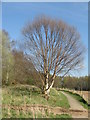
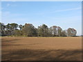
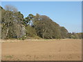
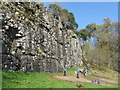
Nearby Images from Geograph Britain and Ireland:
©2017(licence)
©2017(licence)
©2017(licence)
©2017(licence)
©2017(licence)
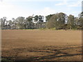
The above images may not be of the site on this page, they are loaded from Geograph.
Please Submit an Image of this site or go out and take one for us!
Click here to see more info for this site
Nearby sites
Key: Red: member's photo, Blue: 3rd party photo, Yellow: other image, Green: no photo - please go there and take one, Grey: site destroyed
Download sites to:
KML (Google Earth)
GPX (GPS waypoints)
CSV (Garmin/Navman)
CSV (Excel)
To unlock full downloads you need to sign up as a Contributory Member. Otherwise downloads are limited to 50 sites.
Turn off the page maps and other distractions
Nearby sites listing. In the following links * = Image available
133m NNE 11° Crieff Cursus Cursus (NN86561910)
1.2km WNW 296° Concraig* Standing Stone (Menhir) (NN8548419503)
1.2km NNW 329° Dargill* Standing Stone (Menhir) (NN85922004)
1.4km N 5° Crieff Cursus Cursus (NN86702040)
1.8km N 359° Duchlage, Crieff Standing Stone (Menhir) (NN86552079)
2.4km ENE 68° Millhills Stone Circle (NN88801981)
2.5km N 358° Crieff Cross Slab* Class III Pictish Cross Slab (NN865215)
2.8km WNW 303° Rottenreoch Chambered Cairn (NN842206)
3.7km NNE 12° Ferntower* Stone Circle (NN874226)
5.0km WNW 290° Strowan (Crieff)* Cairn (NN819208)
5.0km NW 306° Samson's Stone Standing Stone (Menhir) (NN82512202)
5.1km SW 231° Dalchirla East (Muthill) Standing Stones (NN8244615893)
5.1km SW 235° Dalchirla North (Muthill) Standing Stone (Menhir) (NN8227416125)
5.3km NNE 29° Cultoquhey* Chambered Cairn (NN8923723485)
5.4km NNE 16° Monzie Circle* Stone Circle (NN88162417)
5.5km NNE 14° Witches' Stone, Monzie* Standing Stone (Menhir) (NN87982431)
6.2km NNW 347° Stonefield Circle Stone Circle (NN85252505)
6.4km NNE 12° Keppoch Standing Stones (NN87982517)
6.7km ESE 113° North Mains Strathallan round barrow* Round Barrow(s) (NN92621621)
6.7km NW 307° Clathick House Standing Stone (Menhir) (NN81212315)
6.8km ESE 111° North Mains B Timber Circle (NN928164)
6.8km ESE 112° North Mains A Timber Circle (NN928163)
7.1km SSW 208° Cairn Wochel Long Barrow (NN83011276)
7.4km W 260° Craigneich Farm* Standing Stone (Menhir) (NN7922617871)
7.4km WNW 298° Lawers* Standing Stone (Menhir) (NN80102267)
View more nearby sites and additional images


 We would like to know more about this location. Please feel free to add a brief description and any relevant information in your own language.
 Wir möchten mehr über diese Stätte erfahren. Bitte zögern Sie nicht, eine kurze Beschreibung und relevante Informationen in Deutsch hinzuzufügen.
 Nous aimerions en savoir encore un peu sur les lieux. S'il vous plaît n'hesitez pas à ajouter une courte description et tous les renseignements pertinents dans votre propre langue.
 Quisieramos informarnos un poco más de las lugares. No dude en añadir una breve descripción y otros datos relevantes en su propio idioma.