

<< Text Pages >> Dwarf's Tomb (Alva) - Burial Chamber or Dolmen in Scotland in Clackmannanshire
Submitted by Anne T on Wednesday, 06 September 2017 Page Views: 1971
Neolithic and Bronze AgeSite Name: Dwarf's Tomb (Alva)Country: Scotland County: Clackmannanshire Type: Burial Chamber or Dolmen
Nearest Town: Alva
Map Ref: NS88489754
Latitude: 56.157450N Longitude: 3.797053W
Condition:
| 5 | Perfect |
| 4 | Almost Perfect |
| 3 | Reasonable but with some damage |
| 2 | Ruined but still recognisable as an ancient site |
| 1 | Pretty much destroyed, possibly visible as crop marks |
| 0 | No data. |
| -1 | Completely destroyed |
| 5 | Superb |
| 4 | Good |
| 3 | Ordinary |
| 2 | Not Good |
| 1 | Awful |
| 0 | No data. |
| 5 | Can be driven to, probably with disabled access |
| 4 | Short walk on a footpath |
| 3 | Requiring a bit more of a walk |
| 2 | A long walk |
| 1 | In the middle of nowhere, a nightmare to find |
| 0 | No data. |
| 5 | co-ordinates taken by GPS or official recorded co-ordinates |
| 4 | co-ordinates scaled from a detailed map |
| 3 | co-ordinates scaled from a bad map |
| 2 | co-ordinates of the nearest village |
| 1 | co-ordinates of the nearest town |
| 0 | no data |
Be the first person to rate this site - see the 'Contribute!' box in the right hand menu.
Internal Links:
External Links:
Burial Chamber (Dolmen) in Clackmannanshire
The tomb is recorded as Canmore ID 47076 which tells us the flexed skeleton of a dwarf which had been buried in natural cavity in the rock was discovered in 1913 whilst quarrying at the mouth of Alva Glen. They add: "The body had been placed in a cavity or rock shelter in the face of the cliff, about 40ft from the base and about 200ft above sea-level, and a rough, curved wall of dry-stone building, about 1ft thick, had been built across the opening, which faced east."
The Northern Antiquarian (TNA) also features a page for this curious site - see their entry for Dwarf’s Tomb, Alva, Clackmannanshire, which gives directions for finding the tomb, together with photographs and a brief archaeology & history and local folklore which says the place is haunted by the spirit of a dangerous witch!
TNA add a note saying: "The exact spot of the tomb appears to have been destroyed, or at the very least is certainly covered over and no longer visible. The section of the quarry looking east, into which the tomb was built, is all-but gone and no initial evidence prevails to show its exact location. However, it would seem from the description to have been close to the tops of the tree-line, perhaps giving a clear view to the rising sun in the east. Perhaps…
The position of this tomb, enclosed high up in the cliffs, hidden away at the entrance to the deeply cut ravine of the Alva Glen, is intriguing in that it is a rarity."
Note: Have you visited this site? Do you have any photographs or comments to add?
You may be viewing yesterday's version of this page. To see the most up to date information please register for a free account.
Do not use the above information on other web sites or publications without permission of the contributor.
Nearby Images from Geograph Britain and Ireland:
©2009(licence)
©2014(licence)
©2021(licence)
©2023(licence)
©2006(licence)
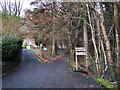
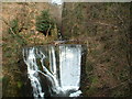
The above images may not be of the site on this page, they are loaded from Geograph.
Please Submit an Image of this site or go out and take one for us!
Click here to see more info for this site
Nearby sites
Key: Red: member's photo, Blue: 3rd party photo, Yellow: other image, Green: no photo - please go there and take one, Grey: site destroyed
Download sites to:
KML (Google Earth)
GPX (GPS waypoints)
CSV (Garmin/Navman)
CSV (Excel)
To unlock full downloads you need to sign up as a Contributory Member. Otherwise downloads are limited to 50 sites.
Turn off the page maps and other distractions
Nearby sites listing. In the following links * = Image available
351m NNE 13° Ladies Well (Alva) Holy Well or Sacred Spring (NS88579788)
452m SE 132° St Serf's Well (Alva) Holy Well or Sacred Spring (NS88819723)
2.6km E 90° Lady's Well (Tillicoultry) Holy Well or Sacred Spring (NS91119749)
3.3km SW 226° Priest's Well (Tullibody) Holy Well or Sacred Spring (NS8606995324)
3.3km SW 226° The Maiden Stone (Tullibody)* Sculptured Stone (NS86039533)
3.5km SW 233° Lady's Well (Tullibody) Holy Well or Sacred Spring (NS85639548)
3.5km NNW 328° Bengengie North Ancient Village or Settlement (NN8668000601)
3.9km E 89° Tillicoultry House Carving (Tillicoultry) Rock Art (NS92409752)
4.0km SW 224° Haer Stane* Standing Stone (Menhir) (NS85659475)
4.1km ENE 64° Eliston West (Tilicoultry) Cairn (NS92209924)
4.1km E 95° Cunninghar Stone Circle (NS92569708)
4.8km S 171° Hawk Hill Cairn (Alloa) Cairn (NS89119282)
5.1km SSE 160° Parkmill Cross (Alloa) Ancient Cross (NS9013392661)
5.4km SSE 155° Hawk Hill (Alloa) Stone Circle (NS906926)
5.6km ESE 107° Balhearty Standing Stone (Menhir) (NS9378295816)
5.7km SE 135° Grassmainston Well (Clackmannan) Holy Well or Sacred Spring (NS9247893403)
5.9km ENE 73° White Stane of Tam Baird (Dollar) Natural Stone / Erratic / Other Natural Feature (NS9413599110)
6.2km SSE 154° Mercat Cross (Clackmannan)* Ancient Cross (NS9111091889)
6.2km SSE 154° Stone of Mannan* Standing Stone (Menhir) (NS91119188)
6.4km SSE 154° Lady Well (Clackmannan) Holy Well or Sacred Spring (NS91129166)
6.6km SE 146° Hawk Hill Stone Circle (NS920920)
6.9km W 264° Logie Old Kirk (Stirling)* Early Christian Sculptured Stone (NS81549696)
7.0km NW 311° Sheriff Muir Row* Stone Row / Alignment (NN83240226)
7.1km W 261° The Victoria Stone* Marker Stone (NS8141296608)
7.1km W 273° Fairy Well (Logie)* Holy Well or Sacred Spring (NS81359804)
View more nearby sites and additional images


 We would like to know more about this location. Please feel free to add a brief description and any relevant information in your own language.
 Wir möchten mehr über diese Stätte erfahren. Bitte zögern Sie nicht, eine kurze Beschreibung und relevante Informationen in Deutsch hinzuzufügen.
 Nous aimerions en savoir encore un peu sur les lieux. S'il vous plaît n'hesitez pas à ajouter une courte description et tous les renseignements pertinents dans votre propre langue.
 Quisieramos informarnos un poco más de las lugares. No dude en añadir una breve descripción y otros datos relevantes en su propio idioma.