<< Our Photo Pages >> Wildshaw Burn - Stone Circle in Scotland in South Lanarkshire
Submitted by Tom_Bullock on Wednesday, 03 March 2004 Page Views: 13304
Neolithic and Bronze AgeSite Name: Wildshaw BurnCountry: Scotland
NOTE: This site is 0.996 km away from the location you searched for.
County: South Lanarkshire Type: Stone Circle
Nearest Town: Douglas
Map Ref: NS882271 Landranger Map Number: 71
Latitude: 55.524795N Longitude: 3.772529W
Condition:
| 5 | Perfect |
| 4 | Almost Perfect |
| 3 | Reasonable but with some damage |
| 2 | Ruined but still recognisable as an ancient site |
| 1 | Pretty much destroyed, possibly visible as crop marks |
| 0 | No data. |
| -1 | Completely destroyed |
| 5 | Superb |
| 4 | Good |
| 3 | Ordinary |
| 2 | Not Good |
| 1 | Awful |
| 0 | No data. |
| 5 | Can be driven to, probably with disabled access |
| 4 | Short walk on a footpath |
| 3 | Requiring a bit more of a walk |
| 2 | A long walk |
| 1 | In the middle of nowhere, a nightmare to find |
| 0 | No data. |
| 5 | co-ordinates taken by GPS or official recorded co-ordinates |
| 4 | co-ordinates scaled from a detailed map |
| 3 | co-ordinates scaled from a bad map |
| 2 | co-ordinates of the nearest village |
| 1 | co-ordinates of the nearest town |
| 0 | no data |
Internal Links:
External Links:
I have visited· I would like to visit
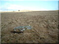
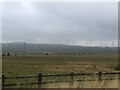
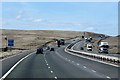
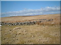
h_fenton visited on 23rd Sep 2010 - their rating: Amb: 3 Access: 3 Visited Wildshaw Burn stone circle as it was getting light, occasionaly surrounded by hill fog; the ground oozing water after heavy overnight rain. Most of the stones (I found 22) were submerged in puddles, a few others above the peaty ground were lying on their sides. Apart from a lost pair of glasses there were no obvious signs of modern human activity on the site - but still it was not exactly serene, on one side there is the hum of great electricity pylons and the other the M74 motorway.
Not the easiest site to find, but it is where it is marked on the map
")
Canmore site no. 46425.
You may be viewing yesterday's version of this page. To see the most up to date information please register for a free account.
")
")
Do not use the above information on other web sites or publications without permission of the contributor.
Nearby Images from Geograph Britain and Ireland:
©2021(licence)
©2022(licence)
©2014(licence)
©2006(licence)
©2022(licence)
The above images may not be of the site on this page, they are loaded from Geograph.
Please Submit an Image of this site or go out and take one for us!
Click here to see more info for this site
Nearby sites
Key: Red: member's photo, Blue: 3rd party photo, Yellow: other image, Green: no photo - please go there and take one, Grey: site destroyed
Download sites to:
KML (Google Earth)
GPX (GPS waypoints)
CSV (Garmin/Navman)
CSV (Excel)
To unlock full downloads you need to sign up as a Contributory Member. Otherwise downloads are limited to 50 sites.
Turn off the page maps and other distractions
Nearby sites listing. In the following links * = Image available
4.4km SSE 150° Blackhill Hillfort (NS9032423216)
5.9km ESE 108° Cold Chapel prehistoric settlement* Ancient Village or Settlement (NS93782512)
7.0km ESE 117° Arbory Hill* Hillfort (NS944238)
7.3km E 79° Devonshaw Hill* Hillfort (NS954283)
7.5km SE 134° Kirkton Fort* Hillfort (NS935218)
8.4km SE 129° Kirkton Fort and Settlement* Hillfort (NS946216)
8.7km SE 126° Castle Crawford Farm Fort* Hillfort (NS951218)
10.3km ESE 117° Normangill Henge* Henge (NS97252212)
10.5km ESE 121° Normangill Rig Cairn* Cairn (NS97092153)
12.5km NE 38° Fallburn at Tinto Hillfort (NS96193674)
13.1km SE 140° Bodsberry Hill* Hillfort (NS963168)
14.4km NE 42° Boatbridge Quarry Cist (NS981376)
14.6km WNW 302° Standingstone Hill (Lesmahagow) Standing Stone (Menhir) (NS759351)
15.2km ENE 65° Culterpark Hill* Hillfort (NT02213305)
15.3km ENE 67° Snaip Hill* Hillfort (NT02463269)
15.7km SSE 151° Daer valley Ancient Village or Settlement (NS956132)
16.1km ENE 70° Nisbet* Hillfort (NT03543216)
16.3km NNW 341° Clarkston (Dillarburn) Standing Stone (Menhir) (NS832426)
16.4km NE 53° Biggar Cursus Cursus (NT01663657)
16.6km N 356° St Patrick's Well (Lanark) Holy Well or Sacred Spring (NS8744443652)
16.6km W 272° Muirkirk Stane* Standing Stone (Menhir) (NS71622821)
17.9km NNW 341° Blackhill (Hazelbank) Standing Stone (Menhir) (NS82904423)
18.9km SSW 212° Crawick Multiverse* Modern Stone Circle etc (NS7763311439)
19.0km NE 54° Moat Park Heritage Centre Museum (NT040378)
19.4km ENE 67° Mitchelhill Rings Hillfort (NT06283417)
View more nearby sites and additional images


 We would like to know more about this location. Please feel free to add a brief description and any relevant information in your own language.
 Wir möchten mehr über diese Stätte erfahren. Bitte zögern Sie nicht, eine kurze Beschreibung und relevante Informationen in Deutsch hinzuzufügen.
 Nous aimerions en savoir encore un peu sur les lieux. S'il vous plaît n'hesitez pas à ajouter une courte description et tous les renseignements pertinents dans votre propre langue.
 Quisieramos informarnos un poco más de las lugares. No dude en añadir una breve descripción y otros datos relevantes en su propio idioma.