<< Our Photo Pages >> Banwen Gwys 2 - Cairn in Wales in Powys
Submitted by sem on Sunday, 12 September 2010 Page Views: 3345
Neolithic and Bronze AgeSite Name: Banwen Gwys 2Country: Wales
NOTE: This site is 0.902 km away from the location you searched for.
County: Powys Type: Cairn
Nearest Village: Glyntawe
Map Ref: SN7977318259
Latitude: 51.849938N Longitude: 3.746877W
Condition:
| 5 | Perfect |
| 4 | Almost Perfect |
| 3 | Reasonable but with some damage |
| 2 | Ruined but still recognisable as an ancient site |
| 1 | Pretty much destroyed, possibly visible as crop marks |
| 0 | No data. |
| -1 | Completely destroyed |
| 5 | Superb |
| 4 | Good |
| 3 | Ordinary |
| 2 | Not Good |
| 1 | Awful |
| 0 | No data. |
| 5 | Can be driven to, probably with disabled access |
| 4 | Short walk on a footpath |
| 3 | Requiring a bit more of a walk |
| 2 | A long walk |
| 1 | In the middle of nowhere, a nightmare to find |
| 0 | No data. |
| 5 | co-ordinates taken by GPS or official recorded co-ordinates |
| 4 | co-ordinates scaled from a detailed map |
| 3 | co-ordinates scaled from a bad map |
| 2 | co-ordinates of the nearest village |
| 1 | co-ordinates of the nearest town |
| 0 | no data |
Internal Links:
External Links:
I have visited· I would like to visit
sem has visited here
")
Coflein NPRN is 408294.
You may be viewing yesterday's version of this page. To see the most up to date information please register for a free account.
Do not use the above information on other web sites or publications without permission of the contributor.
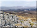
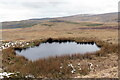
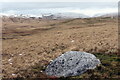
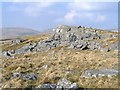
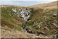
Nearby Images from Geograph Britain and Ireland:
©2007(licence)
©2021(licence)
©2021(licence)
©2007(licence)
©2021(licence)
The above images may not be of the site on this page, they are loaded from Geograph.
Please Submit an Image of this site or go out and take one for us!
Click here to see more info for this site
Nearby sites
Key: Red: member's photo, Blue: 3rd party photo, Yellow: other image, Green: no photo - please go there and take one, Grey: site destroyed
Download sites to:
KML (Google Earth)
GPX (GPS waypoints)
CSV (Garmin/Navman)
CSV (Excel)
To unlock full downloads you need to sign up as a Contributory Member. Otherwise downloads are limited to 50 sites.
Turn off the page maps and other distractions
Nearby sites listing. In the following links * = Image available
225m NNE 18° Banwen Gwys 1* Cairn (SN7984818471)
1.3km E 80° Pwll-y-Cig Cairn* Cairn (SN8105818446)
2.4km E 92° Waun Fignen Felen Ancient Village or Settlement (SN82201810)
2.9km NW 314° Carnau'r Garreg Las* Cairn (SN77752031)
3.1km WSW 249° Carn Fadog* Cairn (SN76861721)
3.1km W 261° Nant-y-Llyn (Carmarthenshire)* Standing Stone (Menhir) (SN76701784)
3.4km SSW 198° Llorfa* Stone Circle (SN7861915010)
3.7km SSW 210° Llwyncwmstabl* Cairn (SN77851509)
3.8km ESE 110° Twyn Ddu* Cairn (SN833169)
3.9km NNE 20° Picws Du* Cairn (SN81172185)
4.1km NNW 330° Carn y Gigfran* Cairn (SN7778621863)
4.4km SE 134° Pwll-y-Wythen Fach* Ancient Village or Settlement (SN8288115107)
4.5km NE 37° Fan Brycheiniog* Cairn (SN82532179)
4.5km SE 128° Saith Maen Cairn Ring Cairn (SN833154)
4.5km SE 128° Saith Maen NW* Stone Row / Alignment (SN8330615399)
4.6km ESE 117° Dan-yr-Ogof* Cave or Rock Shelter (SN838161)
4.6km NNE 34° Twr-y-Fan Foel cairn* Cairn (SN82432206)
4.7km NE 40° Llyn y Fan Fawr* Standing Stones (SN82882180)
4.7km SSW 210° Dorwen* Standing Stones (SN7730414239)
4.7km NNE 29° Fan Foel Cairns* Round Cairn (SN8214722341)
4.8km SW 220° Derlwyn Isaf* Cairn (SN76611467)
4.9km SE 138° The Sleeping Giant* Natural Stone / Erratic / Other Natural Feature (SN830145)
5.1km SE 142° Cribarth Cairns* Cairn (SN8283514203)
5.4km NW 323° Pant-y-Turnor standing stone* Standing Stone (Menhir) (SN766226)
5.4km NNE 25° Rhyd Wen Fach* Stone Circle (SN82232312)
View more nearby sites and additional images


 We would like to know more about this location. Please feel free to add a brief description and any relevant information in your own language.
 Wir möchten mehr über diese Stätte erfahren. Bitte zögern Sie nicht, eine kurze Beschreibung und relevante Informationen in Deutsch hinzuzufügen.
 Nous aimerions en savoir encore un peu sur les lieux. S'il vous plaît n'hesitez pas à ajouter une courte description et tous les renseignements pertinents dans votre propre langue.
 Quisieramos informarnos un poco más de las lugares. No dude en añadir una breve descripción y otros datos relevantes en su propio idioma.