<< Text Pages >> Cwm Irfon Standing Stones (Seven Sisters) - Standing Stones in Wales in South Glamorgan
Submitted by coldrum on Saturday, 02 July 2011 Page Views: 5578
Neolithic and Bronze AgeSite Name: Cwm Irfon Standing Stones (Seven Sisters)Country: Wales
NOTE: This site is 1.469 km away from the location you searched for.
County: South Glamorgan Type: Standing Stones
Map Ref: SN834085
Latitude: 51.763004N Longitude: 3.690959W
Condition:
| 5 | Perfect |
| 4 | Almost Perfect |
| 3 | Reasonable but with some damage |
| 2 | Ruined but still recognisable as an ancient site |
| 1 | Pretty much destroyed, possibly visible as crop marks |
| 0 | No data. |
| -1 | Completely destroyed |
| 5 | Superb |
| 4 | Good |
| 3 | Ordinary |
| 2 | Not Good |
| 1 | Awful |
| 0 | No data. |
| 5 | Can be driven to, probably with disabled access |
| 4 | Short walk on a footpath |
| 3 | Requiring a bit more of a walk |
| 2 | A long walk |
| 1 | In the middle of nowhere, a nightmare to find |
| 0 | No data. |
| 5 | co-ordinates taken by GPS or official recorded co-ordinates |
| 4 | co-ordinates scaled from a detailed map |
| 3 | co-ordinates scaled from a bad map |
| 2 | co-ordinates of the nearest village |
| 1 | co-ordinates of the nearest town |
| 0 | no data |
Be the first person to rate this site - see the 'Contribute!' box in the right hand menu.
Internal Links:
External Links:
Standing Stones in South Glamorgan
Coflein entry.
https://www.coflein.gov.uk/en/site/102
You may be viewing yesterday's version of this page. To see the most up to date information please register for a free account.
Do not use the above information on other web sites or publications without permission of the contributor.
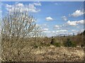
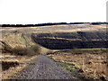
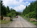
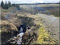
Nearby Images from Geograph Britain and Ireland:
©2023(licence)
©2017(licence)
©2008(licence)
©2023(licence)
©2023(licence)
The above images may not be of the site on this page, they are loaded from Geograph.
Please Submit an Image of this site or go out and take one for us!
Click here to see more info for this site
Nearby sites
Key: Red: member's photo, Blue: 3rd party photo, Yellow: other image, Green: no photo - please go there and take one, Grey: site destroyed
Download sites to:
KML (Google Earth)
GPX (GPS waypoints)
CSV (Garmin/Navman)
CSV (Excel)
To unlock full downloads you need to sign up as a Contributory Member. Otherwise downloads are limited to 50 sites.
Turn off the page maps and other distractions
Nearby sites listing. In the following links * = Image available
5.7km N 353° Cribarth Cairns* Cairn (SN8283514203)
6.0km N 355° The Sleeping Giant* Natural Stone / Erratic / Other Natural Feature (SN830145)
6.2km NNE 27° Pump Maen (Five Stones)* Stone Row / Alignment (SN86361400)
6.3km E 79° Sgwd Gwladus Stone* Natural Stone / Erratic / Other Natural Feature (SN896095)
6.4km ENE 58° Nant Hir stone* Marker Stone (SN889118)
6.6km N 354° Pwll-y-Wythen Fach* Ancient Village or Settlement (SN8288115107)
6.7km NNE 23° Saith Maen SE* Stone Row / Alignment (SN862146)
6.9km NNE 24° The Gnomen Standing Stone (Menhir) (SN8635214716)
6.9km N 358° Saith Maen NW* Stone Row / Alignment (SN8330615399)
6.9km N 358° Saith Maen Cairn Ring Cairn (SN833154)
7.0km NNE 24° Saith Maen East Cairn* Cairn (SN8642414831)
7.0km NNE 12° Powell's Cave Cave or Rock Shelter (SN84991535)
7.2km WNW 284° Ffynnon Ddrewllyd* Holy Well or Sacred Spring (SN764104)
7.3km NNE 22° Careg Lywd 2* Stone Row / Alignment (SN8629315186)
7.4km NNE 20° Penwyllt Cairn* Cairn (SN8606715391)
7.6km N 2° Dan-yr-Ogof* Cave or Rock Shelter (SN838161)
7.8km SE 127° Craig-Y-Pant Cairn (SN89560367)
7.8km S 187° Carn Caca Cairn* Ring Cairn (SN82230077)
7.9km SE 124° Y Foel Cherwn Cairn (SN89840388)
8.1km NW 322° Llorfa* Stone Circle (SN7861915010)
8.4km NNE 29° Carreg Cadno* Stone Row / Alignment (SN87671569)
8.4km NW 312° Dorwen* Standing Stones (SN7730414239)
8.4km N 358° Twyn Ddu* Cairn (SN833169)
8.6km NW 319° Llwyncwmstabl* Cairn (SN77851509)
8.8km NNE 26° The Nipple* Cairn (SN87441635)
View more nearby sites and additional images


 We would like to know more about this location. Please feel free to add a brief description and any relevant information in your own language.
 Wir möchten mehr über diese Stätte erfahren. Bitte zögern Sie nicht, eine kurze Beschreibung und relevante Informationen in Deutsch hinzuzufügen.
 Nous aimerions en savoir encore un peu sur les lieux. S'il vous plaît n'hesitez pas à ajouter une courte description et tous les renseignements pertinents dans votre propre langue.
 Quisieramos informarnos un poco más de las lugares. No dude en añadir una breve descripción y otros datos relevantes en su propio idioma.