<< Our Photo Pages >> Kilphedir - Broch or Nuraghe in Scotland in Sutherland
Submitted by h_fenton on Sunday, 27 March 2011 Page Views: 8281
Iron Age and Later PrehistorySite Name: Kilphedir Alternative Name: Kilphader TowerCountry: Scotland
NOTE: This site is 2.673 km away from the location you searched for.
County: Sutherland Type: Broch or Nuraghe
Nearest Town: Kildonan
Map Ref: NC99431891
Latitude: 58.147614N Longitude: 3.710214W
Condition:
| 5 | Perfect |
| 4 | Almost Perfect |
| 3 | Reasonable but with some damage |
| 2 | Ruined but still recognisable as an ancient site |
| 1 | Pretty much destroyed, possibly visible as crop marks |
| 0 | No data. |
| -1 | Completely destroyed |
| 5 | Superb |
| 4 | Good |
| 3 | Ordinary |
| 2 | Not Good |
| 1 | Awful |
| 0 | No data. |
| 5 | Can be driven to, probably with disabled access |
| 4 | Short walk on a footpath |
| 3 | Requiring a bit more of a walk |
| 2 | A long walk |
| 1 | In the middle of nowhere, a nightmare to find |
| 0 | No data. |
| 5 | co-ordinates taken by GPS or official recorded co-ordinates |
| 4 | co-ordinates scaled from a detailed map |
| 3 | co-ordinates scaled from a bad map |
| 2 | co-ordinates of the nearest village |
| 1 | co-ordinates of the nearest town |
| 0 | no data |
Internal Links:
External Links:

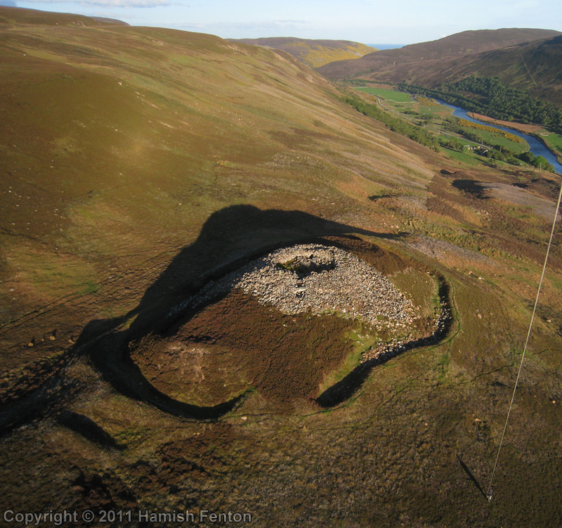
Ruins of a broch with preserved lower parts of the walls, remains of an intramural staircase and guard chamber.
Read More at ScotlandsPlaces.
Kilphedir Broch is located near Kilphedir Lodge on the north side of Strath of Kildonan (Strath Ullie). The broch occupies a hillock 110metres above the valley bottom which affords extensive views up and down the strath.
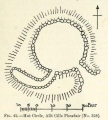
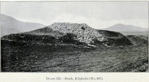
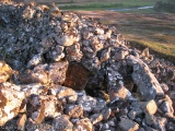
Internally the broch has a diameter of 10metres, the walls are upto 4.7metres thick and stand upto c.2.3metres high (uncertain quite how deep in the rubble the floor is). The entrance passageway faces northwest, there is no sign of an entrance to a guard chamber, but the passageway is fairly choked with rubble. Directly opposite the entrance is a doorway leading into an intra-mural gallery, visitors in the 19th-early20thcentury recorded that the stairs was still extant here but today there is no sign of it despite being able to see down into the intra-mural gallery to a depth of about 60cm. Lintels can be seen crossing the intra-mural gallery linking the inner and outer walls. Internally as well as eternally there is a lot of rubble from the collapse of the walls of the broch, in the mid 19th century it was recorded that the walls were standing upto 15feet (4.6metres) high. Outside the wall the broch is further protected by a bank and large ditch, to the north and south between these outworks and the wall are some further banks dividing the ground (forming enclosures).
Access, there is space to park by the road A867 near the bridge (NC 9895 1863) at Kilphedir. A modern trackway from the road to the east of the bridge leads uphill, follow this for about 400metres you should then see the broch about 250metres away on your right (about 70metres away on your left is the remains of a substantial stone hutcircle). The ground in this area may be boggy (soft) so take care where you walk.
For further information see: http://canmore.rcahms.gov.uk/en/site/7000/details/kilphedir/
You may be viewing yesterday's version of this page. To see the most up to date information please register for a free account.


Do not use the above information on other web sites or publications without permission of the contributor.
Click here to see more info for this site
Nearby sites
Key: Red: member's photo, Blue: 3rd party photo, Yellow: other image, Green: no photo - please go there and take one, Grey: site destroyed
Download sites to:
KML (Google Earth)
GPX (GPS waypoints)
CSV (Garmin/Navman)
CSV (Excel)
To unlock full downloads you need to sign up as a Contributory Member. Otherwise downloads are limited to 50 sites.
Turn off the page maps and other distractions
Nearby sites listing. In the following links * = Image available
1.3km SW 234° Eldrable Broch or Nuraghe (NC98331816)
1.8km ESE 119° Caen Burn 2 Broch or Nuraghe (ND0118)
2.6km SE 125° Caen Burn 1 Broch or Nuraghe (ND015174)
2.9km W 270° Kildonan NE* Multiple Stone Rows / Avenue (NC96541898)
3.9km W 263° Kildonan SW* Multiple Stone Rows / Avenue (NC9550918564)
4.5km SE 136° St John the Baptist's Well (Helmsdale)* Holy Well or Sacred Spring (ND025156)
4.6km W 260° Gailiable Broch or Nuraghe (NC94871823)
4.9km W 269° Balvalaich* Broch or Nuraghe (NC94521898)
5.4km SSE 156° Dun Phail Broch or Nuraghe (ND01481387)
6.1km S 172° Portgower Broch or Nuraghe (ND00081279)
6.5km W 268° Kilearnan Hill* Broch or Nuraghe (NC92931882)
6.6km SW 233° Clach Mhic Mhios* Standing Stone (Menhir) (NC9404515083)
7.0km NE 36° Langwell Water Enclosure Ancient Village or Settlement (ND03712445)
7.1km NE 50° Langwell Hut Circle Ancient Village or Settlement (ND05052335)
7.1km NNE 33° Langwell Earth House Souterrain (Fogou, Earth House) (ND03442484)
7.2km W 268° Kilearnan Broch* Broch or Nuraghe (NC92161887)
7.3km N 5° Wagmore Rigg* Ancient Village or Settlement (ND00292614)
7.5km NE 54° Langwell Water Souterrain (Fogou, Earth House) (ND05602322)
7.7km E 89° Ousdale Burn* Broch or Nuraghe (ND07131881)
7.8km NE 56° Langwell Water Earth House Souterrain (Fogou, Earth House) (ND06032313)
8.5km SW 216° Carn Bran* Broch or Nuraghe (NC94201219)
8.5km SW 222° Glen Loth* Standing Stones (NC936127)
8.9km NE 53° Strathy Burn Souterrain (Fogou, Earth House) (ND06742409)
9.3km ENE 65° Langwell Water Hut Circle Ancient Village or Settlement (ND08002266)
10.2km ENE 70° Berriedale Chambered Cairn (ND09152223)
View more nearby sites and additional images


 We would like to know more about this location. Please feel free to add a brief description and any relevant information in your own language.
 Wir möchten mehr über diese Stätte erfahren. Bitte zögern Sie nicht, eine kurze Beschreibung und relevante Informationen in Deutsch hinzuzufügen.
 Nous aimerions en savoir encore un peu sur les lieux. S'il vous plaît n'hesitez pas à ajouter une courte description et tous les renseignements pertinents dans votre propre langue.
 Quisieramos informarnos un poco más de las lugares. No dude en añadir una breve descripción y otros datos relevantes en su propio idioma.